MyTopo
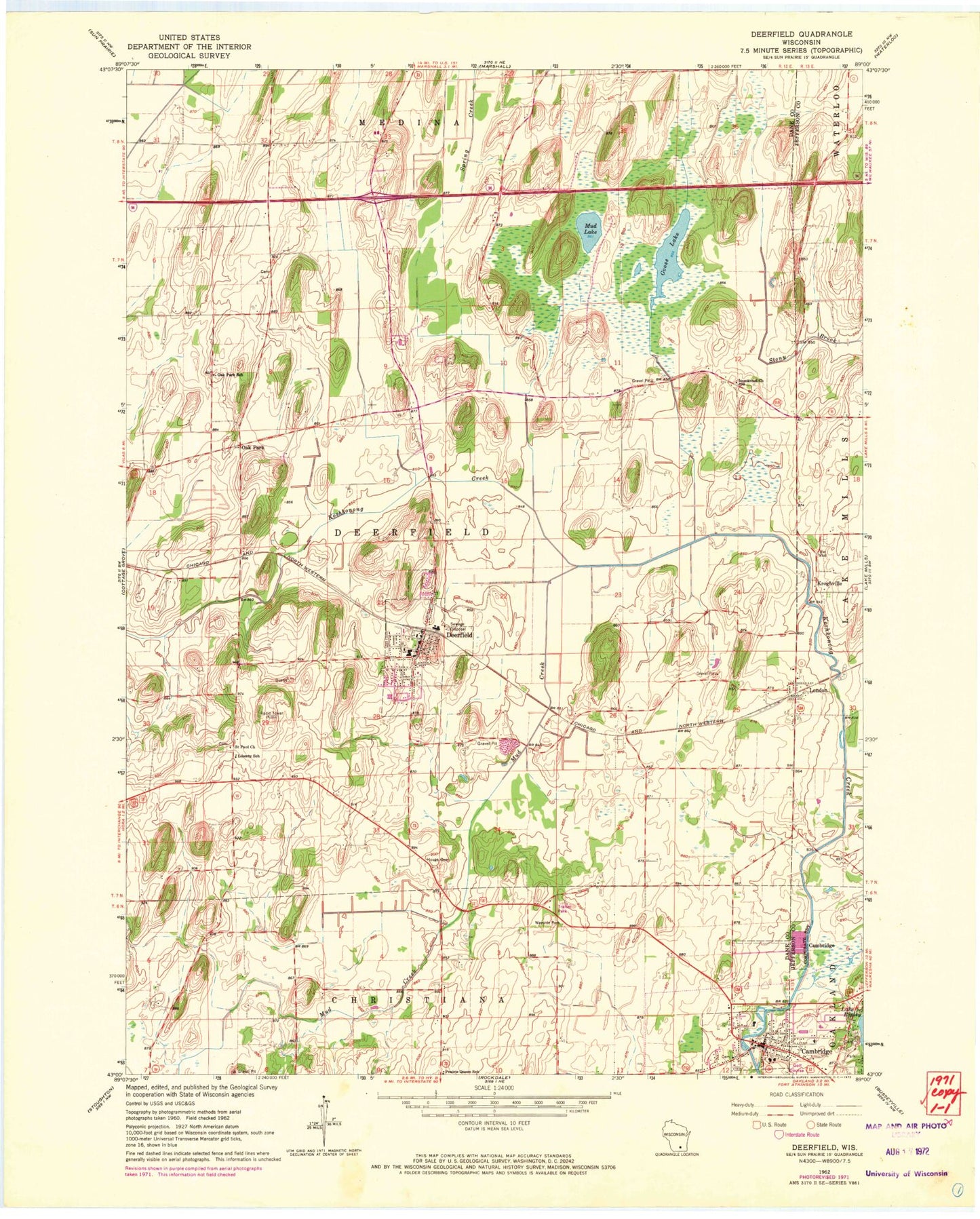
Classic USGS Deerfield Wisconsin 7.5'x7.5' Topo Map
Couldn't load pickup availability
Historical USGS topographic quad map of Deerfield in the state of Wisconsin. Map scale may vary for some years, but is generally around 1:24,000. Print size is approximately 24" x 27"
This quadrangle is in the following counties: Dane, Jefferson.
The map contains contour lines, roads, rivers, towns, and lakes. Printed on high-quality waterproof paper with UV fade-resistant inks, and shipped rolled.
Contains the following named places: Cambridge, Cambridge Area Emergency Medical Services, Cambridge Elementary School, Cambridge High School, Cambridge Police Department, Cambridge Post Office, Cambridge Volunteer Fire Department, Christiana Farms, Coolwater Farms, Deerfield, Deerfield Elementary School, Deerfield High School, Deerfield Lutheran Cemetery, Deerfield Middle School, Deerfield Police Department, Deerfield Post Office, Deerfield Volunteer Fire Department, Deerfield Wastewater Treatment Plant, Gerike Cemetery, Goose Lake, Goose Lake Drumlins State Natural Area, Goose Lake State Wildlife Area, Hauge Cemetery, Immanuel Church, Kroghville, Lake Ripley Cemetery, Liberty Lutheran Cemetery, Liberty School, London, Lutheran Moravian Cemetery, Mikkelson Farm, Mud Creek, Mud Lake, Nikolay Middle School, Oak Park, Oak Park School, Old Deerfield, Pioneer Norwegian Cemetery, Prairie Queen School, Saint Anne's Catholic Cemetery, Saint Paul Church, Smithback Farm, Town of Deerfield, Vasby Farms, Village of Cambridge, Village of Deerfield, Willerup Methodist Cemetery, WTFX-FM (Watertown), ZIP Code: 53531