MyTopo
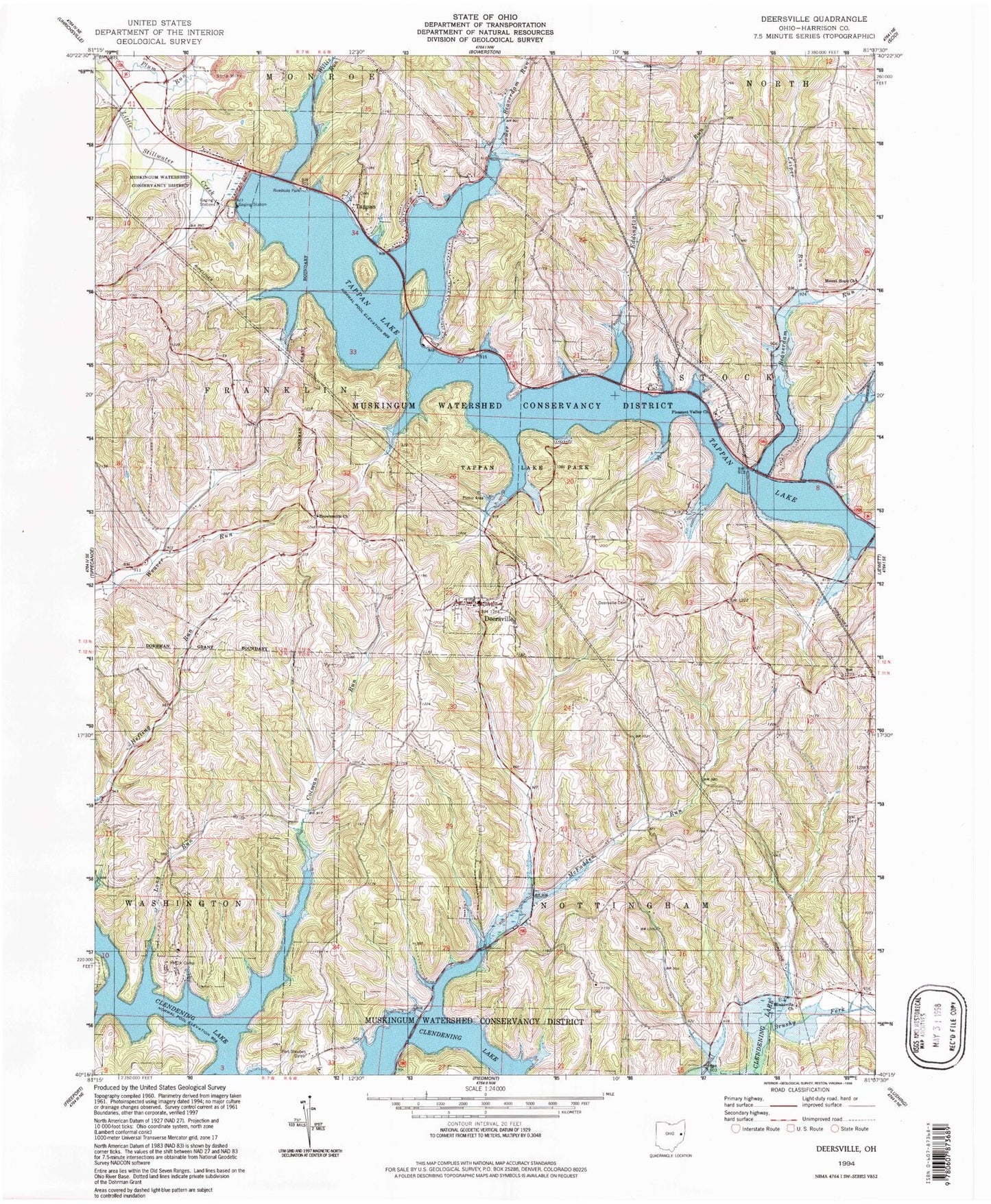
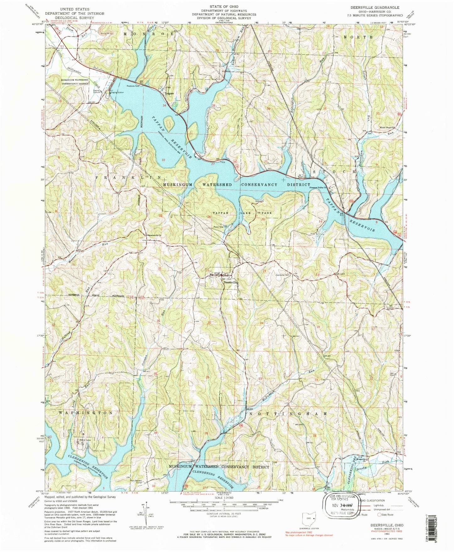
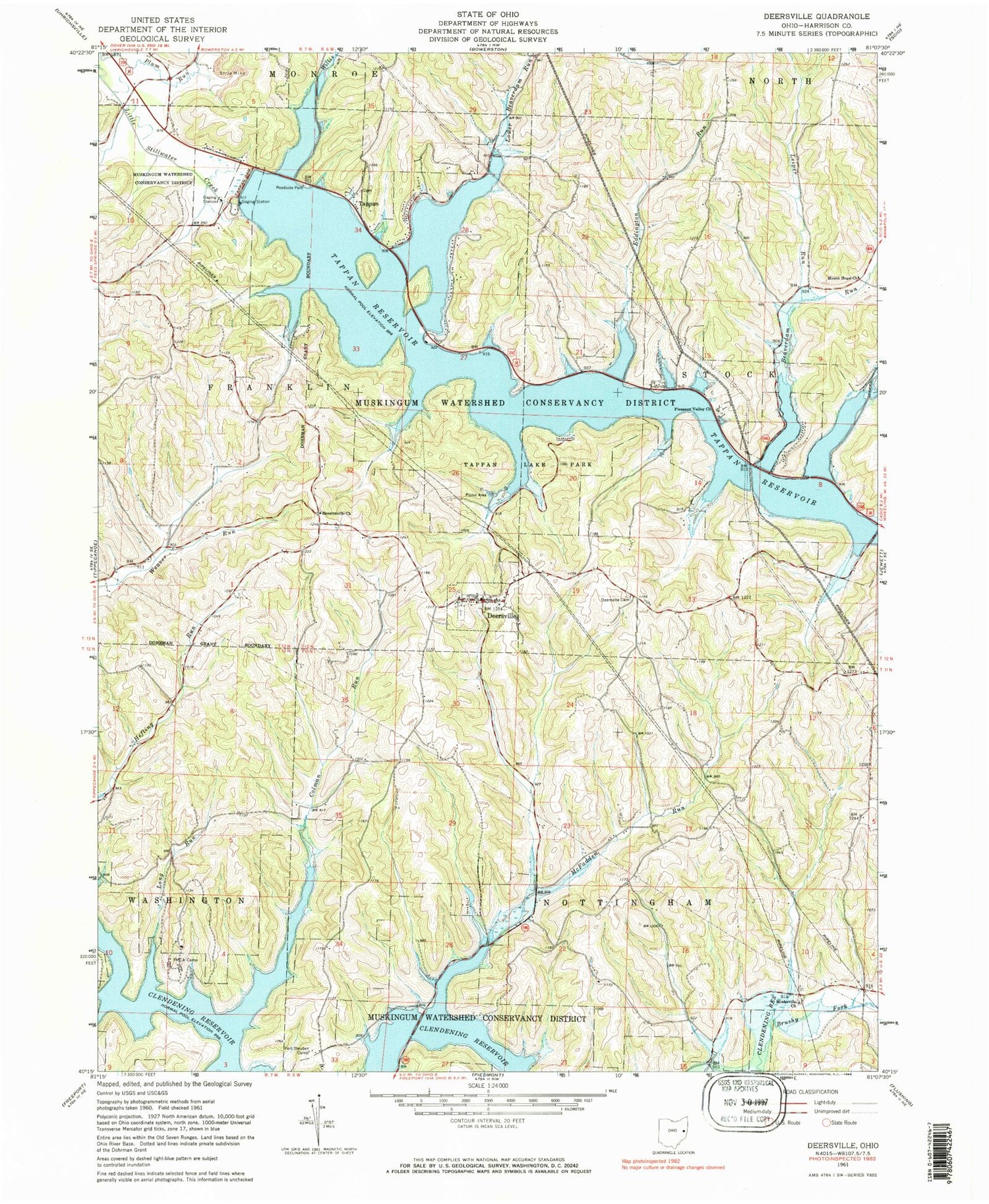
Classic USGS Deersville Ohio 7.5'x7.5' Topo Map
Couldn't load pickup availability
Historical USGS topographic quad map of Deersville in the state of Ohio. Typical map scale is 1:24,000, but may vary for certain years, if available. Print size: 24" x 27"
This quadrangle is in the following counties: Harrison.
The map contains contour lines, roads, rivers, towns, and lakes. Printed on high-quality waterproof paper with UV fade-resistant inks, and shipped rolled.
Contains the following named places: Beaverdam Run, Brownsville Church, Clear Fork, Colman Run, Deersville, Deersville Cemetery, Long Run, Lower Beaverdam Run, McFadden Run, Minksville Church, Mount Hope Church, Pleasant Valley Church, Tappan Lake Park, Tappan Lake, Willis Run, YMCA Camp, Forty Steuben Camp, Hattonia (historical), Eddington Run, Laceyville (historical), Clendening (historical), Tappan, Leiper Run, Plum Run, Smithdale (historical), Tappan Dam, Van Horn Pond Dam, Van Horn Pond, Pleasant Valley (historical), Township of Franklin, Township of Nottingham, Township of Stock, Deersville Methodist Episcopal Cemetery, Minksville Cemetery, Pleasant Valley Cemetery, Tappan Cemetery, Beall Bay, Beaverdam Run Bay, Bontrager Bay, Brushy Fork Bay, Clear Fork Bay, Colman Run Bay, Deersville Bay, East Shore Cottage Area, Edgington Run Bay, Little Colman Bay, Long Point, Lower Beaverdam Bay, Mathews Bay, Tappan Lake Marina, West Shore Cottage Area, Willis Run Bay, Wye Bay, Clendening Post Office (historical), Laceyville Post Office (historical), Smithdale Post Office (historical), Tappan Post Office (historical), Deersville Post Office, Hattonia Post Office, Village of Deersville, Tappan Lake Volunteer Fire Department, Deersville Community Volunteer Fire Department and Emergency Medical Services