MyTopo
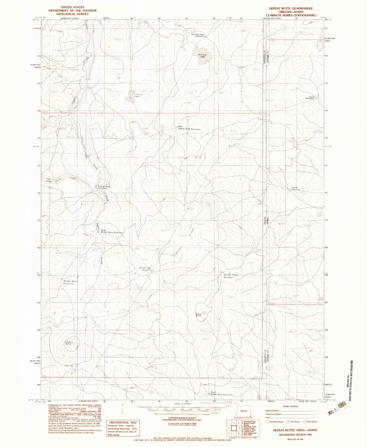
Classic USGS Defeat Butte Oregon 7.5'x7.5' Topo Map
Couldn't load pickup availability
Historical USGS topographic quad map of Defeat Butte in the states of Oregon, Idaho. Map scale may vary for some years, but is generally around 1:24,000. Print size is approximately 24" x 27"
This quadrangle is in the following counties: Malheur, Owyhee.
The map contains contour lines, roads, rivers, towns, and lakes. Printed on high-quality waterproof paper with UV fade-resistant inks, and shipped rolled.
Contains the following named places: Black Snake Reservoir, Butch Reservoir, Defeat Butte, Defeat Butte Reservoir, Defeat Lake Reservoir, Defeat Ridge, East Hoodoo Butte Reservoir, East Toppin Creek Reservoir, Hoodoo Butte, Hoodoo Butte Reservoir, Inside Reservoir, Little Lake, Mustang Lake, Mustang Lake Reservoir, North Hoodoo Butte Reservoir, South Fork Toppin Creek