
MyTopo
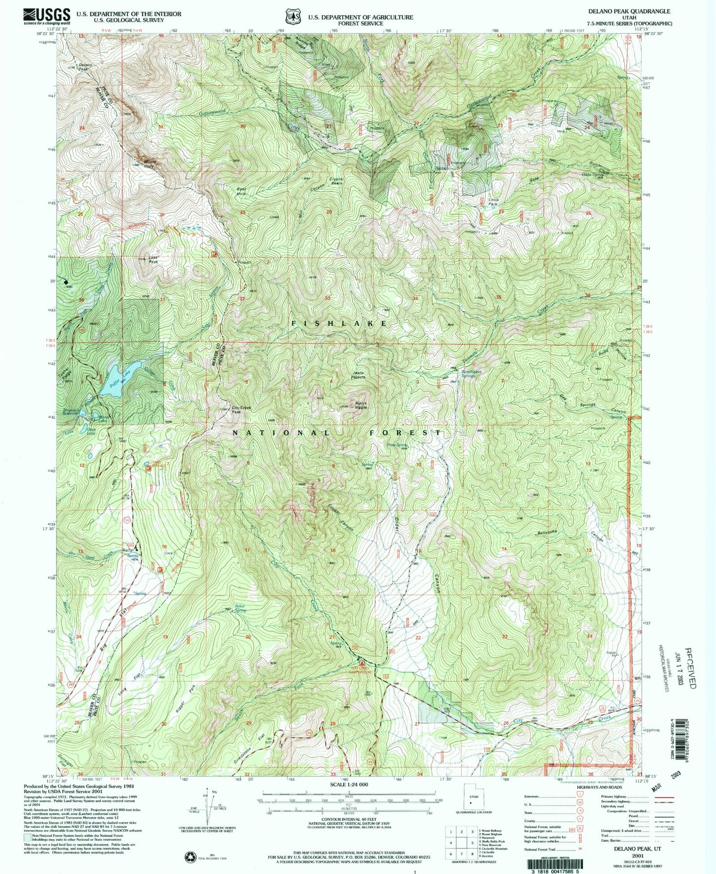
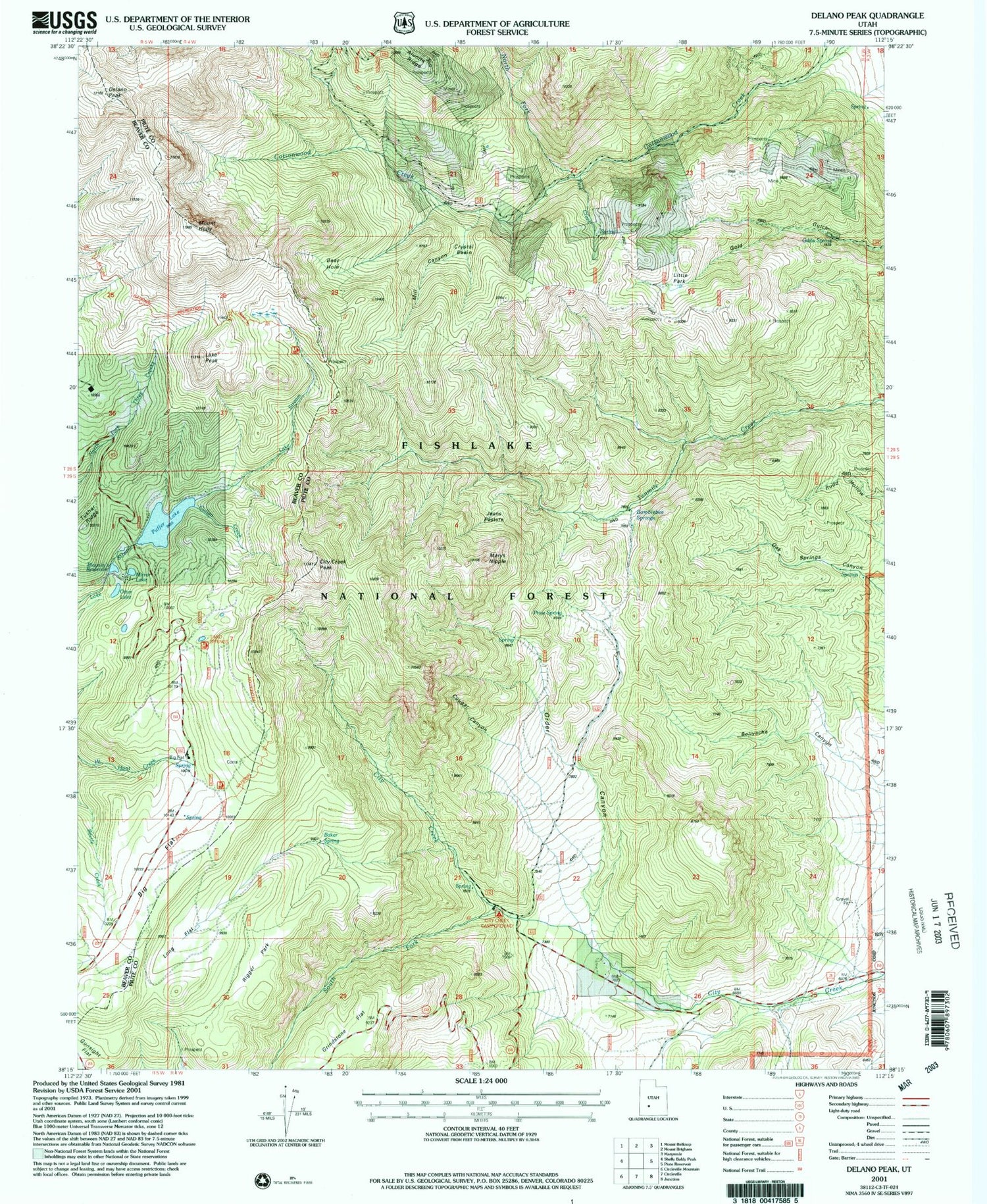
Classic USGS Delano Peak Utah 7.5'x7.5' Topo Map
Couldn't load pickup availability
Historical USGS topographic quad map of Delano Peak in the state of Utah. Typical map scale is 1:24,000, but may vary for certain years, if available. Print size: 24" x 27"
This quadrangle is in the following counties: Beaver, Piute.
The map contains contour lines, roads, rivers, towns, and lakes. Printed on high-quality waterproof paper with UV fade-resistant inks, and shipped rolled.
Contains the following named places: Baker Spring, Bay Cabin, Bear Hole, Big Flat, Big Flat Guard Station, Bumblebee Springs, City Creek Park, City Creek Peak, Cougar Canyon, Crystal Basin, Cullen Creek, Delano Peak, Gibbs Spring, Grindstone Flat, Mount Hawley, Jeans Pasture, Lake Peak, Little Park, Long Flat, Marys Nipple, Mill Canyon, North Fork Cottonwood Creek, Order Canyon, Otter Lake, Park Creek, Price Spring, Rigger Park, South Fork City Creek, Telluride Cabin, Tushar Ridge, Puffer Lake, Puffer Lake Dam, Blainies Dam, Mirror Lake, Skyline National Recreation Trail, City Creek Campground, Elk Meadows Ski Area