MyTopo
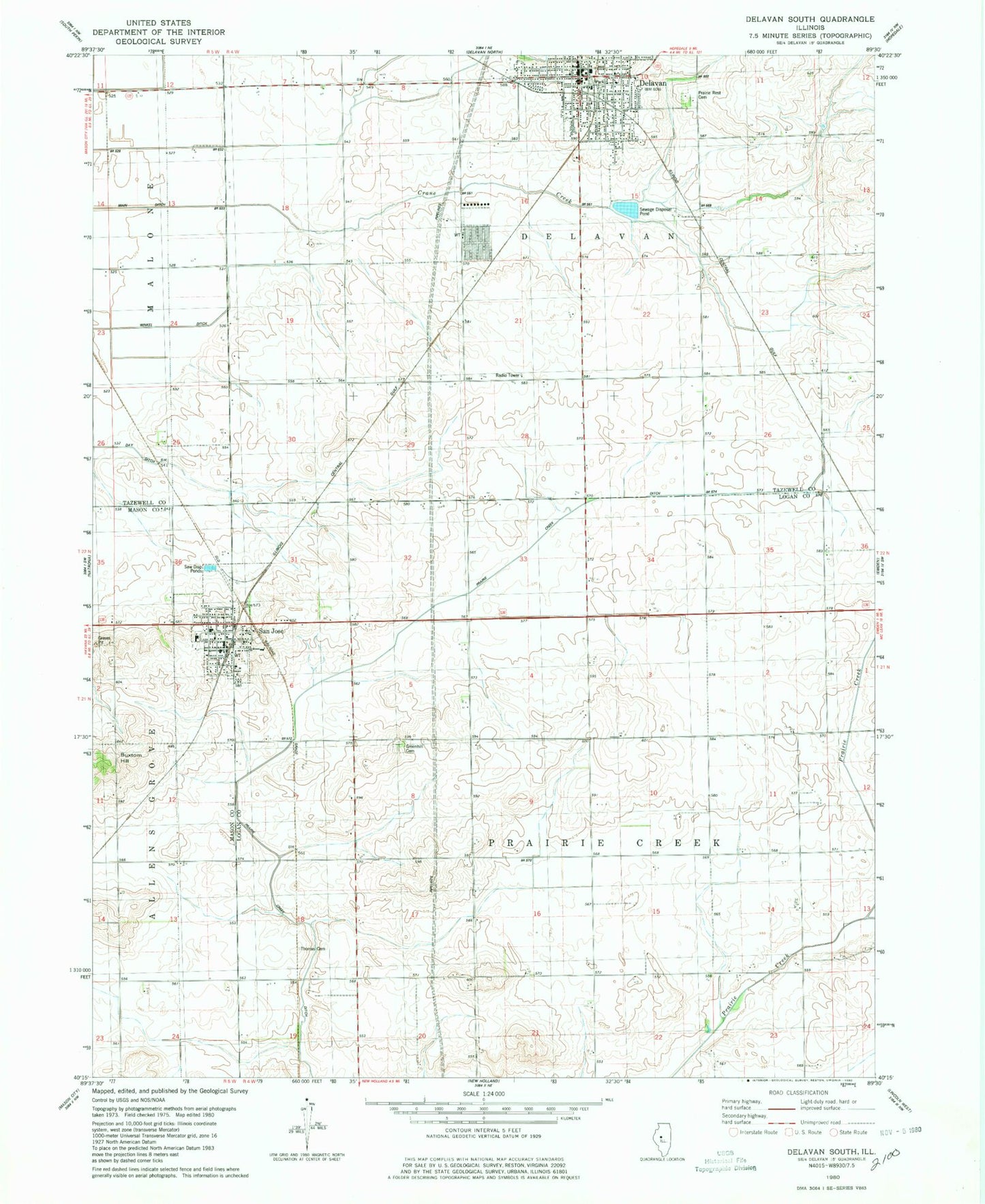
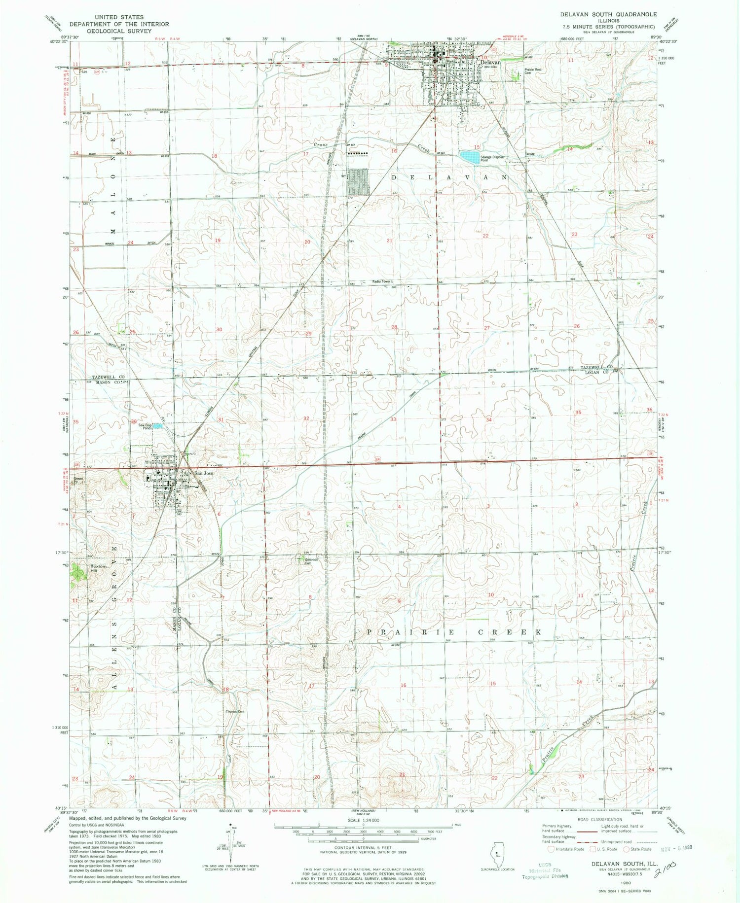
Classic USGS Delavan South Illinois 7.5'x7.5' Topo Map
Couldn't load pickup availability
Historical USGS topographic quad map of Delavan South in the state of Illinois. Map scale may vary for some years, but is generally around 1:24,000. Print size is approximately 24" x 27"
This quadrangle is in the following counties: Logan, Mason, Tazewell.
The map contains contour lines, roads, rivers, towns, and lakes. Printed on high-quality waterproof paper with UV fade-resistant inks, and shipped rolled.
Contains the following named places: Buxtom Hill, City of Delavan, Crane Creek, Cream Ridge School, Delavan, Delavan Ambulance Service, Delavan Fire Protection District, Delavan High School, Delavan Police Department, Delavan Post Office, Elder Grove School, Green Hill Cemetery, Home School, Liberty School, Neibuhr School, Pawson School, Pleasant View School, Prairie Creek Ditch, Prairie Rest Cemetery, San Jose, San Jose Fire Protection District, San Jose Police Department, San Jose Post Office, Thomas Cemetery, Township of Delavan, Township of Prairie Creek, Victory School, Village of San Jose, Zoar School