MyTopo
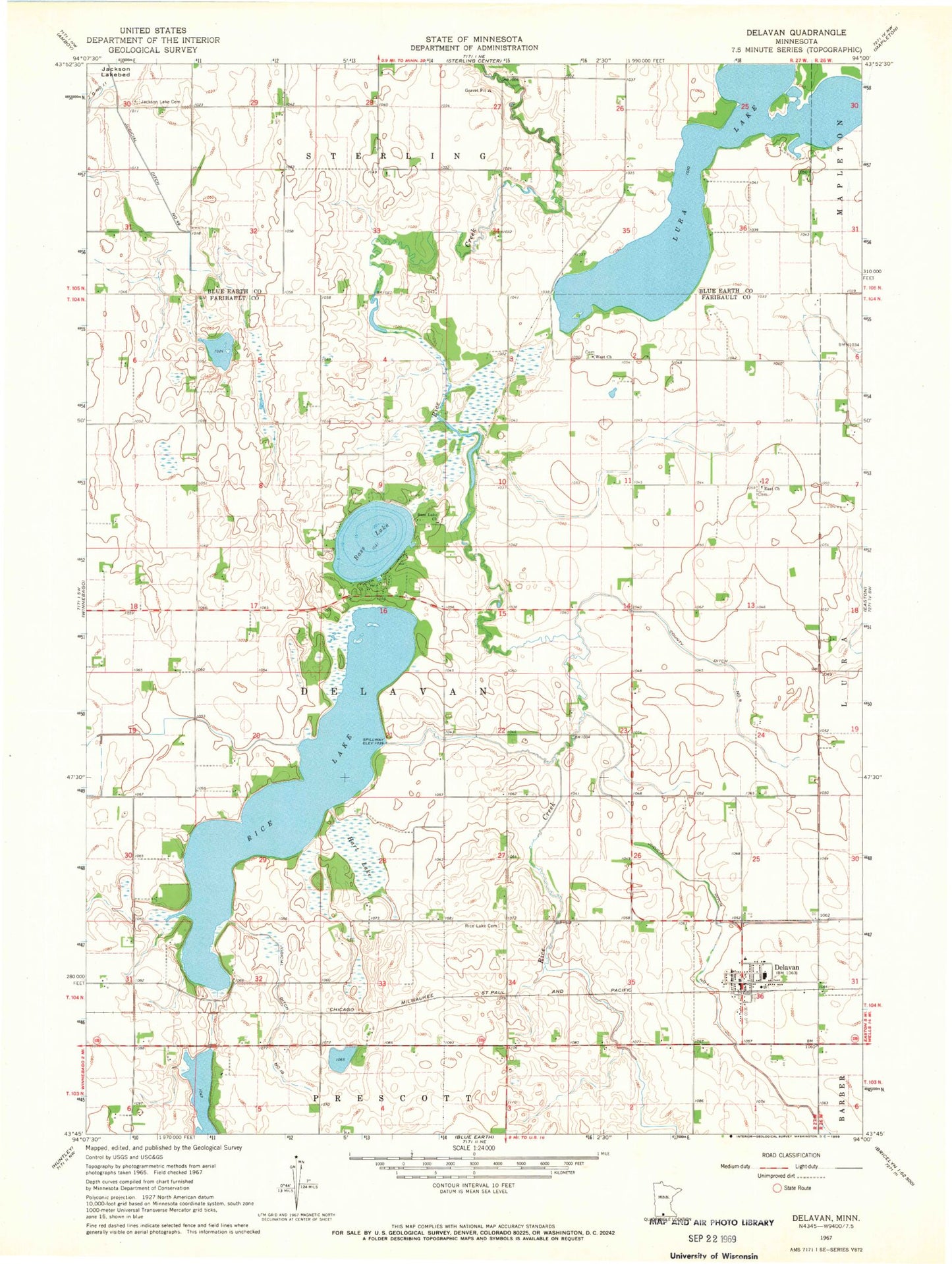
Classic USGS Delavan Minnesota 7.5'x7.5' Topo Map
Couldn't load pickup availability
Historical USGS topographic quad map of Delavan in the state of Minnesota. Map scale may vary for some years, but is generally around 1:24,000. Print size is approximately 24" x 27"
This quadrangle is in the following counties: Blue Earth, Faribault.
The map contains contour lines, roads, rivers, towns, and lakes. Printed on high-quality waterproof paper with UV fade-resistant inks, and shipped rolled.
Contains the following named places: Bass Lake, Bass Lake Cemetery, City of Delavan, County Ditch Number Nine, Daly Park, Daly Park Campground, Delavan, Delavan Catholic Church, Delavan Post Office, Delavan Village Hall, Delavan Volunteer Fire Department, East Church, East Lutheran Cemetery, Faith Lutheran Church, Hart Lake, Jackson Lake Cemetery, Judicial Ditch Number One, Judicial Ditch Number Ten, Lura Lake, Rice Lake, Rice Lake Cemetery, Rice Lake Dam, Township of Delavan, United Methodist Church, Vernon Finseth Dam, West Lutheran Cemetery, ZIP Code: 56023