MyTopo
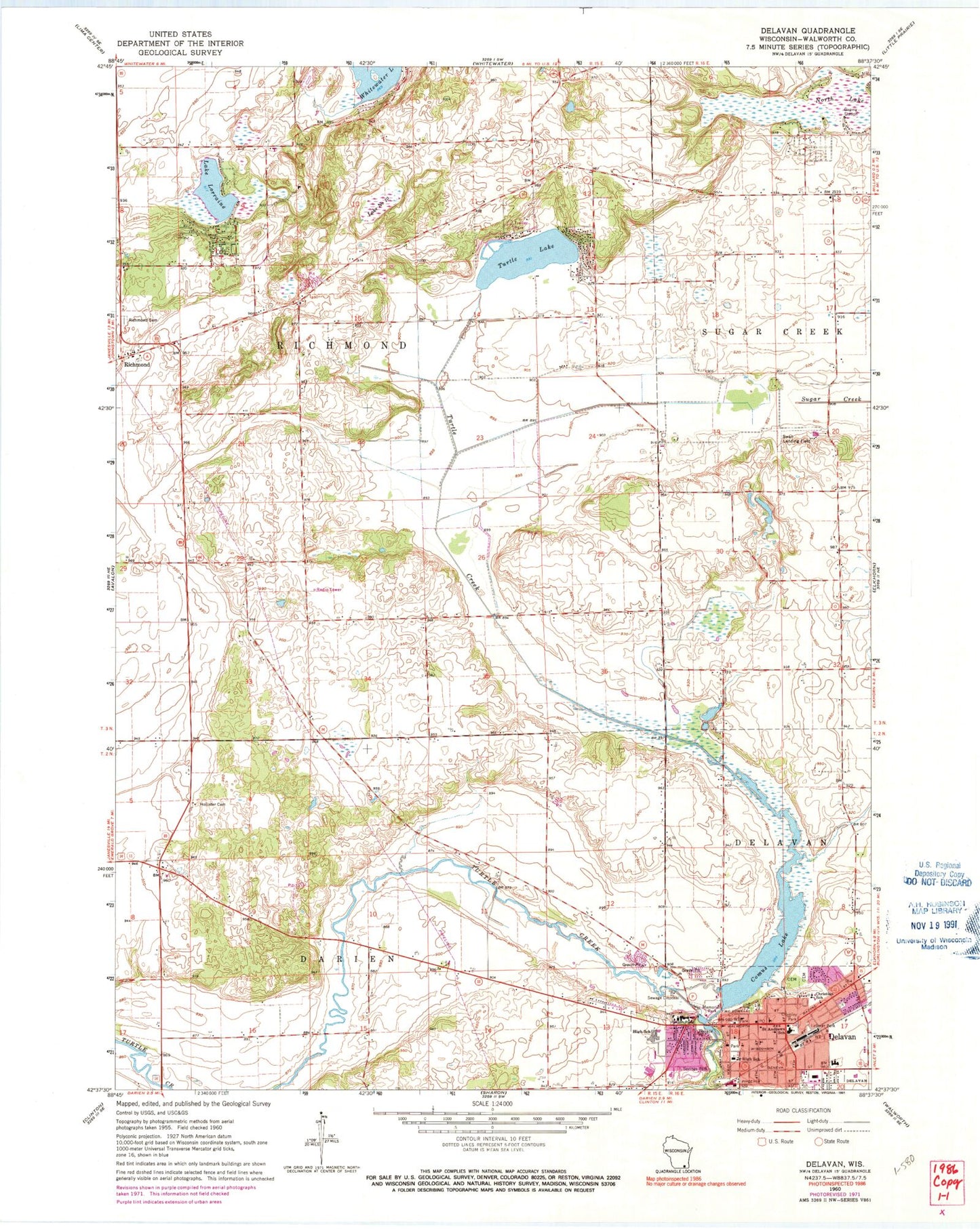
Classic USGS Delavan Wisconsin 7.5'x7.5' Topo Map
Couldn't load pickup availability
Historical USGS topographic quad map of Delavan in the state of Wisconsin. Map scale may vary for some years, but is generally around 1:24,000. Print size is approximately 24" x 27"
This quadrangle is in the following counties: Walworth.
The map contains contour lines, roads, rivers, towns, and lakes. Printed on high-quality waterproof paper with UV fade-resistant inks, and shipped rolled.
Contains the following named places: Ames Private Airport, Aram Public Library, Bountiful Acres Airport, Christ Episcopal Church of Delavan, City of Delavan, Community Reformed Church, Comus Lake, Delavan, Delavan - Darien High School, Delavan 3WR1282 Dam, Delavan Christian School, Delavan City Police Department, Delavan City Volunteer Fire Department, Delavan Post Office, Delavan Rescue Squad, Faith Baptist Church, First Baptist Church, Hollister Cemetery, Holton Park, Holy Cross Lutheran Church for the Deaf, Lake Comus 67, Lake Lorraine, Lake Lorraine Census Designated Place, Lake Number Ten, Latimer Park, Luther Memorial Lutheran Church, Mallard Lake Recycling and Disposal Facility, New Hollister Wetlands Conservancy, North Lake, Old Settlers Cemetery, Our Redeemer Lutheran Church, Our Redeemer Lutheran School, Paratech Ambulance Service, Phoenix Middle School, Phoenix Park, Richmond, Richmond Cemetery, Robert H Miller Park, Saint Andrew Parish School, Saint Andrews Catholic Church, Saint Andrews Cemetery, Sevneth Day Adventist Church, Spring Grove Cemetery, Springs Park, Swan Airport, Terrace Park, Town of Darien, Town of Richmond, Turtle Creek Elementary School, Turtle Lake, Turtle Lake Census Designated Place, Veterans Memorial Park, Wileman Elementary School, Wisconsin School for the Deaf, ZIP Code: 53115


