MyTopo
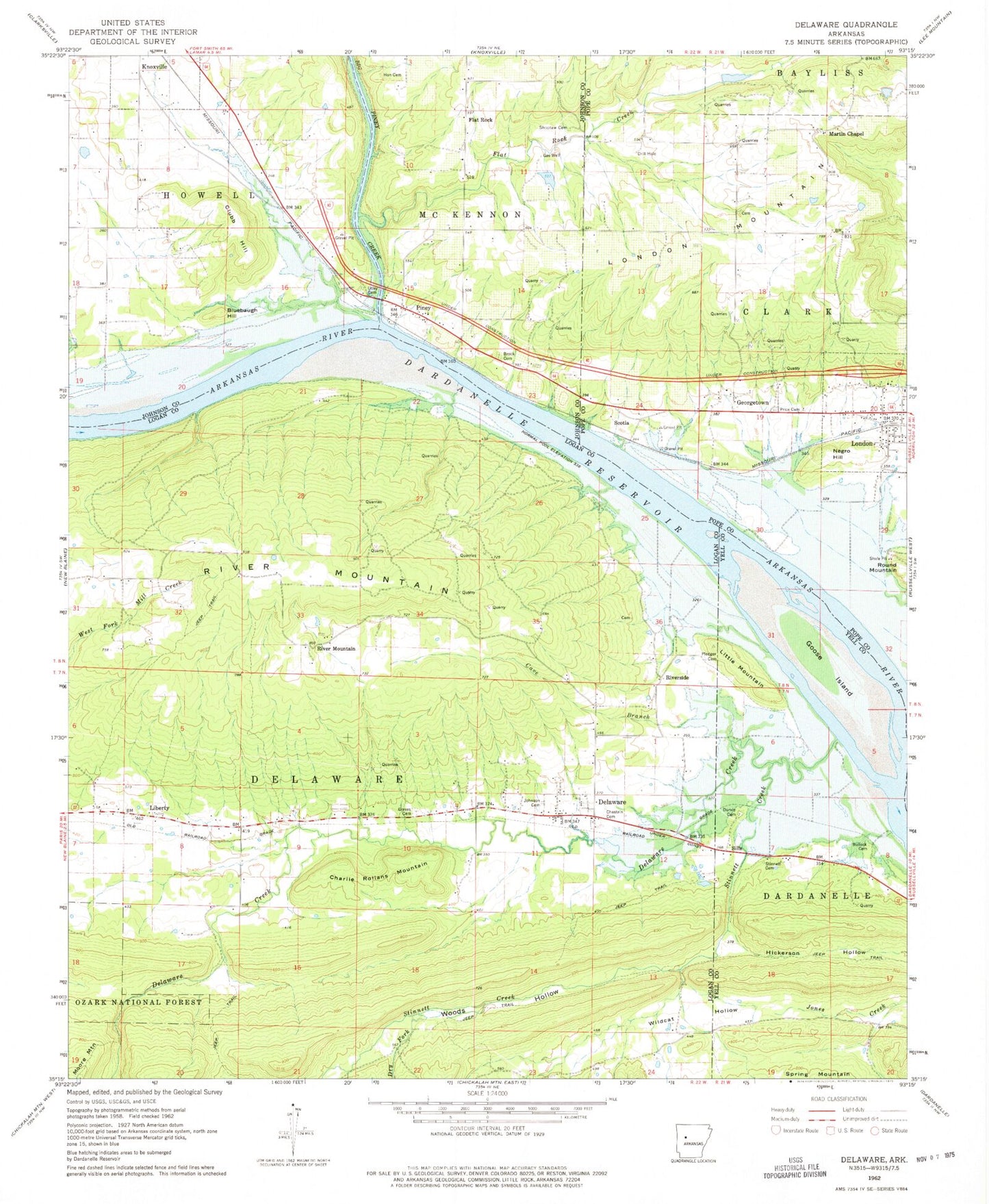
Classic USGS Delaware Arkansas 7.5'x7.5' Topo Map
Couldn't load pickup availability
Historical USGS topographic quad map of Delaware in the state of Arkansas. Map scale may vary for some years, but is generally around 1:24,000. Print size is approximately 24" x 27"
This quadrangle is in the following counties: Johnson, Logan, Pope, Yell.
The map contains contour lines, roads, rivers, towns, and lakes. Printed on high-quality waterproof paper with UV fade-resistant inks, and shipped rolled.
Contains the following named places: Big Piney Creek, Bluebaugh Hill, Brock Cemetery, Bullock Cemetery, Cave Branch, Charlie Rollans Mountain, Chastain Cemetery, Clubb Hill, Delaware, Delaware Creek, Delaware Park, Delaware Post Office, Delaware Volunteer Fire Department, Dry Fork, Durvin Cemetery, First Baptist Church, Flat Rock, Flat Rock Assembly of God Church, Flat Rock Creek, Flat Rock Use Area, Garrison Cemetery, Georgetown, Georgetown Church of Christ, Georgetown School, Goose Island, Graves Cemetery, Hon Cemetery, Johnson Cemetery, Johnson County Rural Fire District 5 Flat Rock, Lake Dardanelle State Fish Hatchery, Lake Vinson, Lake Vinson Dam, Liberty, Little Mountain, London, London Mountain, London Police Department, London Post Office, London Rural Fire Station, Martin Chapel Assembly of God Church, Martins School, Mount Nebo Oil and Gas Field, Negro Hill, New Liberty Church, Piney, Piney Bible Baptist Church, Pledger Cemetery, Price Cemetery, River Mountain, Riverside, Rocky Branch, Scotia, Shoptaw Cemetery, Sills, Stinnett Cemetery, Stinnett Creek, Township of Delaware, Utley Cemetery, Wildcat Hollow, Woods Hollow, ZIP Code: 72835