MyTopo
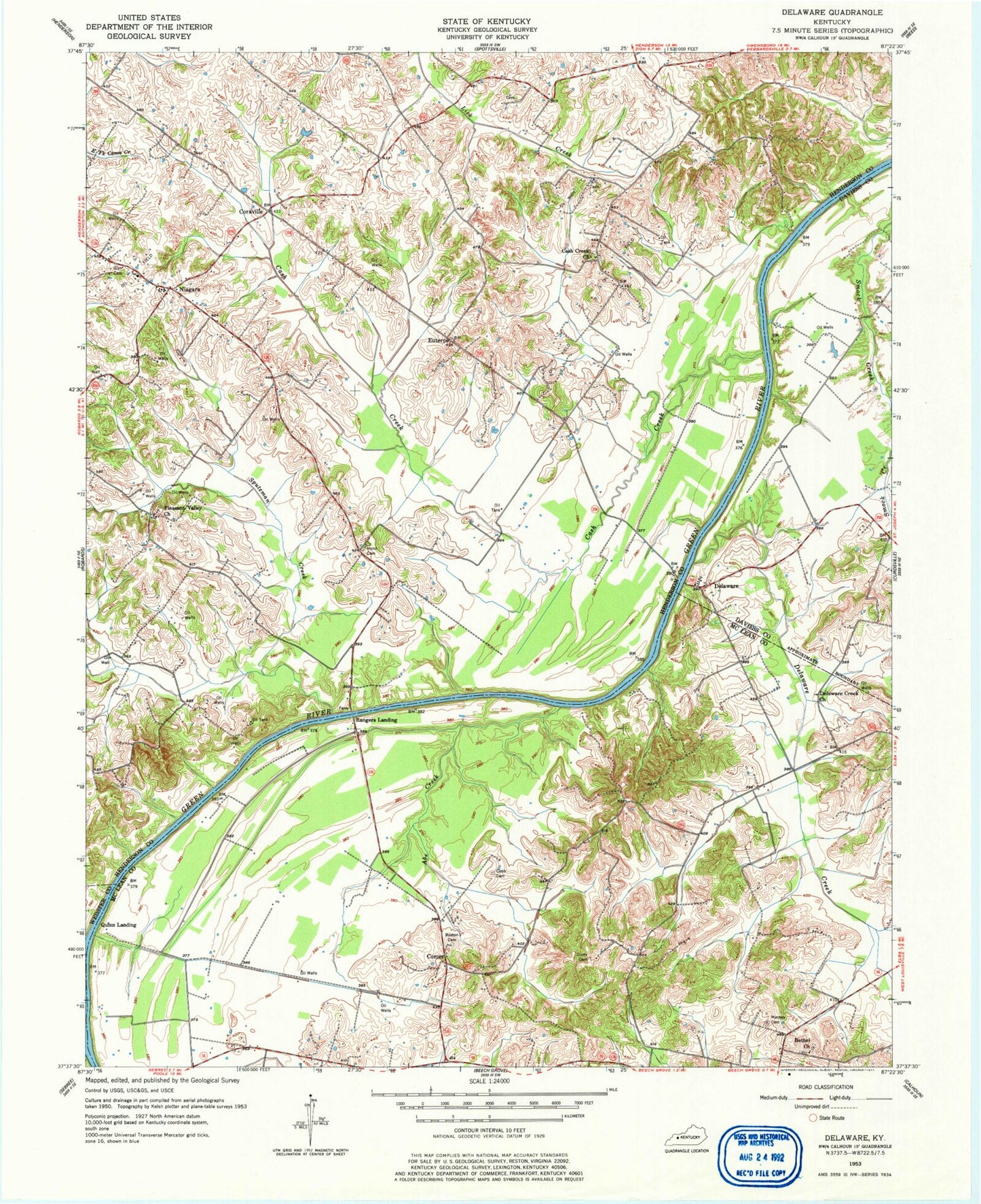
Classic USGS Delaware Kentucky 7.5'x7.5' Topo Map
Couldn't load pickup availability
Historical USGS topographic quad map of Delaware in the state of Kentucky. Map scale may vary for some years, but is generally around 1:24,000. Print size is approximately 24" x 27"
This quadrangle is in the following counties: Daviess, Henderson, McLean, Webster.
The map contains contour lines, roads, rivers, towns, and lakes. Printed on high-quality waterproof paper with UV fade-resistant inks, and shipped rolled.
Contains the following named places: Abe Creek, Bethel Church, Boston Cemetery, Cash Creek, Cash Creek Church, Cobb Cemetery, Comer, Coraville, Corey Cemetery, Delaware, Delaware Creek, Delaware Creek Church, Euterpe, Hebbardsville-Robards Division, James Bethel Gresham Historical Marker, Mackey Cemetery, Niagara, Niagara Fire Department, Nunn Cemetery, Pleasant Valley Church, Quinn Landing, Rangers Landing, Sputzman Creek