MyTopo
Classic USGS Delectable Mountain Vermont 7.5'x7.5' Topo Map
Couldn't load pickup availability
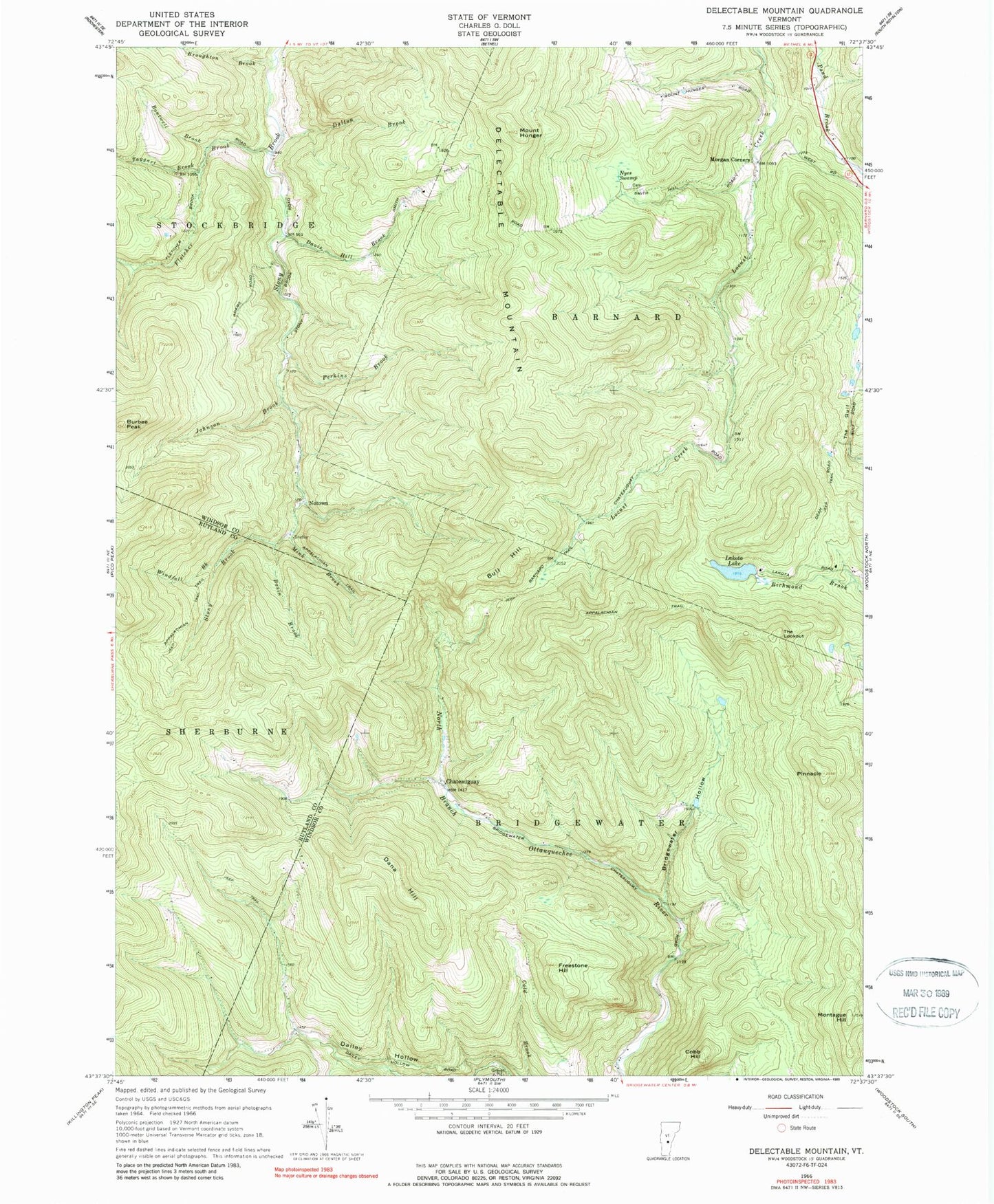
Historical USGS topographic quad map of Delectable Mountain in the state of Vermont. Typical map scale is 1:24,000, but may vary for certain years, if available. Print size: 24" x 27"
This quadrangle is in the following counties: Rutland, Windsor.
The map contains contour lines, roads, rivers, towns, and lakes. Printed on high-quality waterproof paper with UV fade-resistant inks, and shipped rolled.
Contains the following named places: Barnard Trail, Basin Brook, Bridgewater Hollow, Broughton Brook, Bull Hill, Burbee Peak, Chateauguay, Cobb Hill, Dalton Brook, Dana Hill, Davis Hill Brook, Delectable Mountain, Dimick Brook, Freestone Hill, Mount Hunger, Johnson Brook, Lakota Lake, Mink Brook, Montague Hill, Morgan Corners, Nyes Swamp, Perkins Brook, Pinnacle, The Gulf, The Lookout, Windfall Brook, Notown, Boutwell Brook, Fletcher Brook, Taggart Brook, Town of Bridgewater, Lakota Lake Dam, Barnard Town Forest, Nye Cemetery