MyTopo
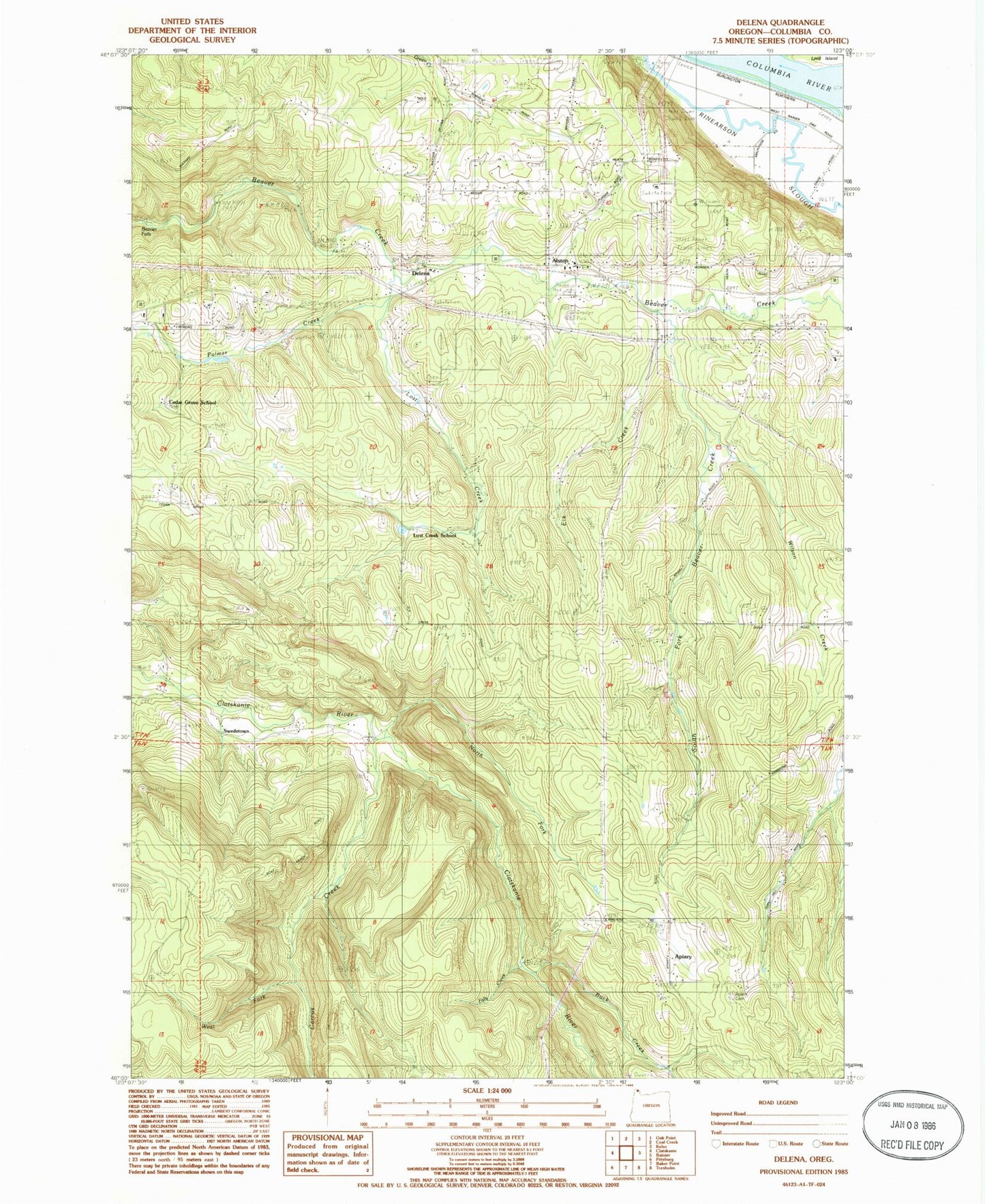
Classic USGS Delena Oregon 7.5'x7.5' Topo Map
Couldn't load pickup availability
Historical USGS topographic quad map of Delena in the state of Oregon. Map scale may vary for some years, but is generally around 1:24,000. Print size is approximately 24" x 27"
This quadrangle is in the following counties: Columbia.
The map contains contour lines, roads, rivers, towns, and lakes. Printed on high-quality waterproof paper with UV fade-resistant inks, and shipped rolled.
Contains the following named places: Alston, Apiary, Apiary Cemetery, Apiary Post Office, Beaver Falls, Buck Creek, Carcus Creek, Cedar Grove School, Clatskanie Rural Fire Delena Station, Delena, Delena Post Office, Dibblee Point, Elk Creek, Falls Creek, Firwood Post Office, Hudson, Hudson Post Office, Kyser, Kyser Post Office, Lost Creek, Lost Creek School, North Fork Clatskanie River, Palm Creek, Rinearson Point, South Fork Beaver Creek, Swedetown, West Fork Carcus Creek, Wilson Creek