MyTopo
Classic USGS Dell Arkansas 7.5'x7.5' Topo Map
Couldn't load pickup availability
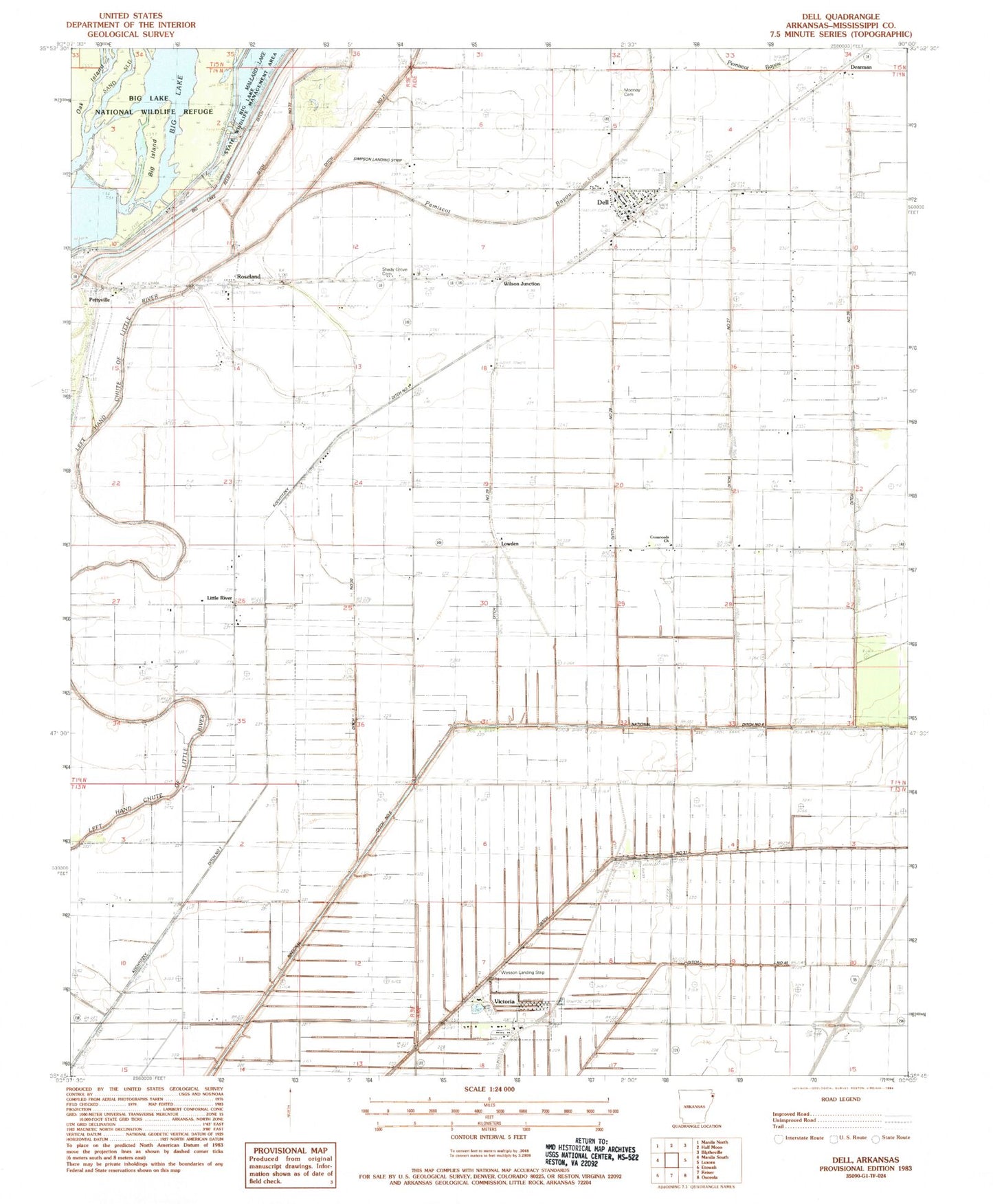
Historical USGS topographic quad map of Dell in the state of Arkansas. Map scale may vary for some years, but is generally around 1:24,000. Print size is approximately 24" x 27"
This quadrangle is in the following counties: Mississippi.
The map contains contour lines, roads, rivers, towns, and lakes. Printed on high-quality waterproof paper with UV fade-resistant inks, and shipped rolled.
Contains the following named places: Bethel Church, Big Island, Brushy Arbor School, Cross Roads Baptist Church, Dearman, Dell, Dell Elementary School, Dell Police Department, Dell Post Office, Dell Volunteer Fire Department, Ditch Number 224, Ditch Number 26, Ditch Number 27, Ditch Number 28, Ditch Number 29, Ditch Number 30, Ditch Number 31, Ditch Number 40, Ditch Number 73, High Tower School, Hightower, Hodges Store, Kochtitzky Ditch Number 1, Little River, Lowden, Lowden School, McFerrin, McFerrin Plantation, Mississippi County, Mound Place Cemetery, Mount Olive Church, Number 3 Camp, Pemiscot Bayou, Pettyville, Roseland, Sassafras Bend, Shady Grove Cemetery, Shady Grove Church, Shady Oak School, Shonyo, Simmons Plantation, Simpson Landing Strip, Stevens Store, Sunny Side School, Town of Dell, Town of Victoria, Township of Hector, Turner, Vegch Plantation, Victoria, Wesson Landing Strip, Wilson Junction, ZIP Code: 72426