
MyTopo
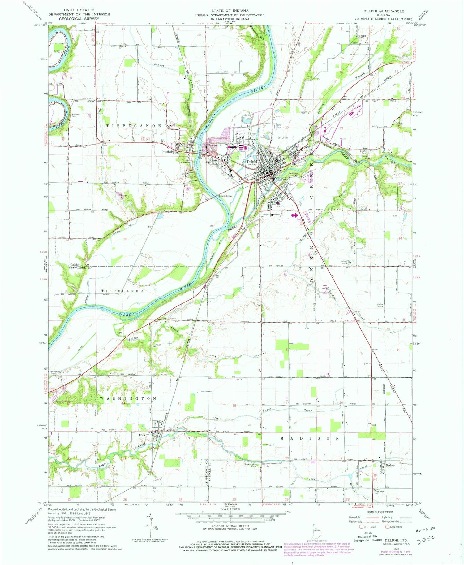
Classic USGS Delphi Indiana 7.5'x7.5' Topo Map
Couldn't load pickup availability
Historical USGS topographic quad map of Delphi in the state of Indiana. Map scale may vary for some years, but is generally around 1:24,000. Print size is approximately 24" x 27"
This quadrangle is in the following counties: Carroll, Tippecanoe.
The map contains contour lines, roads, rivers, towns, and lakes. Printed on high-quality waterproof paper with UV fade-resistant inks, and shipped rolled.
Contains the following named places: Americus Census Designated Place, Baum Cemetery, Benham Cemetery, Bowen Ditch, Bridge Creek, Carroll County Sheriff's Office, City of Delphi, Colburn, Colburn Census Designated Place, Cunningham Cemetery, De Ford Airport, Deer Creek, Delphi, Delphi Cemetery, Delphi Courthouse Square Historic District, Delphi Limestone Quarry, Delphi Municipal Airport, Delphi Police Department, Delphi Post Office, Delphi Tri - Township Fire Department, Gray Turkey Farms, Harley, Harley Siding, Hillcrest Elementary School, Julien Ditch, Little Sugar Creek, Mears Cemetery, New Hope School, Pittsburg, Pleasant Run, Radnor, Robinson Branch, Saint Joseph Catholic Cemetery, Sugar Creek, Sugar Creek Branch Number One, Tannery Branch, Township of Deer Creek, Township of Madison, Township of Tippecanoe, Township of Washington, Wabash and Erie Canal, Wingard Cemetery, ZIP Code: 46923


