MyTopo
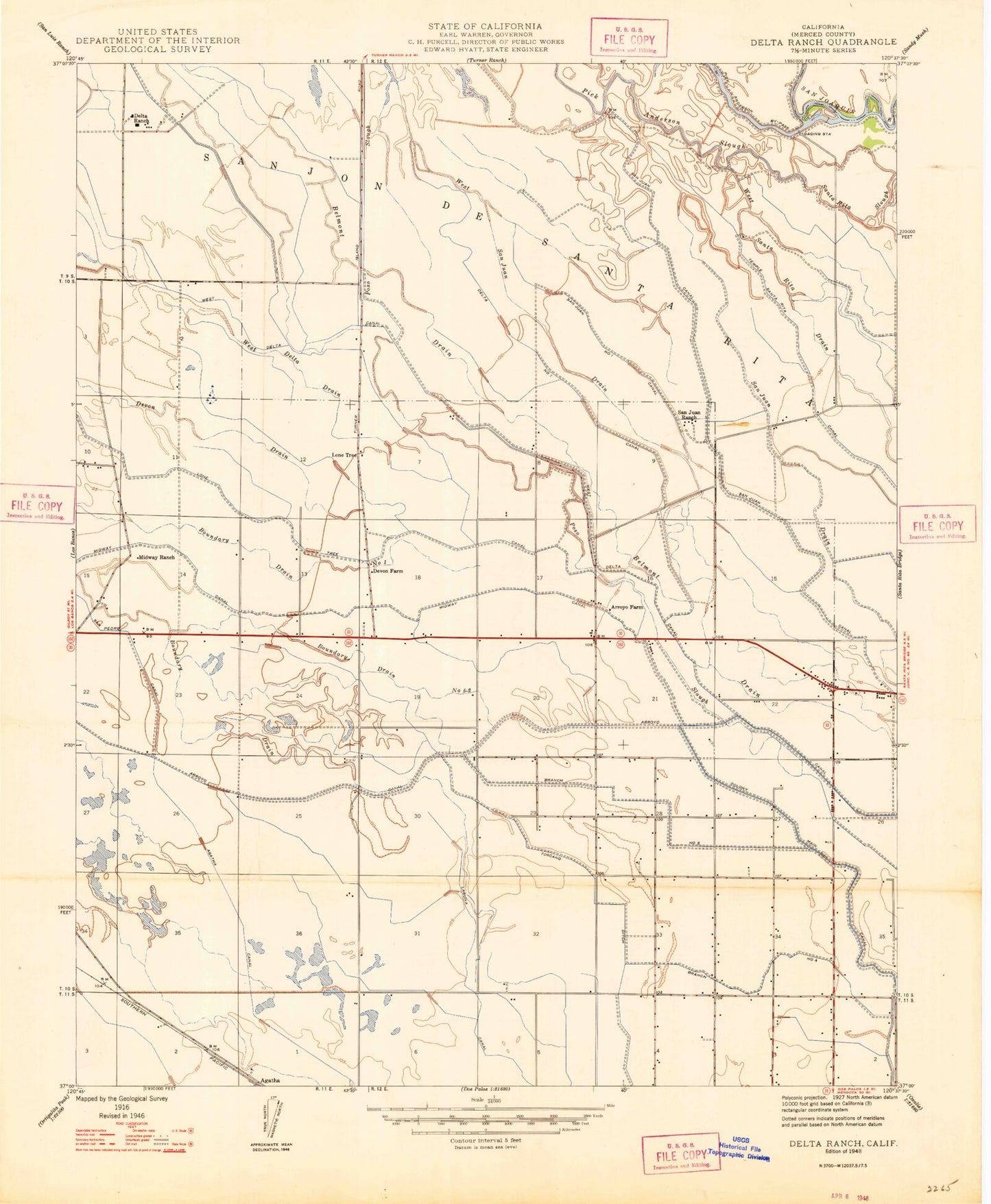
Classic USGS Delta Ranch California 7.5'x7.5' Topo Map
Couldn't load pickup availability
Historical USGS topographic quad map of Delta Ranch in the state of California. Map scale may vary for some years, but is generally around 1:24,000. Print size is approximately 24" x 27"
This quadrangle is in the following counties: Merced.
The map contains contour lines, roads, rivers, towns, and lakes. Printed on high-quality waterproof paper with UV fade-resistant inks, and shipped rolled.
Contains the following named places: Agatha Canal, Arroyo Canal, Arroyo Farm, Belmont Drain, Bennett Ditch, Boundary Drain, Boundary Drain Number Five, Boundary Drain Number Five-Two, Circle Six Ranch, Clark Ditch, Colony Branch Number Five, Colony Branch Number Four, Colony Main Canal, Community Ditch, County Road Ditch, Delta Canal, Delta Number One Canal, Delta Ranch, Dos Palos Division, Dos Palos Y, Dos Palos Y Census Designated Place, East Delta Canal, Geis Ditch, Lone Tree Camp, Lone Tree Canal, Machado Ditch, Merced County Fire Department Station 75, Midway Canal, Midway Ranch, Midway Swamp Ditch, Miller and Lux Ranch, O'Banion Gun Club, Poso Drain, Salt Slough Ditch, San Juan Canal, San Juan Number One Levy Canal, San Juan Ranch, Sanjon De Santa Rita, Santa Rita Park Post Office, Sierra Gun Club, Sportsman Ranch, Tambellini Ditch, Temple Santa Rita Extension Canal, Toscano Ditch, West San Juan Drain, West San Juan Drain Number One, West Santa Rita Drain, ZIP Code: 93620