MyTopo
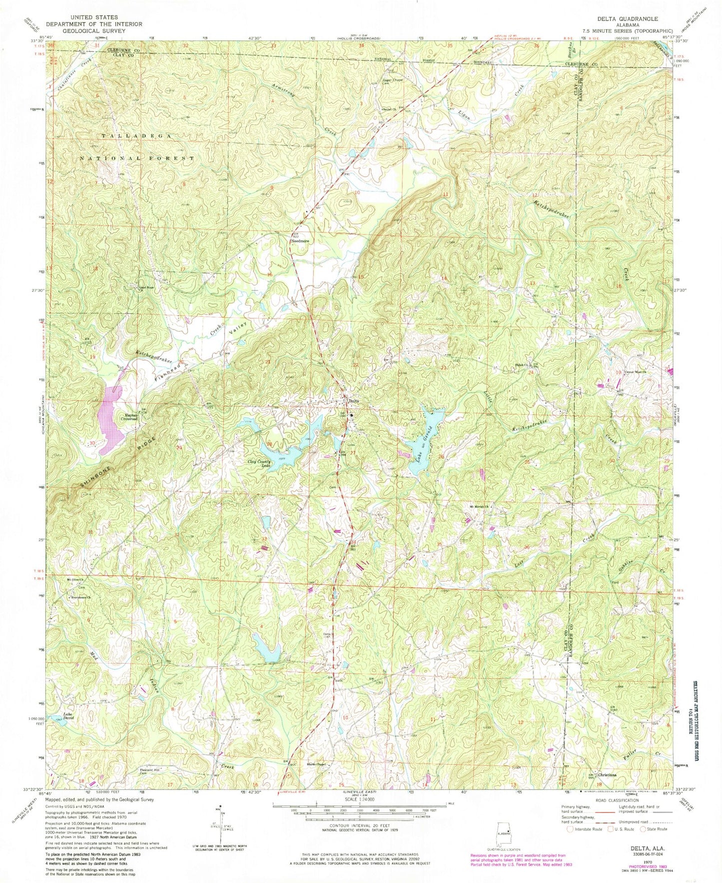
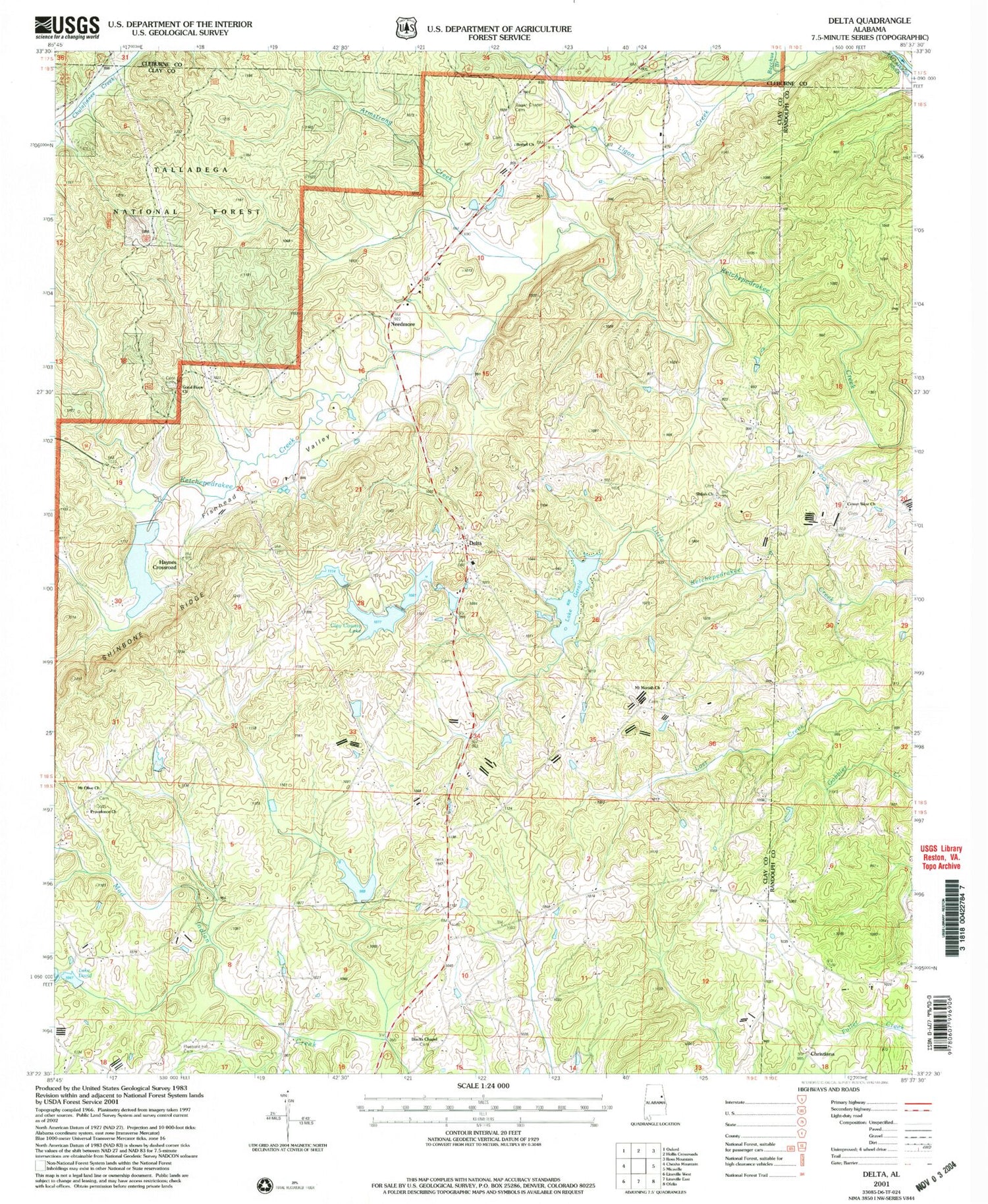
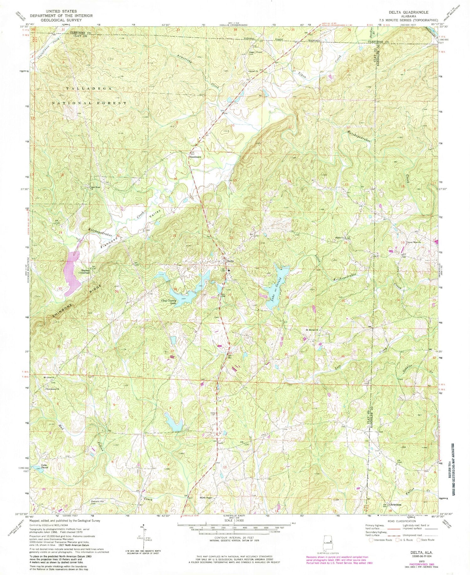
Classic USGS Delta Alabama 7.5'x7.5' Topo Map
Couldn't load pickup availability
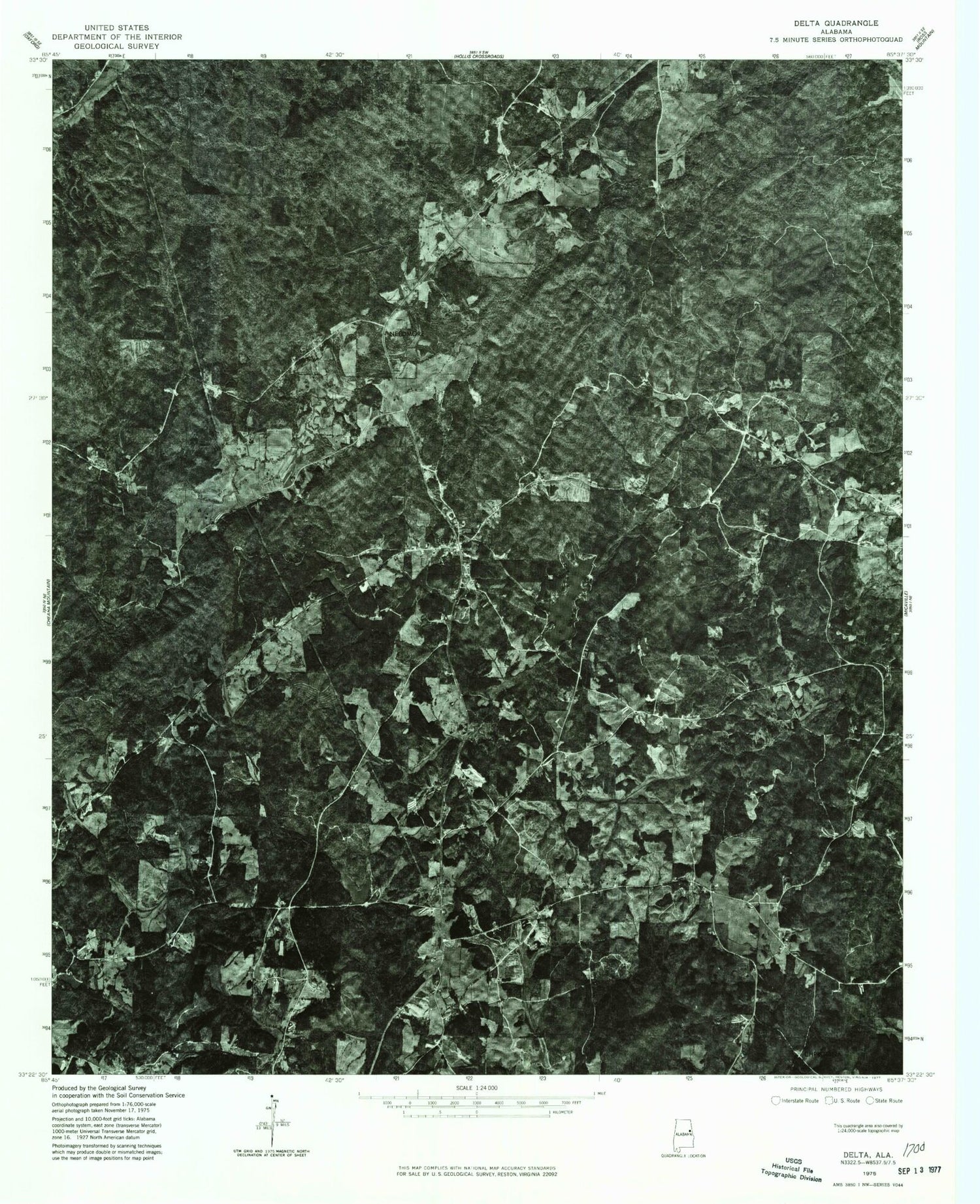
Historical USGS topographic quad map of Delta in the state of Alabama. Typical map scale is 1:24,000, but may vary for certain years, if available. Print size: 24" x 27"
This quadrangle is in the following counties: Clay, Cleburne, Randolph.
The map contains contour lines, roads, rivers, towns, and lakes. Printed on high-quality waterproof paper with UV fade-resistant inks, and shipped rolled.
Contains the following named places: Delta Church, Smith Prospect, Armstrong Mill (historical), Armstrong Creek, Bacchus Branch, Bethel Baptist Church, Black's Chapel United Methodist Church, Center West Church, Christiana, Clay County Lake, Lake David, Delta, Fishhead Valley, Lake Gerald, Good Hope Church, Haynes Crossroad, Ligon Creek, Mount Moriah Church, Mount Olive Church, Needmore, Pleasant Hill Cemetery, Providence Church, Ragan Chapel Cemetery, Shiloh Primitive Baptist Church, Center Hill Dam, Center Hill Lake, Lower State Lake Dam, Gerald Lake Dam, Lake Virginia, Virginia Lake Dam, Upper State Lake Dam, Upper State Lake, Ketchepedrakee Watershed Dam Number 15, Rocky Mount (historical), Dukes Mill (historical), Ingram Mill (historical), Millers Gin (historical), Oak Lane (historical), Center West, Delta Junior High School (historical), Delta Mine, Smith Number One Mine, New Hope Church (historical), Latham (historical), Bethel Cemetery, Delta Church, Mount Moriah, Mount Moriah Baptist Church Cemetery, Shiloh Primitive Baptist Church Cemetery, Blacks Chapel Methodist Church Cemetery, Delta Cemetery, Good Hope Cemetery, Mount Olive Cemetery, Providence Cemetery, Delta Census Designated Place, Delta Volunteer Fire Department, Delta Post Office, Delta Church, Smith Prospect, Armstrong Mill (historical), Armstrong Creek, Bacchus Branch, Bethel Baptist Church, Black's Chapel United Methodist Church, Center West Church, Christiana, Clay County Lake, Lake David, Delta, Fishhead Valley, Lake Gerald, Good Hope Church, Haynes Crossroad, Ligon Creek, Mount Moriah Church, Mount Olive Church, Needmore, Pleasant Hill Cemetery, Providence Church, Ragan Chapel Cemetery, Shiloh Primitive Baptist Church, Center Hill Dam, Center Hill Lake, Lower State Lake Dam, Gerald Lake Dam, Lake Virginia, Virginia Lake Dam, Upper State Lake Dam, Upper State Lake, Ketchepedrakee Watershed Dam Number 15, Rocky Mount (historical), Dukes Mill (historical), Ingram Mill (historical), Millers Gin (historical), Oak Lane (historical), Center West, Delta Junior High School (historical), Delta Mine, Smith Number One Mine, New Hope Church (historical), Latham (historical), Bethel Cemetery, Delta Church, Mount Moriah, Mount Moriah Baptist Church Cemetery, Shiloh Primitive Baptist Church Cemetery, Blacks Chapel Methodist Church Cemetery, Delta Cemetery, Good Hope Cemetery, Mount Olive Cemetery, Providence Cemetery, Delta Census Designated Place, Delta Volunteer Fire Department, Delta Post Office