MyTopo
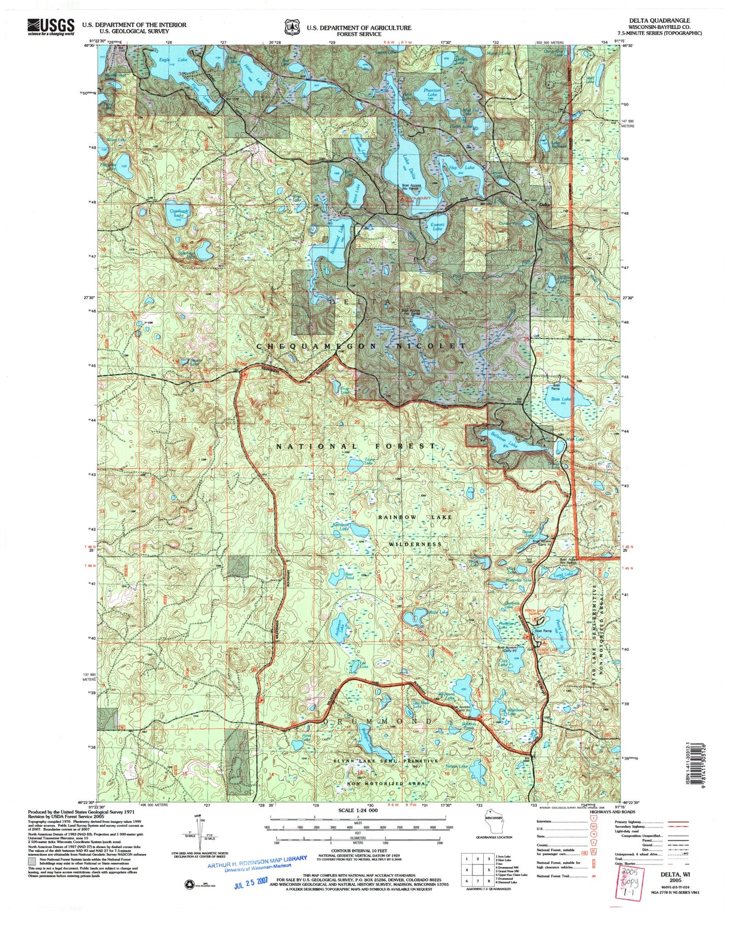
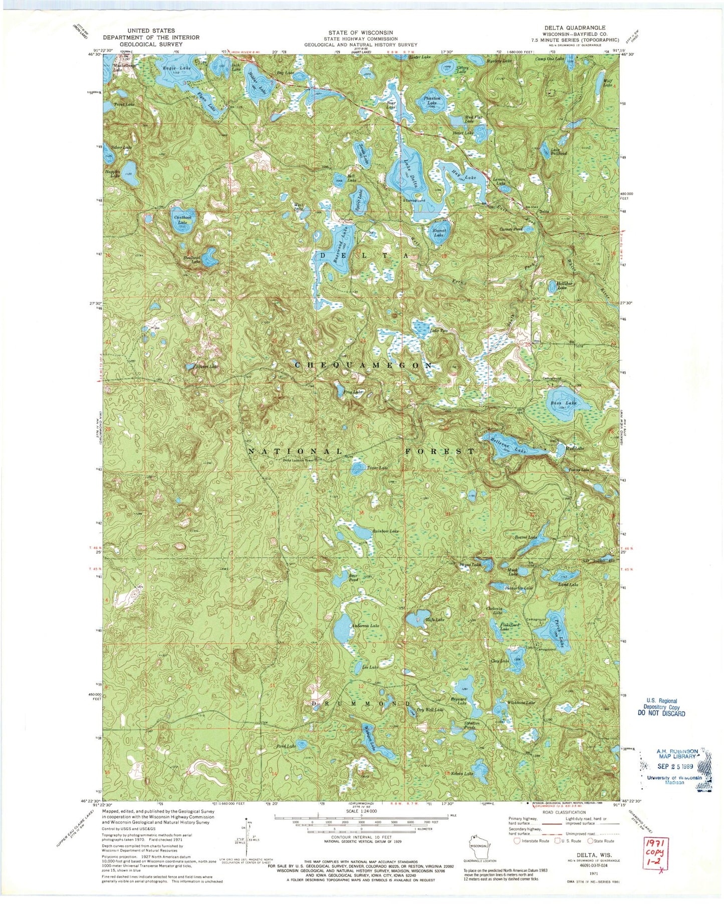
Classic USGS Delta Wisconsin 7.5'x7.5' Topo Map
Couldn't load pickup availability
Historical USGS topographic quad map of Delta in the state of Wisconsin. Typical map scale is 1:24,000, but may vary for certain years, if available. Print size: 24" x 27"
This quadrangle is in the following counties: Bayfield.
The map contains contour lines, roads, rivers, towns, and lakes. Printed on high-quality waterproof paper with UV fade-resistant inks, and shipped rolled.
Contains the following named places: Namagosh Lake, Broadax Lake, Anderson Lake, Bass Lake, Basswood Lake, Bear Lake, Bear Pond, Beaver Lake, Bell Lake, Bellevue Lake, Bog Lake, Bufo Lake, Lake Bullhead, Canthook Lake, Carson Pond, Chelonia Lake, Clay Lake, Delta, Lake Delta, Dry Well Lake, Eagle Lake, East Fork White River, Everett Lake, Flakefjord Lake, Flynn Lake, Frog Lake, Getsey Lake, Happles Lake, Hay Lake, Heart Lake, Hildur Lake, Hollibar Lake, Inch Lake, Lee Lake, Lemon Lake, Lund Lake, Muck Lake, Mud Flat Lake, Mud Lake, Muskellunge Lake, Mystery Lake, Nelson Lake, Perch Lake, Phantom Lake, Physa Lake, Planorbis Lake, Pond Lake, Rainbow Lake, Reynard Lake, South Fork White River, Spirit Lake, Square Lake, Steelhead Lake, Stratton Ponds, Swede Lake, Teacup Lake, Tower Lake, Lake Two, Wabigon Lake, West Fork White River, West Lake, Wishbone Lake, Wolf Lake, Three Lake, Rainbow Lake Wilderness, Perch Lake Campground, Delta Lookout Tower, Town of Delta, Murrays 2WP1034 Dam, Pike Lake Chain of Lakes 13, Delta Civilian Conservation Corps Camp (historical)