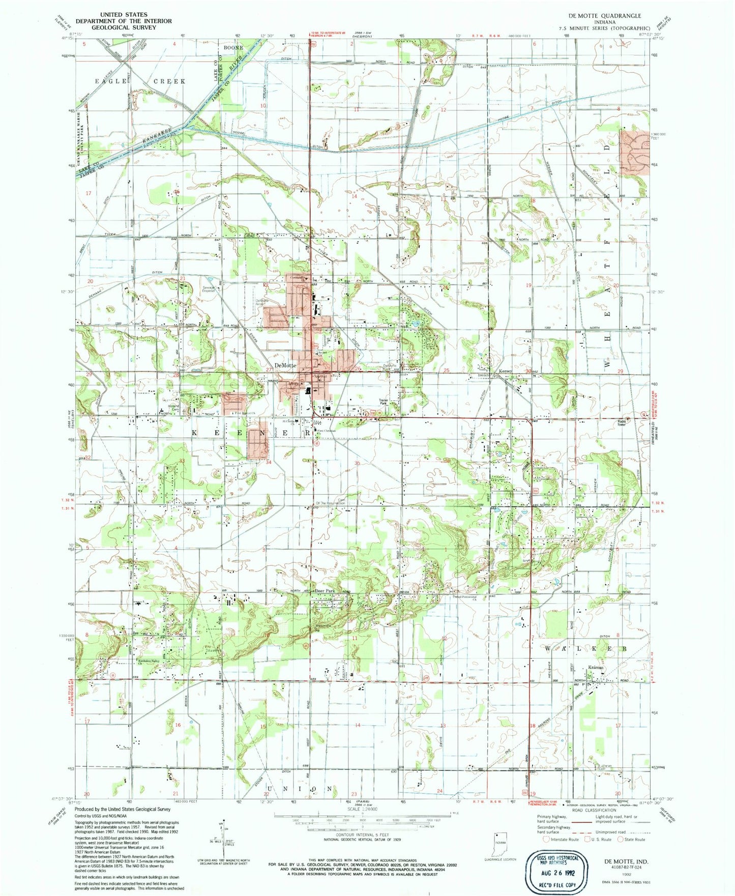
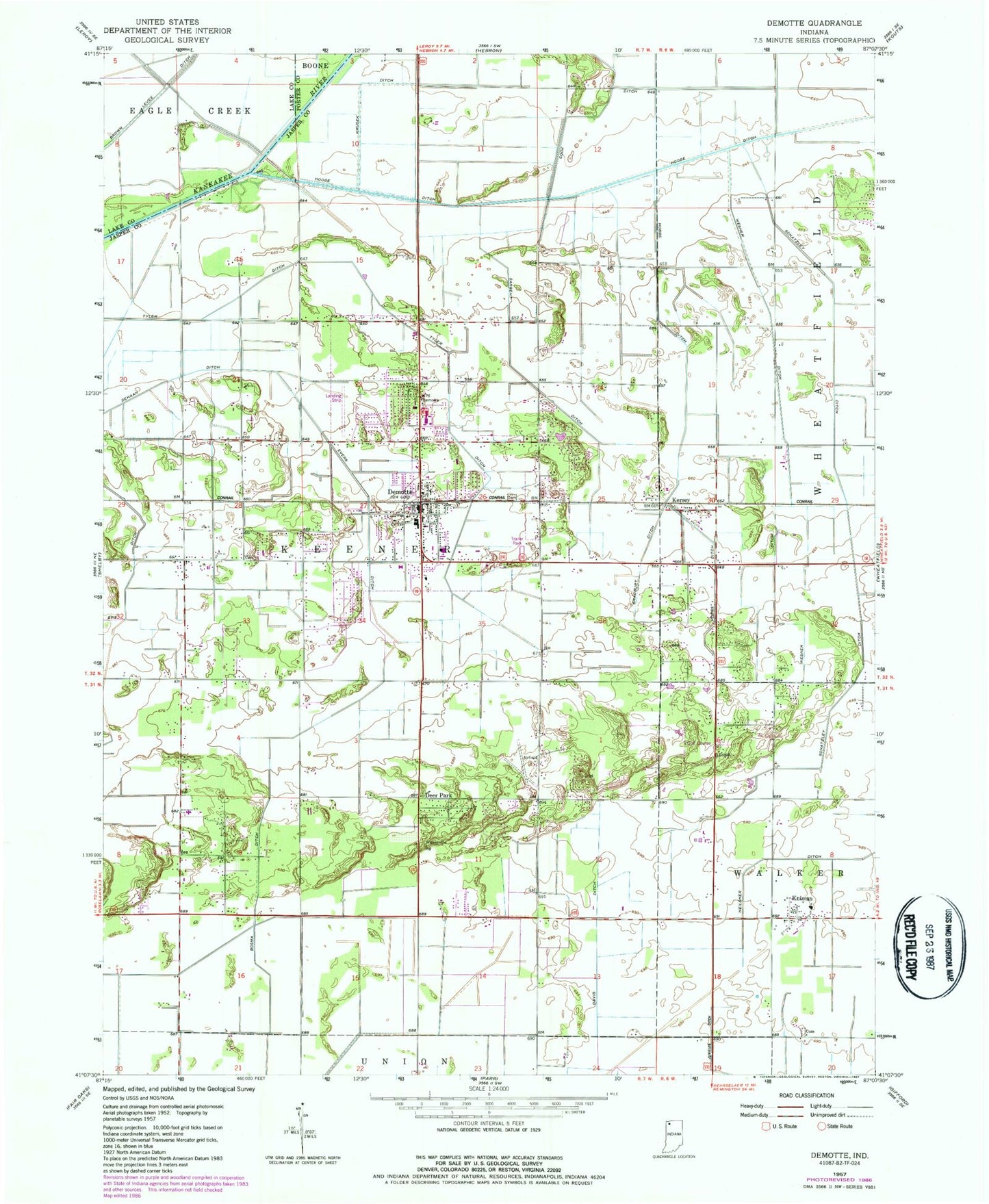
MyTopo
Classic USGS DeMotte Indiana 7.5'x7.5' Topo Map
Couldn't load pickup availability
Historical USGS topographic quad map of DeMotte in the state of Indiana. Map scale may vary for some years, but is generally around 1:24,000. Print size is approximately 24" x 27"
This quadrangle is in the following counties: Jasper, Lake, Porter.
The map contains contour lines, roads, rivers, towns, and lakes. Printed on high-quality waterproof paper with UV fade-resistant inks, and shipped rolled.
Contains the following named places: Bethel Christian Reformed Church, Bosma Ditch, Bradbury Ditch, Brent Ditch, Cemetery of the Resurrection, Cheever Airport, Church of Christ, Davis Ditch, Deer Park, DeMotte, DeMotte Airport, DeMotte Cemetery, DeMotte Christian Church, DeMotte Christian School, Demotte Elementary School, Demotte Police Department, Demotte Post Office, Evers Ditch, Eylander Hog Farms, Faith Lutheran Cemetery, First Baptist Church, First Christian Reformed Church, First Reformed Church, Freedom Park, Henning's Greenhouses, Hobbs Ditch, Hodge Ditch, Holland Cemetery, Kankakee Valley Bible Baptist Church, Keener Township Emergency Medical Services, Keener Township Volunteer Fire Department, Kersey, Kingma Greenhouses, Kniman, Krucek Ditch, Otis Ditch, Saint Cecilia Catholic Church, Sargent Ditch, Schatzley Ditch, Shady Pines Golf Course, Spencer Park, Town of De Motte, Township of Keener, Tyler Ditch, United Methodist Church, United Pentecostal Church, Wesner Ditch, ZIP Code: 46310