MyTopo
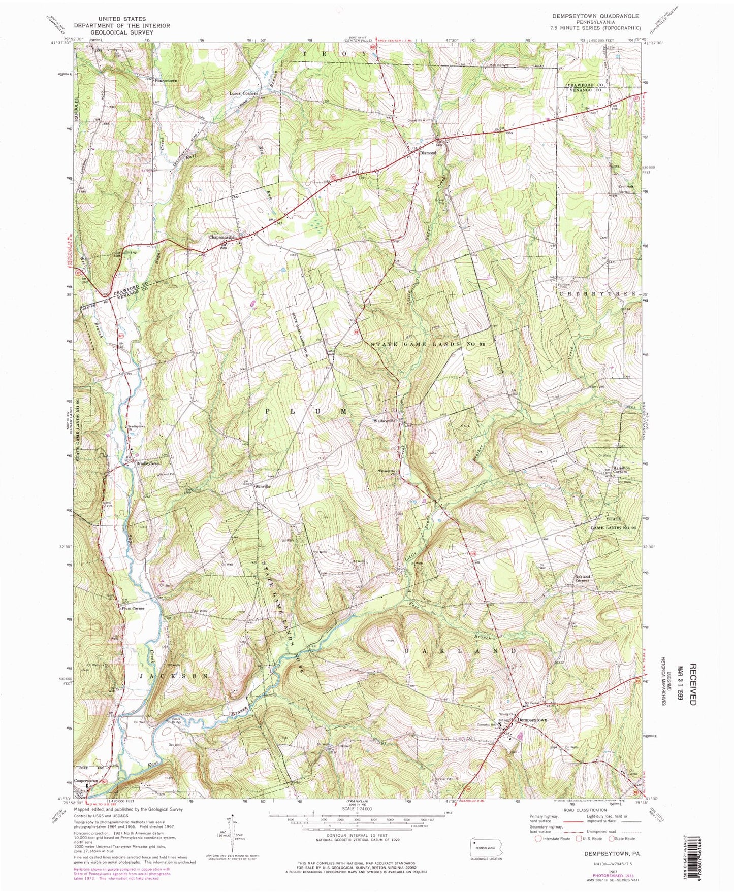
Classic USGS Dempseytown Pennsylvania 7.5'x7.5' Topo Map
Couldn't load pickup availability
Historical USGS topographic quad map of Dempseytown in the state of Pennsylvania. Map scale may vary for some years, but is generally around 1:24,000. Print size is approximately 24" x 27"
This quadrangle is in the following counties: Crawford, Venango.
The map contains contour lines, roads, rivers, towns, and lakes. Printed on high-quality waterproof paper with UV fade-resistant inks, and shipped rolled.
Contains the following named places: Alcorn School, Baums Corners, Boals Bridge, Boat School, Boyd Center Corners, Bradleytown, Bradleytown Church, Chapmanville, Chapmanville Volunteer Fire Department, Cooperstown Volunteer Fire Department Station 5, Copperstown Post Office, Dempseytown, Dets School, Diamond, Dry Run, East Branch Sugar Creek, Fairview Cemetery, Fauncetown, Hamilton Corners, Little Sugar Creek, Luces Corners, Maple Hill Cemetery, Mount Carmel Church, Oakland Corners, Oakland Township Volunteer Fire Department Station 13, Plum Center School, Plum Corner, Plum Post Office, Prather Creek, Propers Corners, Prospect Hill Church, Red Run, State Game Lands Number 96, Sunville, Sunville Post Office, Township of Oakland, Township of Plum, Trinity Church, Valley School, Wallaceville, Wallaceville Church, Wallaceville Post Office, West Branch Sugar Creek, ZIP Code: 16317