MyTopo
Classic USGS Dendora Valley Arizona 7.5'x7.5' Topo Map
Regular price
$16.95
Regular price
Sale price
$16.95
Unit price
per
Couldn't load pickup availability
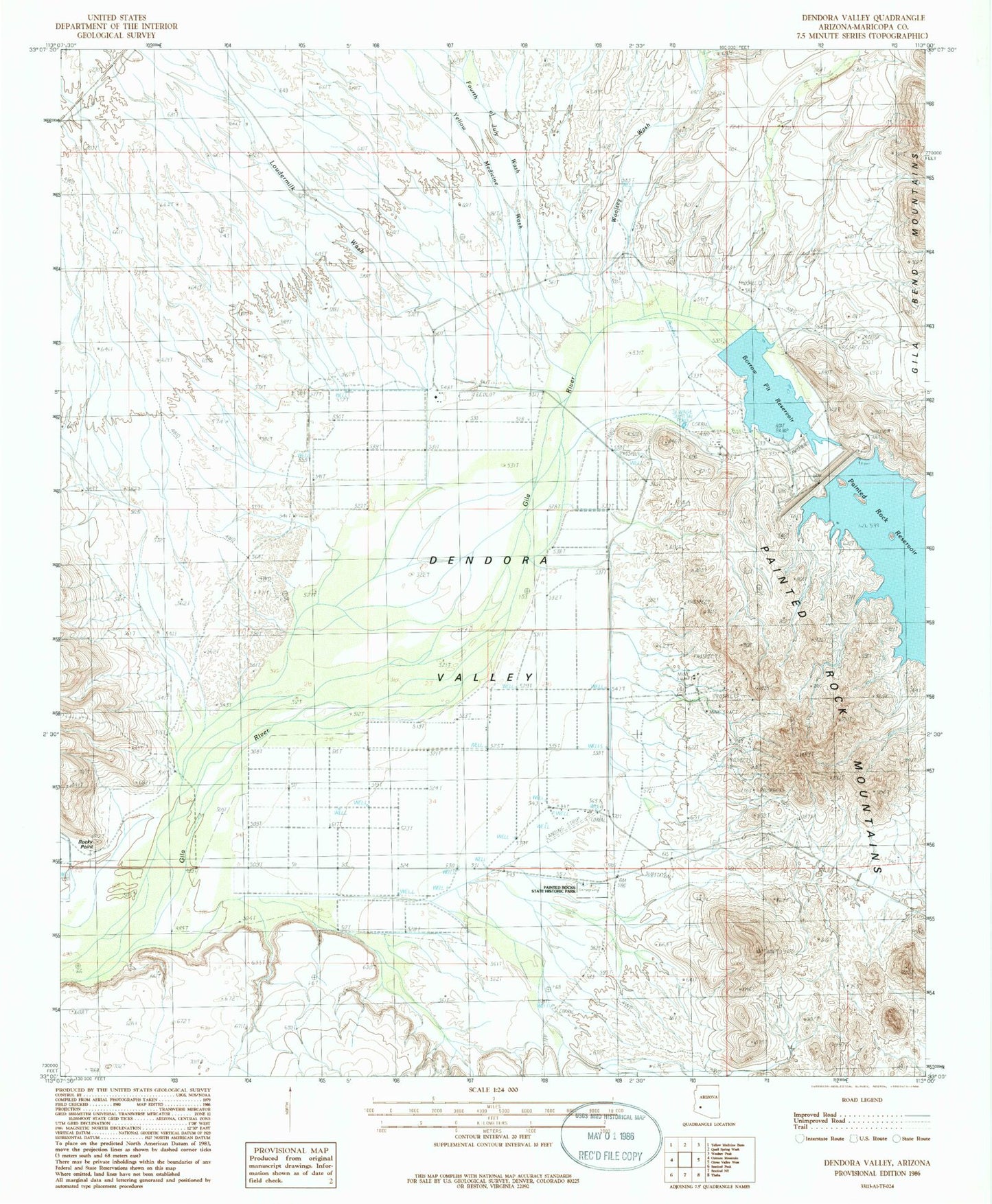
Historical USGS topographic quad map of Dendora Valley in the state of Arizona. Map scale may vary for some years, but is generally around 1:24,000. Print size is approximately 24" x 27"
This quadrangle is in the following counties: Maricopa.
The map contains contour lines, roads, rivers, towns, and lakes. Printed on high-quality waterproof paper with UV fade-resistant inks, and shipped rolled.
Contains the following named places: Alamo Well, Bunyan Substation, Dendora Ranch, Dendora Valley, Fourth of July Wash, Gila River Canyon, Loudermilk Wash, Painted Rock Dam, Painted Rock Historic Park, Painted Rock Reservoir, Rawley Mine, Rocky Point, Woolsey Wash, Yellow Medicine Wash