MyTopo
Classic USGS Denham Mississippi 7.5'x7.5' Topo Map
Couldn't load pickup availability
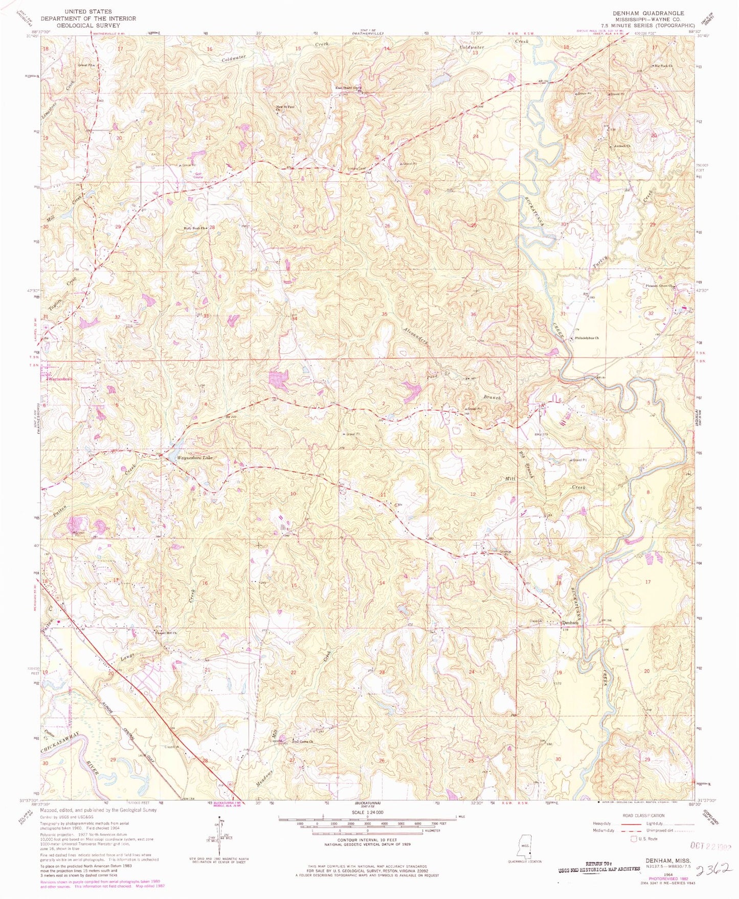
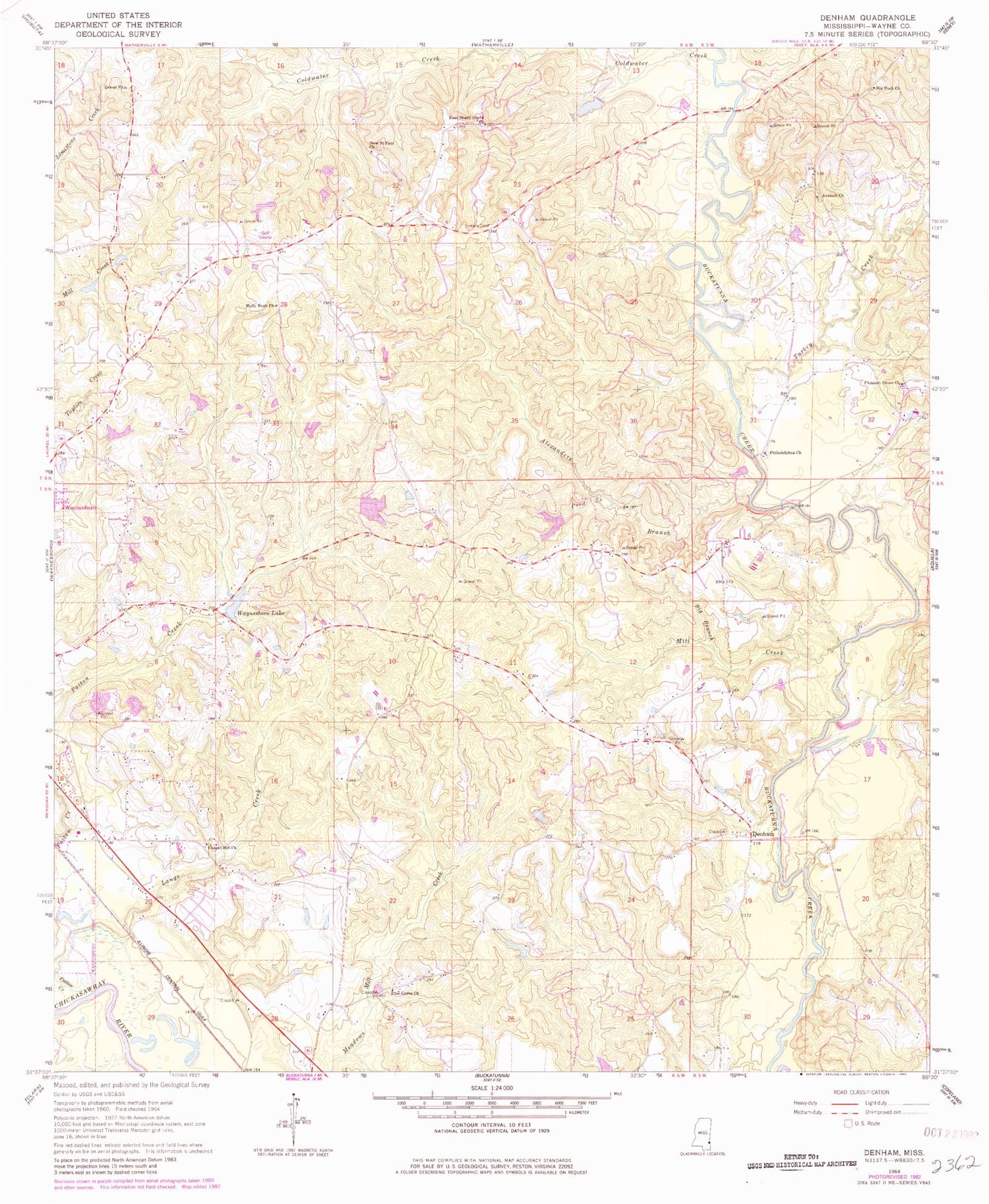
Historical USGS topographic quad map of Denham in the state of Mississippi. Map scale may vary for some years, but is generally around 1:24,000. Print size is approximately 24" x 27"
This quadrangle is in the following counties: Wayne.
The map contains contour lines, roads, rivers, towns, and lakes. Printed on high-quality waterproof paper with UV fade-resistant inks, and shipped rolled.
Contains the following named places: Alexanders Branch, Antioch Church, Big Branch, Big Rock Cemetery, Big Rock Church, Cedar Bridge, Chapel Hill Church, Clark Pond Dam, Coldwater Creek, Denham, Denham School, Dyess Bridge, East Shady Grove Church, Ellis Lake Dam, Eudora Cemetery, Fedora, Fedora Methodist Church, Holly Bush Church, Langs Creek, Macks School, Maynor Creek Water Park Dam, Mill Creek, New Saint Paul Church, Palmer Ponds Dam, Patton Creek, Philadelphus Cemetery, Philadelphus Church, Pine Grove Church, Pleasant Grove Cemetery, Pleasant Grove Church, Pond Branch, Robinsons Store, Supervisor District 2, Tokio, Turkey Creek, Wayne County Farm, Wayne County Volunteer Fire Department Denham Station, Waynesboro Lake, Waynesboro Lake Dam, Winchester Oil Field