MyTopo
Classic USGS Denio Nevada 7.5'x7.5' Topo Map
Couldn't load pickup availability
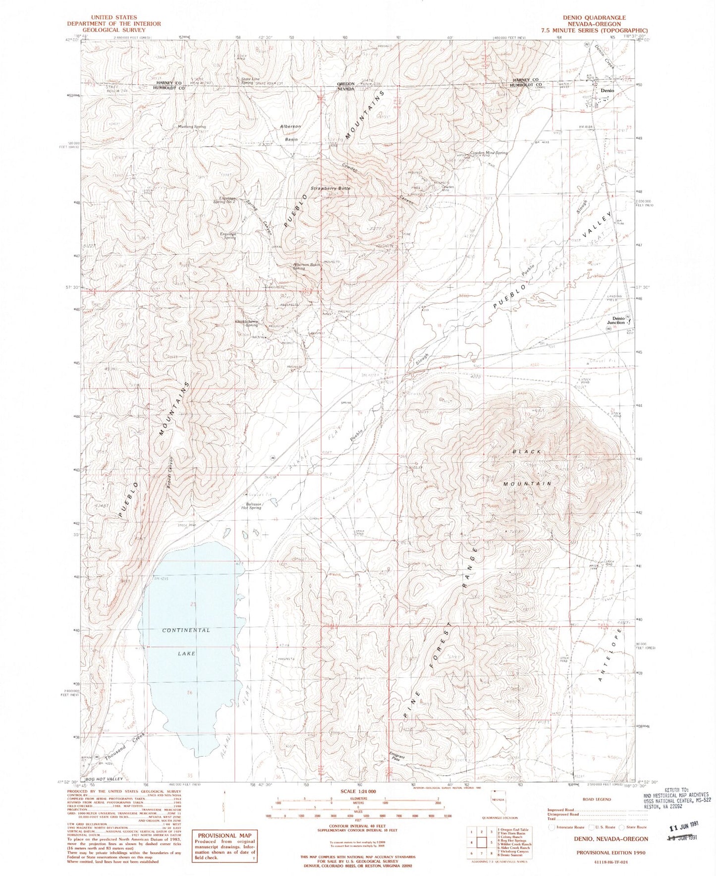
Historical USGS topographic quad map of Denio in the states of Nevada, Oregon. Map scale may vary for some years, but is generally around 1:24,000. Print size is approximately 24" x 27"
This quadrangle is in the following counties: Harney, Humboldt.
The map contains contour lines, roads, rivers, towns, and lakes. Printed on high-quality waterproof paper with UV fade-resistant inks, and shipped rolled.
Contains the following named places: Alberson Basin, Alberson Basin Spring, Albertson Ranch, Antelope, Baltazor Hot Spring, Black Mountain, Bobcat Canyon, Chokecherry Spring, Continental Lake, Cowden Canyon, Cowden Mine, Cowden Mine Spring, Denio, Denio Census Designated Place, Denio Creek, Denio Elementary School, Denio Junction Airport, Denio Post Office, Denio Volunteer Fire Department, Emigrant Pass, Erquiaga Spring, Erquiaga Spring Number Two, Hall Mine, Hot Lake, Mineral Creek, Mustang Spring, Overton, Spring Canyon, State Line Spring, Strawberry Butte, Thousand Creek, Warm Springs Mining District, ZIP Code: 89404