MyTopo
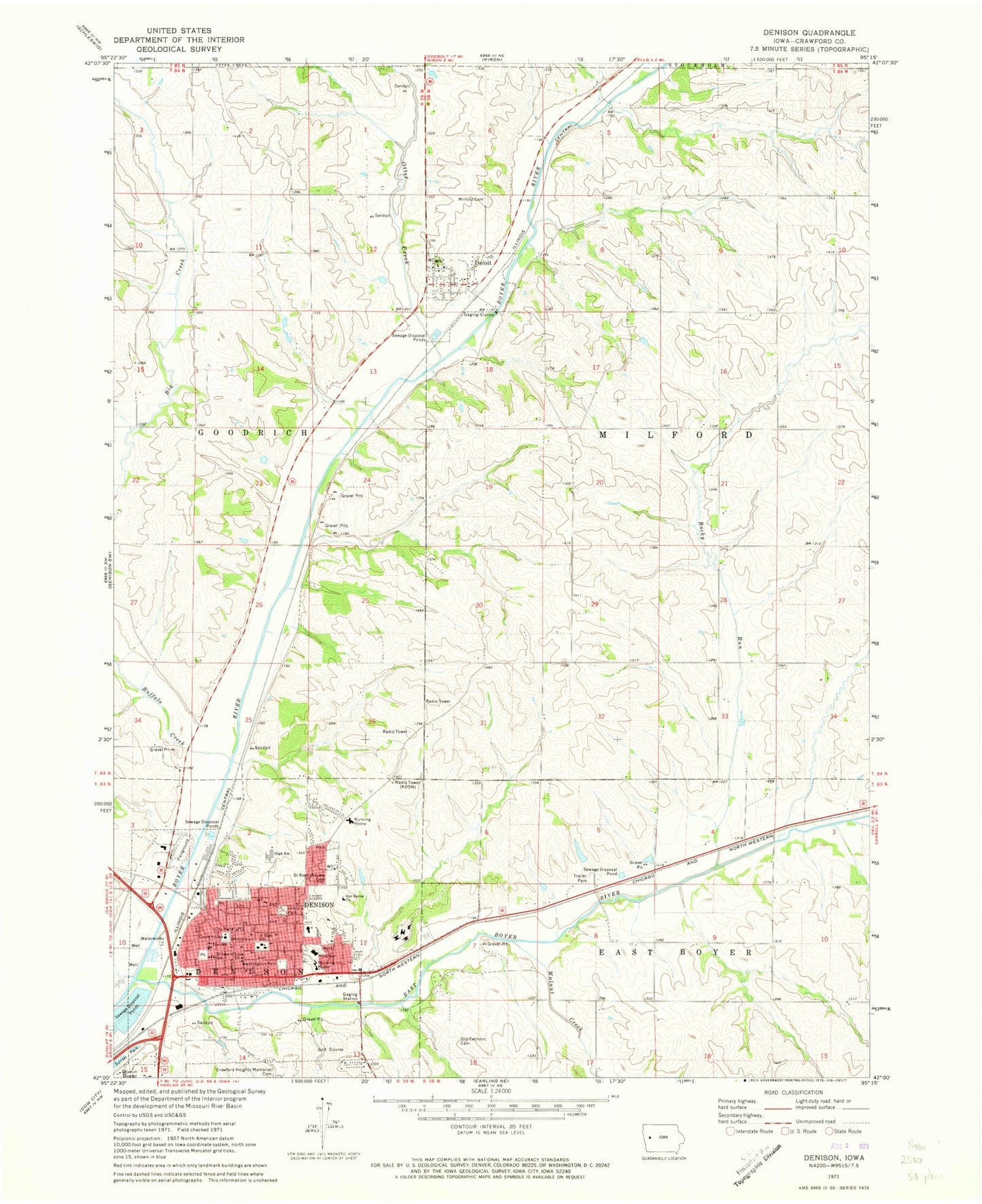
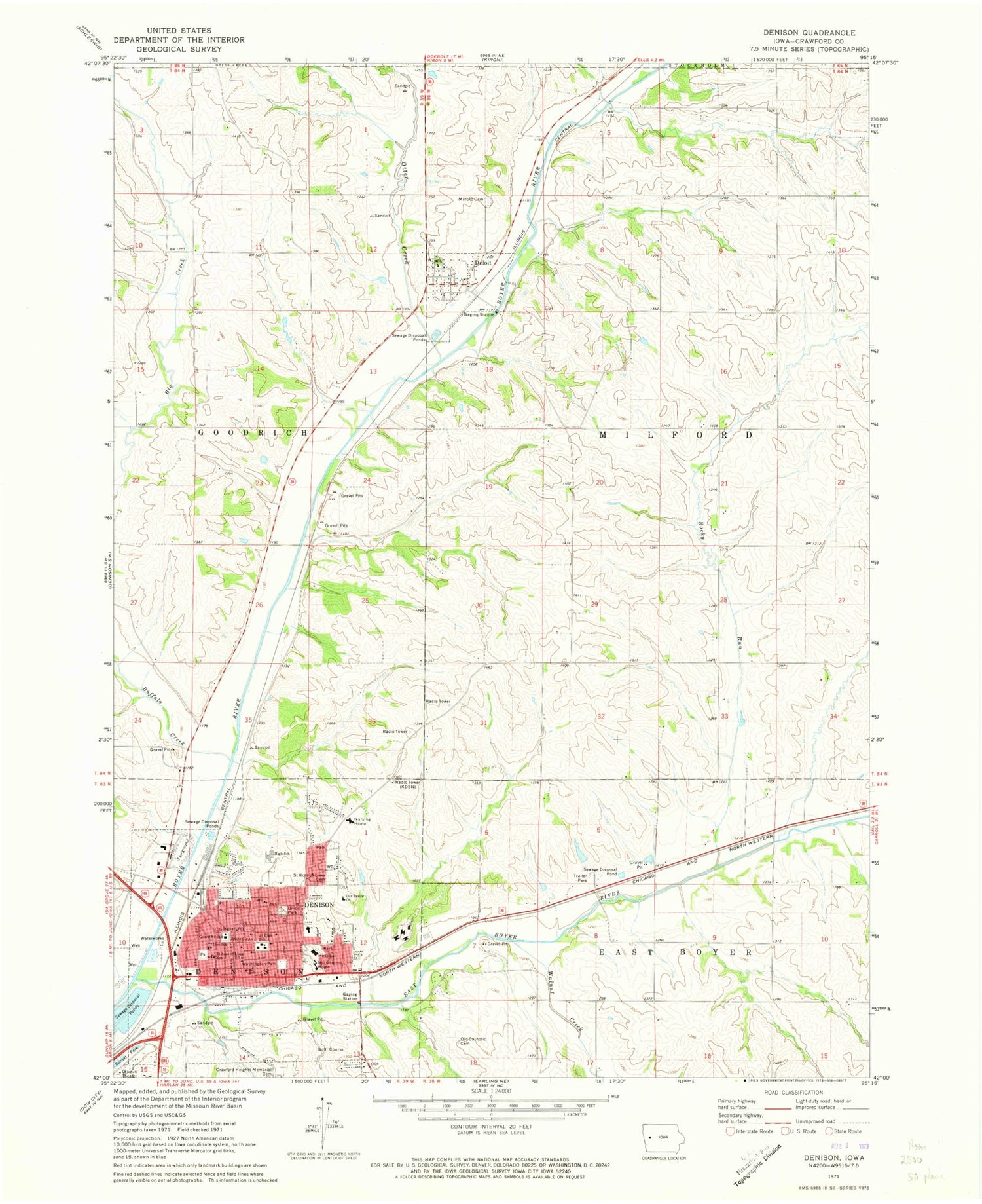
Classic USGS Denison Iowa 7.5'x7.5' Topo Map
Couldn't load pickup availability
Historical USGS topographic quad map of Denison in the state of Iowa. Map scale may vary for some years, but is generally around 1:24,000. Print size is approximately 24" x 27"
This quadrangle is in the following counties: Crawford.
The map contains contour lines, roads, rivers, towns, and lakes. Printed on high-quality waterproof paper with UV fade-resistant inks, and shipped rolled.
Contains the following named places: Abundant Life Assembly of God Church, ANP Foot and Ankle Clinic, Bliesman Landing, Broadway Dental Center, Broadway Elementary School, Buffalo Creek, Church of Christ, City of Deloit, City of Denison, Country View Mobile Home Park, Crawford County Clinic, Crawford County Courthouse, Crawford County Fairgrounds, Crawford County Sheriff's Office, Crawford County Speedway, Crawford Heights Memory Gardens, Deloit, Deloit Fire Department, Deloit Post Office, Denison, Denison Alternative High School, Denison Aquatic Fun Center, Denison Baptist Church, Denison Care Center, Denison Chiropractic Clinic, Denison City Hall, Denison Country Club, Denison Elementary School, Denison Fire Department, Denison High School, Denison Middle School, Denison Police Department, Denison Post Office, Denison Primary Care Center, Denison Wastewater Plant, Denison Water Treatment Plant, Denison Wesleyan Church, Donna Reed Center for Performing Arts, Doty Park, East Boyer River, Eventide Lutheran Home, Fairground Access, Faith Lutheran Church, Family Practice Specialists Center, First United Methodist Church, Jehovahs Witnesses Hall, Johnson Park, KDSN-AM (Denison), KDSN-FM (Denison), Leslie M Shaw State Historical Marker, Maxwell Park, Milford Cemetery, Morningside Park, Norelius Community Library, Northside Recreation Complex, Old Catholic Cemetery, Otter Creek, Our Savior Church, Pioneer Southern Baptist Church, Redeemer Lutheran Church, Reed House, Reorganized Church of Jesus Christ of Latter Day Saints, Rocky Run, Saint Rose of Lima Catholic Church, Saint Rose of Lima Catholic School, Saint Rose of Lima Cemetery, Site of Fort Purdy Historical Marker, Southwest Orthodontic Associates Center, Sunset Park, Sunset Village, Township of Milford, Tucker Park, Union Park, United Presbyterian Church, W A McHenry House, Walnut Creek, Washington Park, Westbrick Park, Western Iowa Tech Community College - Denison Campus, Yellow Smoke Park, Yellow Smoke Park Bridge, Yellow Smoke Park Campgrounds, Zion Lutheran Church, Zion Lutheran School, ZIP Codes: 51441, 51442