MyTopo
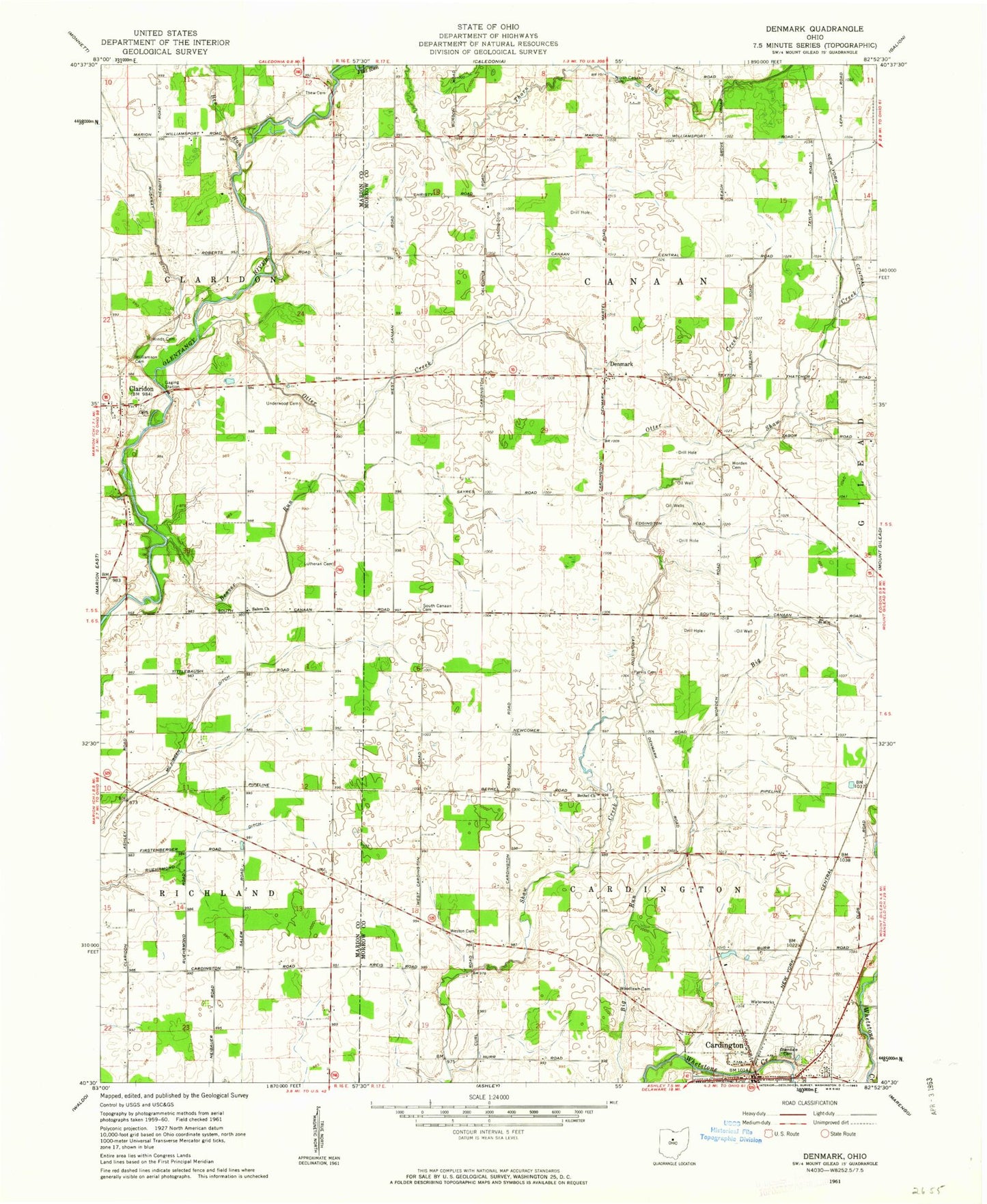
Classic USGS Denmark Ohio 7.5'x7.5' Topo Map
Couldn't load pickup availability
Historical USGS topographic quad map of Denmark in the state of Ohio. Map scale may vary for some years, but is generally around 1:24,000. Print size is approximately 24" x 27"
This quadrangle is in the following counties: Marion, Morrow.
The map contains contour lines, roads, rivers, towns, and lakes. Printed on high-quality waterproof paper with UV fade-resistant inks, and shipped rolled.
Contains the following named places: Beaver Run, Bee Run, Beech, Beech Grove School, Bethel Cemetery, Bethel Church, Bethel School, Cardington, Claridon, Claridon Cemetery, Claridon Post Office, Davis School, Denmark, Egypt School, Gable School, Glendale Cemetery, Graveyard Hill, Hardscrabble School, Hickory Corner School, Hinds Cemetery, Klinefelter School, Long School, Lutheran Cemetery, McKibben Ditch, Muskrat Ditch, North Canaan Cemetery, Otter Creek, Purvis Cemetery, Rainbow Mobile Home Park, Ruehrmond Ditch, Russell School, Saint Paul Evangelical Lutheran Church, Salem Cemetery, Salem Evangelical Church, Salem School, South Canaan Cemetery, Thew Cemetery, Township of Canaan, Township of Cardington, Underwood Cemetery, West Salem School, Weston Cemetery, Weston School, Williamson Cemetery, Wood Valley, Woodlawn Cemetery, Worden Cemetery, Worden School, ZIP Code: 43320