MyTopo
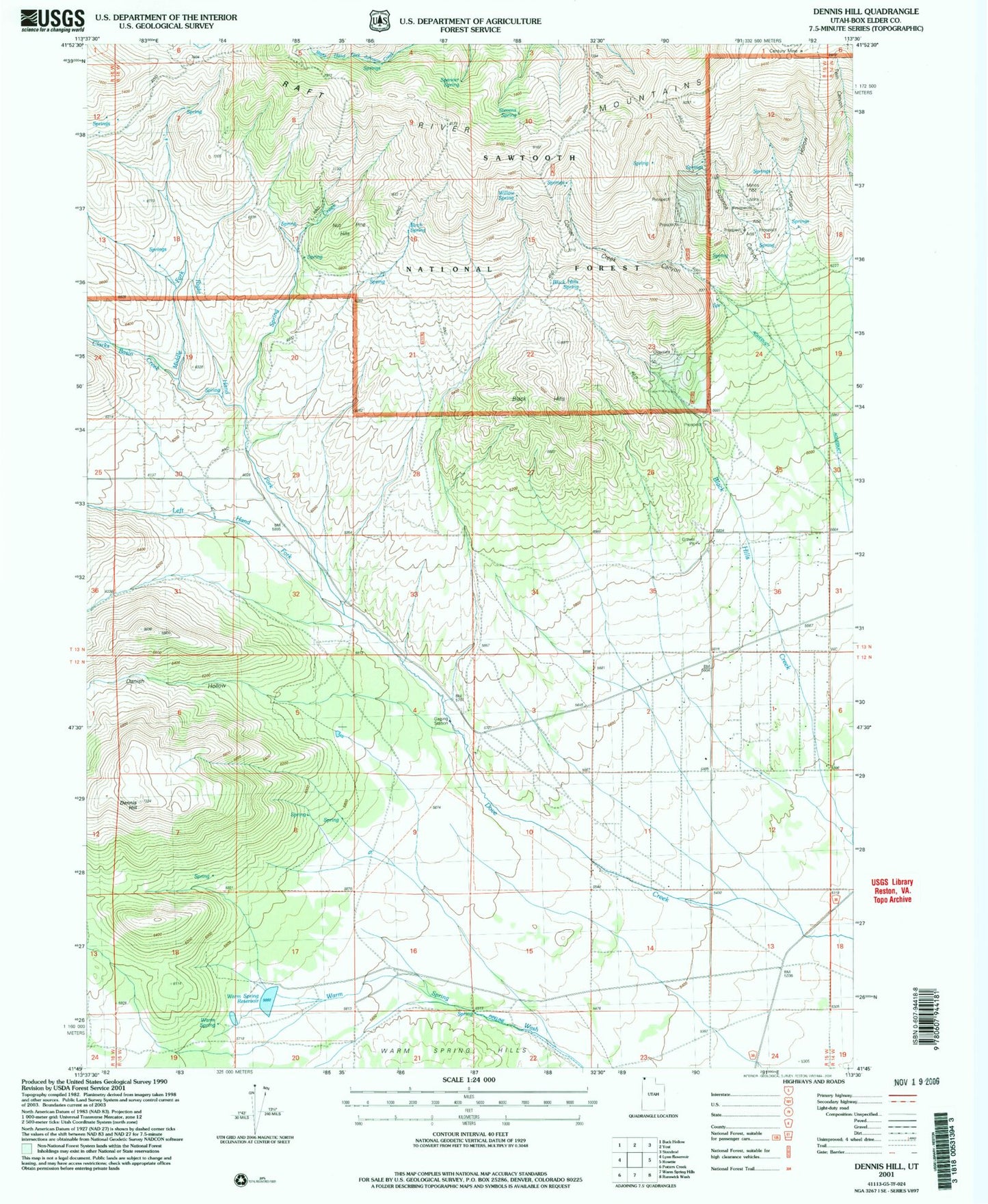
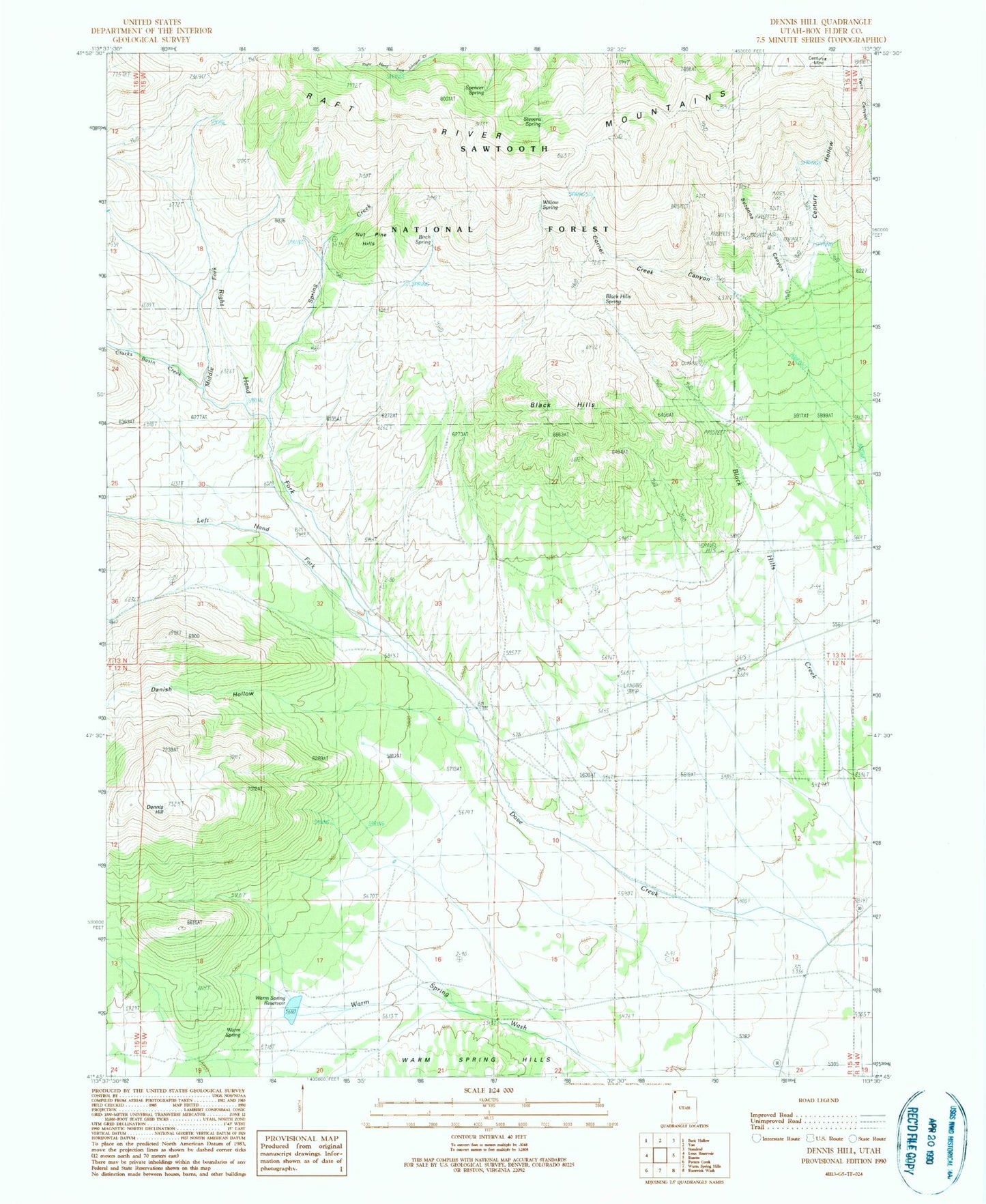
Classic USGS Dennis Hill Utah 7.5'x7.5' Topo Map
Couldn't load pickup availability
Historical USGS topographic quad map of Dennis Hill in the state of Utah. Map scale may vary for some years, but is generally around 1:24,000. Print size is approximately 24" x 27"
This quadrangle is in the following counties: Box Elder.
The map contains contour lines, roads, rivers, towns, and lakes. Printed on high-quality waterproof paper with UV fade-resistant inks, and shipped rolled.
Contains the following named places: Birch Spring, Black Hills, Black Hills Spring, Century Hollow, Century Mine, Clarks Basin Creek, Corner Creek Canyon, Danish Hollow, Dennis Hill, Left Hand Fork Dove Creek, Middle Fork Dove Creek, Nut Pine Hills, Right Hand Fork Dove Creek, Spencer Spring, Spring Creek, Stevens Spring, Suzanna Canyon, Warm Spring, Warm Spring Reservoir, Willow Spring