MyTopo
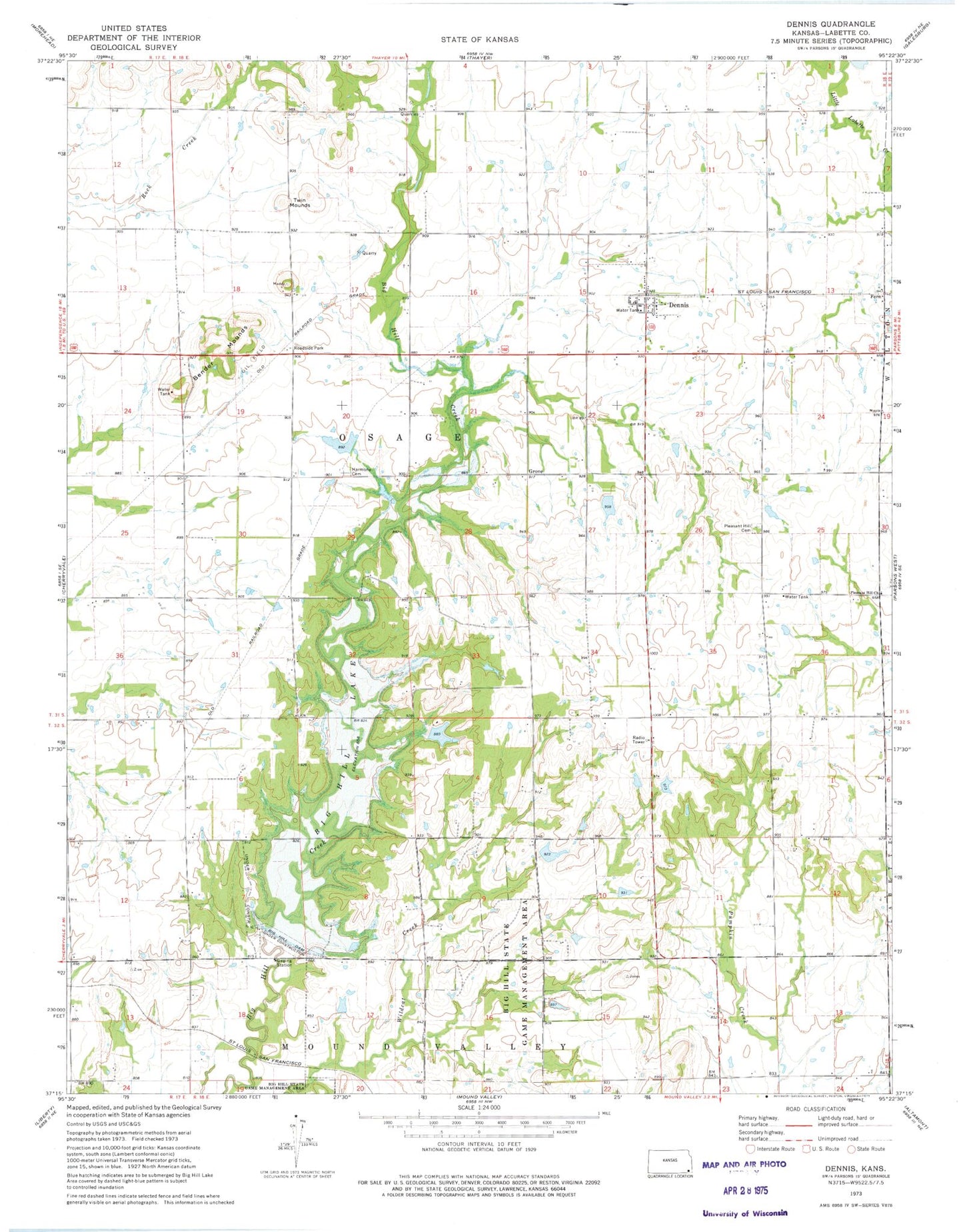
Classic USGS Dennis Kansas 7.5'x7.5' Topo Map
Couldn't load pickup availability
Historical USGS topographic quad map of Dennis in the state of Kansas. Map scale may vary for some years, but is generally around 1:24,000. Print size is approximately 24" x 27"
This quadrangle is in the following counties: Labette.
The map contains contour lines, roads, rivers, towns, and lakes. Printed on high-quality waterproof paper with UV fade-resistant inks, and shipped rolled.
Contains the following named places: Bender Mounds, Big Hill Dam, Big Hill Lake, Big Hill Siding, Big Hill Wildlife Area, Carpenter School, Dennis, Dennis Census Designated Place, Dennis Post Office, Dennis United Methodist Church, Fern, Grove, Harmony Grove Cemetery, Maple Grove School, Maple Valley School, Mortimer, Mount Triumph School, Mount Zion Church, Mount Zion School, Osage Township Fire Department, Pleasant Hill Cemetery, Pleasant Hill Church, Pleasant Hill School, Salem Church, Sylvandale School, Timber Hill School, Township of Osage, Twin Mounds, Twin Mounds School, ZIP Code: 67341