MyTopo
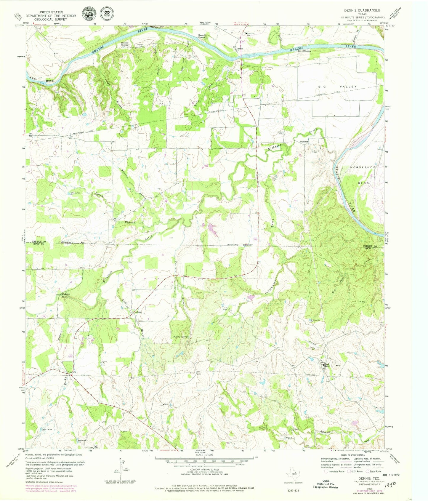
Classic USGS Dennis Texas 7.5'x7.5' Topo Map
Couldn't load pickup availability
Historical USGS topographic quad map of Dennis in the state of Texas. Map scale may vary for some years, but is generally around 1:24,000. Print size is approximately 24" x 27"
This quadrangle is in the following counties: Hood, Parker.
The map contains contour lines, roads, rivers, towns, and lakes. Printed on high-quality waterproof paper with UV fade-resistant inks, and shipped rolled.
Contains the following named places: Aldenhoven Lake Dam, Allison, Big Valley, Bigwater Branch, Black Lake Number 2, Black Lake Number 2 Dam, Black Lake Number 3, Black Lake Number 3 Dam, Black Lake Number 4, Black Lake Number 4 Dam, Black Ranch, Brock - Dennis Volunteer Fire Department Station 2, Buckner, Buckner Cemetery, Cottonwood Creek, Cougar Branch, Cougar Cemetery, Crow Branch, Dennis, Dennis Census Designated Place, Dennis Post Office, Dripping Springs, First Baptist Church of Horseshoe Bend, Holder Cemetery, Horseshoe Bend, Horseshoe Bend Census Designated Place, Horseshoe Bend Volunteer Fire Department Station Number 3, Kickapoo Creek, Kickapoo Falls, Killing Branch, Lazy Bend, Little Onion Branch, Maxwell Crossing, Moccasin Branch, Morton Cemetery, Onion Branch, Patrick Creek, Powell Crossing, Red Bank Creek, Rocky Branch, Rocky Run, Stephens Cemetery, Stephens Crossing, Wash Branch, Waters Branch