MyTopo
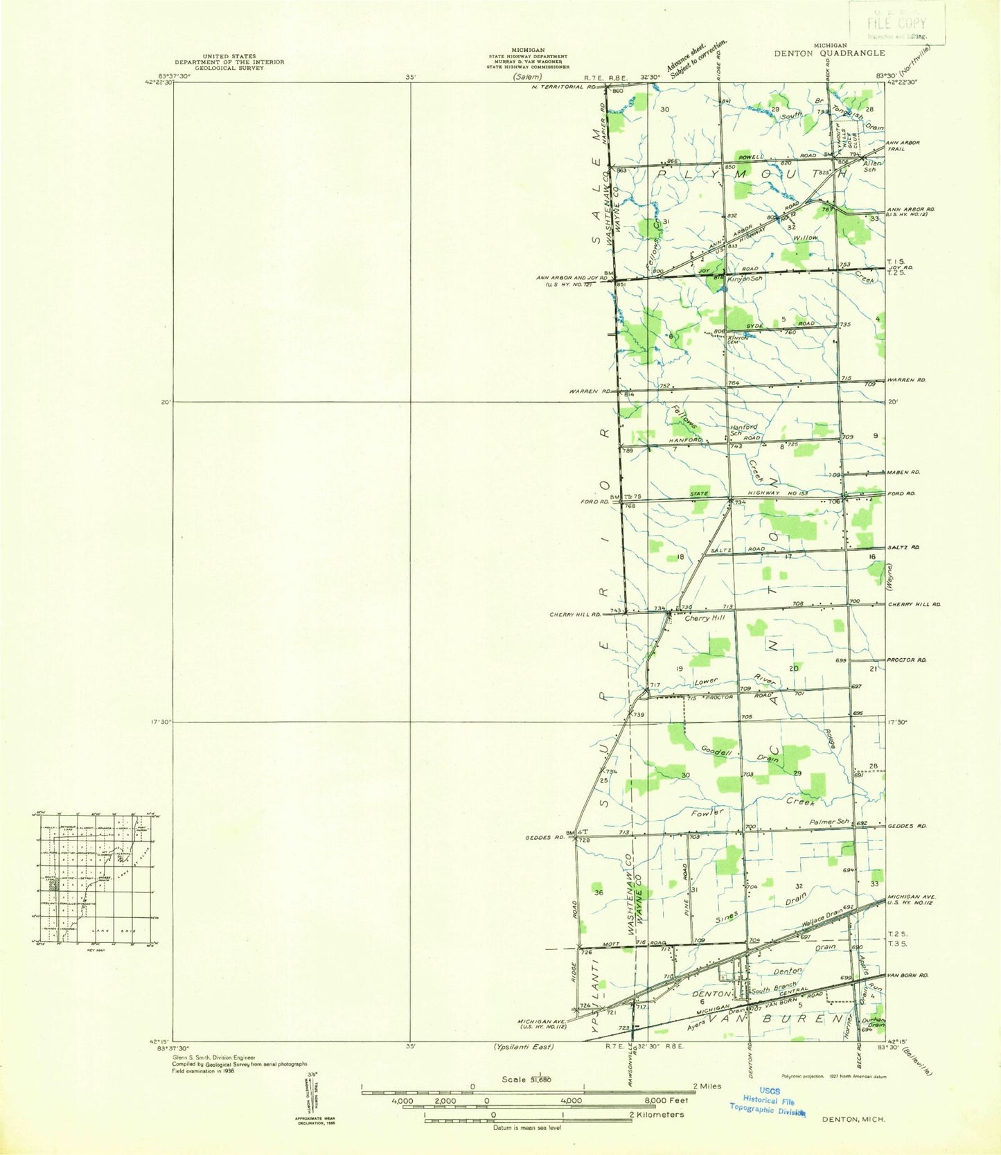
Classic USGS Denton Michigan 7.5'x7.5' Topo Map
Couldn't load pickup availability
Historical USGS topographic quad map of Denton in the state of Michigan. Map scale may vary for some years, but is generally around 1:24,000. Print size is approximately 24" x 27"
This quadrangle is in the following counties: Washtenaw, Wayne.
The map contains contour lines, roads, rivers, towns, and lakes. Printed on high-quality waterproof paper with UV fade-resistant inks, and shipped rolled.
Contains the following named places: Apostolic Church, Apple Ridge Park, Apple Run, Bazley and Foster Drain, Bennett School, Best Residence Hall, Briarwood Baptist Church, Buell Residence Hall, Canton Charter Academy, Canton Community Fire Department Station 3, Charles Street Tot Lot, Charter Township of Superior, Cheney Academy, Cherry Hill, Cherry Hill Cemetery, Cherry Hill School Historical Marker, Cherry Hill United Methodist Church Historical Marker, Cherryhill Post Office, Christ Temple Baptist Church, Church of God in Christ, Community Center Park, Community Park, Cornerstone Ministries, Crippen Drain, Cross and Resurrection Lutheran Church, Denton, Denton Cemetery, Denton Post Office, Denton Station, Dodson Elementary School, Downing Residence Hall, Elmcrest Mobile Village, Faith Church, Fireman's Park, First Free Will Church, Fowler Creek, Fox Hills Country Club, Frain Lake, Genesis Christian Academy, Goodell Drain, Green Oaks Golf Course, Henry Ford School, Hickory Creek Golf Course, Highland Cemetery, Hill Top Country Club, Holmes School, Horner Drain, Huron Valley Catholic School, Independence Park, Ingall Drain, John Wesley Conant House Historical Marker, King of Love University Church, Kingsley Mobile Park, Kinyon Cemetery, Knollwood Memorial Park Cemetery, Laraway Family Plot, LeFurge Woods Nature Preserve, Mount Calvary Baptist Church, Mount Olive Baptist Church, Murray Lake, Nelson Drain, New Bethel Church of God, New Gethsemane Church, Norfolk Park, North Prospect Church, Oakbrook Park, Parks Drain, Peninsular Park, Phelps Residence Hall, Plymouth Church, Pray Cemetery, Putnam Residence Hall, Rambling Road Park, Ridge Road Church of Christ, Ridgewood Hospital, Saint Johns Cemetery, Sellers Residence Hall, South Branch Fellows Creek, Strong Tower Ministry Church, Sunrise Center Shopping Center, Sunset Hills Cemetery, Superior Center Park, Superior Number One Drain, Superior Township Fire Department Station 1 Headquarters, Superior Township Fire Department Station 2, Tonda Elementary School, United Memorial Gardens, Victorious Life Church of God, Village Estates Mobile Home Park, Wagner Drain, Walton Residence Hall, Wendell Holmes Park, Westridge Mobile Home Park, Willow Run, Willow Run High School, Willow Run Middle School, Willow Run Mobile Home Park, Wise Residence Hall, Word of Deliverance Church, WSDS-AM (Salem Township), WSDS-AM (Ypsilanti), WWCM-AM (Ypsilanti), Ypsilanti Assembly of God Church, Ypsilanti Station, ZIP Codes: 48170, 48198