MyTopo
Classic USGS Denton Nebraska 7.5'x7.5' Topo Map
Couldn't load pickup availability
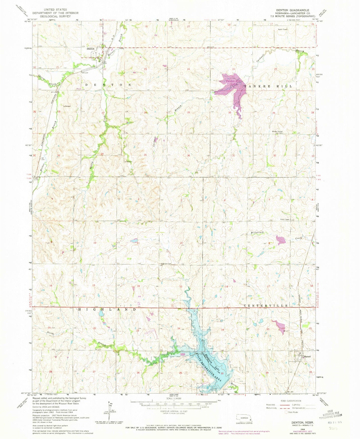
Historical USGS topographic quad map of Denton in the state of Nebraska. Typical map scale is 1:24,000, but may vary for certain years, if available. Print size: 24" x 27"
This quadrangle is in the following counties: Lancaster.
The map contains contour lines, roads, rivers, towns, and lakes. Printed on high-quality waterproof paper with UV fade-resistant inks, and shipped rolled.
Contains the following named places: Bluestem Lake, Cheese Creek, Denton, Highland Cemetery, Martell, North Branch Salt Creek, Spring Creek, Wesley Chapel Cemetery, Yankee Hill Lake, Denton Airfield, Salt Creek Dam 23-B, Salt Creek Reservoir 23-B, Salt Creek Dam 17-A, Salt Creek Reservoir 17-A, Salt Creek Dam 16-A, Killdeer Lake, Yankee Hill Dam-Site 10 Dam, Bluestem Dam-Site 4 Dam, Brandt Dam, Brandt Reservoir, Martell (historical), Southwest Alliance Church, Martell Post Office, Martell United Methodist Church, Area Three Campground, Area Five Campground, Bluestem Lake State Recreation Area, Killdeer Lake State Wildlife Management Area, Yankee Hill State Wildlife Management Area, Township of Highland, Township of Denton, Civilian Conservation Corps Co 2738 Historical Marker, Denton Post Office, Denton United Methodist Church, Saint Mary Catholic Church, Denton, Denton Election Precinct, Highland Election Precinct, Yankee Hill Election Precinct, Village of Denton, Southwest Rural Fire District Station 2, Southwest Rural Fire District Station 3, Martell Census Designated Place