MyTopo
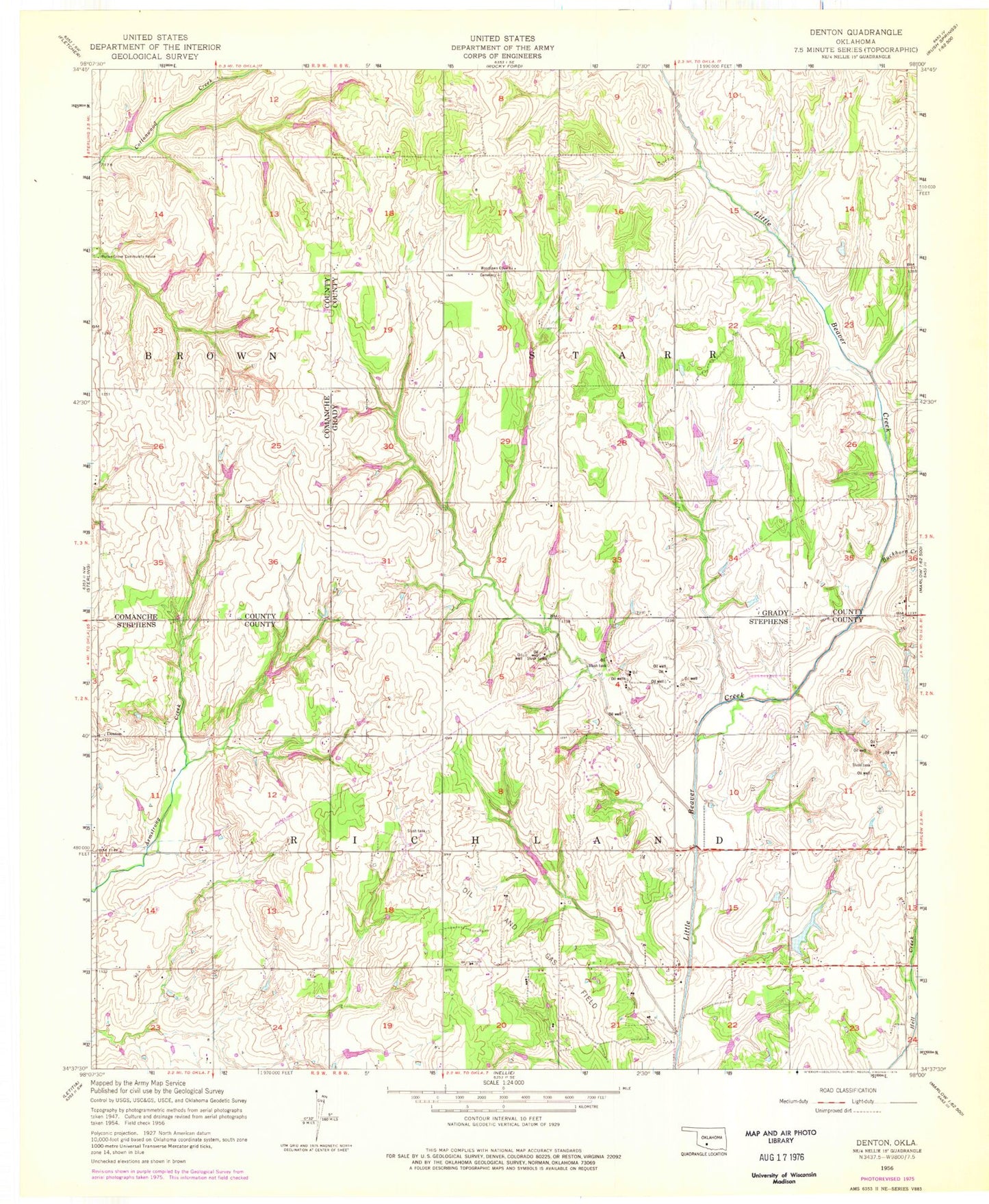
Classic USGS Denton Oklahoma 7.5'x7.5' Topo Map
Couldn't load pickup availability
Historical USGS topographic quad map of Denton in the state of Oklahoma. Map scale may vary for some years, but is generally around 1:24,000. Print size is approximately 24" x 27"
This quadrangle is in the following counties: Comanche, Grady, Stephens.
The map contains contour lines, roads, rivers, towns, and lakes. Printed on high-quality waterproof paper with UV fade-resistant inks, and shipped rolled.
Contains the following named places: Buckhorn Creek, Denton, Hurley Grove Community House, KFXI-FM (Marlow), Oknoname 051048 Dam, Oknoname 051048 Reservoir, Oknoname 051058 Dam, Oknoname 051058 Reservoir, Oknoname 051059 Dam, Oknoname 051059 Reservoir, Oknoname 137002 Dam, Oknoname 137002 Reservoir, Oknoname 137003 Dam, Oknoname 137003 Reservoir, Oknoname 137004 Dam, Oknoname 137004 Reservoir, Oknoname 137061 Dam, Oknoname 137061 Reservoir, Oknoname 137062 Dam, Oknoname 137062 Reservoir, Oknoname 137063 Dam, Oknoname 137063 Reservoir, Oknoname 137064 Dam, Oknoname 137064 Reservoir, Oknoname 137088 Dam, Oknoname 137088 Reservoir, Richard Cox Dam, Richard Cox Reservoir, Township of Starr, Woodlawn Cemetery, Woodlawn Church