
MyTopo
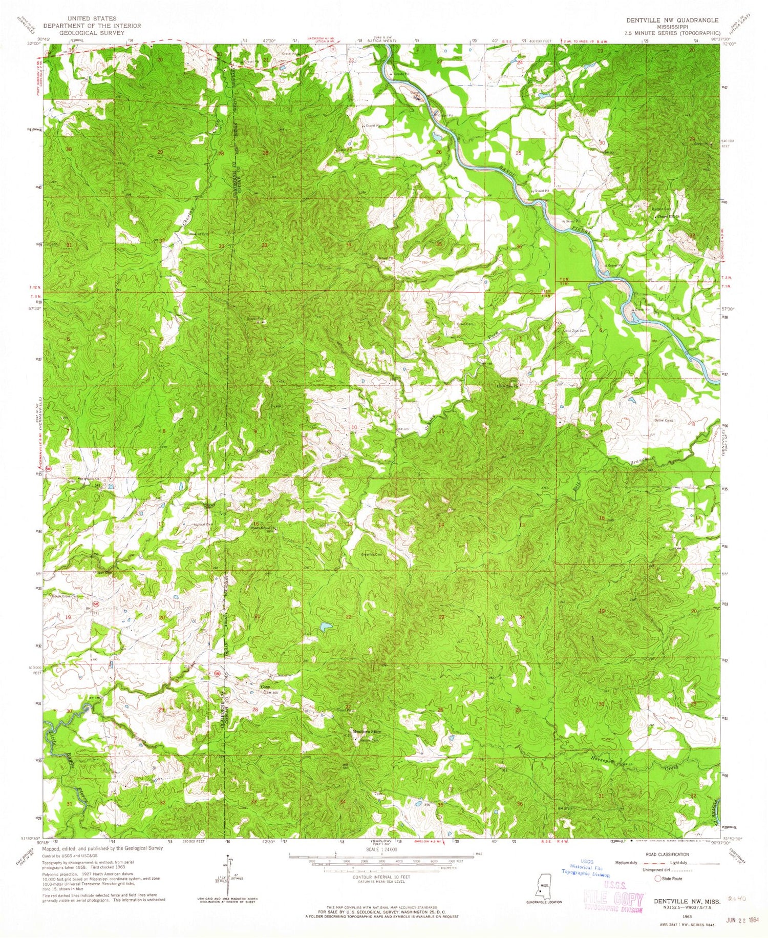
Classic USGS Dentville NW Mississippi 7.5'x7.5' Topo Map
Couldn't load pickup availability
Historical USGS topographic quad map of Dentville NW in the state of Mississippi. Map scale may vary for some years, but is generally around 1:24,000. Print size is approximately 24" x 27"
This quadrangle is in the following counties: Claiborne, Copiah.
The map contains contour lines, roads, rivers, towns, and lakes. Printed on high-quality waterproof paper with UV fade-resistant inks, and shipped rolled.
Contains the following named places: Beech Grove Cemetery, Bethel Cemetery, Brushy Fork, Burtonton, Chapel Hill Church, China Grove Baptist Church, Conn, Glenwood School, Grant Cemetery, Greenlee Cemetery, Griffins Store Post Office, Howard Cemetery, Hulburt Cemetery, Linden, Little Zion Cemetery, Little Zion Church, Meadows Store, Nelson Cemetery, Pisgah Cemetery, Pisgah School, Saint Phillip Church, Scott School, Shady Grove Church, Trimm Cemetery, Vaughn Cemetery, W C Devinney Lake Dam


