MyTopo
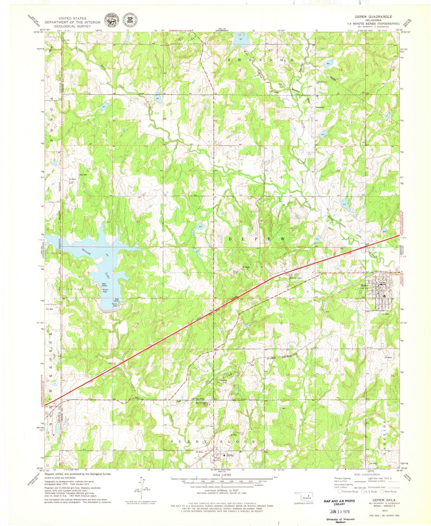
Classic USGS Depew Oklahoma 7.5'x7.5' Topo Map
Couldn't load pickup availability
Historical USGS topographic quad map of Depew in the state of Oklahoma. Map scale may vary for some years, but is generally around 1:24,000. Print size is approximately 24" x 27"
This quadrangle is in the following counties: Creek, Lincoln.
The map contains contour lines, roads, rivers, towns, and lakes. Printed on high-quality waterproof paper with UV fade-resistant inks, and shipped rolled.
Contains the following named places: Depew, Depew Elementary School, Depew High School, Depew Post Office, Depew Volunteer Fire Department, East Spring Creek, Little Deep Fork Creek Site 10 Dam, Little Deep Fork Creek Site 10 Reservoir, Little Deep Fork Creek Site 17 Dam, Little Deep Fork Creek Site 17 Reservoir, Little Deep Fork Creek Site 18 Dam, Little Deep Fork Creek Site 18 Reservoir, Little Deep Fork Creek Site 19 Dam, Little Deep Fork Creek Site 19 Reservoir, Little Deep Fork Creek Site 20 Dam, Little Deep Fork Creek Site 20 Reservoir, Little Deep Fork Creek Site 55c Dam, Little Deep Fork Creek Site 55c Reservoir, Little Deep Fork Creek Site 7 Dam, Little Deep Fork Creek Site 7 Reservoir, Little Deep Fork Creek Site 8 Dam, Little Deep Fork Creek Site 8 Reservoir, Little Deep Fork Creek Site 9 Dam, Little Deep Fork Creek Site 9 Reservoir, Memorial Club Cemetery, Milfay, Milfay Census Designated Place, Milfay Elementary School, Milfay Post Office, Milfay Volunteer Fire Department, Oakdale Cemetery, Salt Camp Creek Site 10 Dam, Salt Camp Creek Site 10 Reservoir, Salt Camp Creek Site Number 6 Dam, Salt Camp Creek Site Number 6 Reservoir, Salt-Camp Creek Site 12 Dam, Spring Creek, Spring Creek Church, Stroud Lake, Stroud Reservoir, Town of Depew, Township of Depew, West Spring Creek, ZIP Codes: 74028, 74046