MyTopo
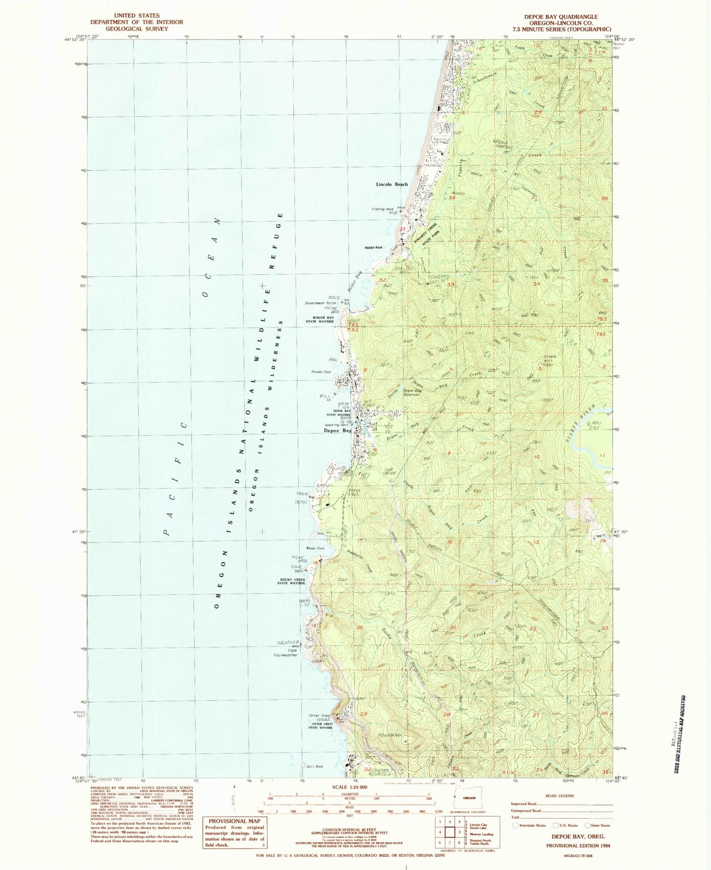
Classic USGS Depoe Bay Oregon 7.5'x7.5' Topo Map
Couldn't load pickup availability
Historical USGS topographic quad map of Depoe Bay in the state of Oregon. Map scale may vary for some years, but is generally around 1:24,000. Print size is approximately 24" x 27"
This quadrangle is in the following counties: Lincoln.
The map contains contour lines, roads, rivers, towns, and lakes. Printed on high-quality waterproof paper with UV fade-resistant inks, and shipped rolled.
Contains the following named places: Ben Jones Bridge, Boiler Bay, Boiler Bay State Park, Briggs Landing, Cape Foulweather, City of Depoe Bay, Coronado Shores, Deadhorse Creek, Depoe Bay, Depoe Bay City Hall, Depoe Bay City Park, Depoe Bay Creek, Depoe Bay Harbor, Depoe Bay Post Office, Depoe Bay Public Works, Depoe Bay Rural Fire Protection District Station 2300 Depoe Bay, Depoe Bay Wastewater Treatment Plant, Depoe Bay Water Treatment Plant, Dope Creek, Finger Rock, Fishing Rock, Fishing Rock State Park, Flat Rock, Fogarty Creek, Fogarty Creek State Park, Government Point, Gull Rock, H2O and S Sewage Disposal, Imperial Marine Services Boat Ramp, KNPT-FM, Lincoln Beach, Lincoln Beach Post Office, Lincoln Beach Wayside, North Depoe Bay Creek, North Depoe Bay Creek Reservoir, North Reef, Otter Crest, Otter Crest Rest Area, Otter Crest State Park, Pacific Palisades, Pirate Cove, Rabbit Rock, Rocky Creek, Rocky Creek State Park, Sabre Creek, Salmon Creek, Schoolhouse Creek, Siletz Hill, South Depoe Bay Creek, United States Coast Guard Motor Lifeboat Station Depoe Bay, Whale Cove, Whale Watching Center, Williams Creek, ZIP Codes: 97341, 97369