MyTopo
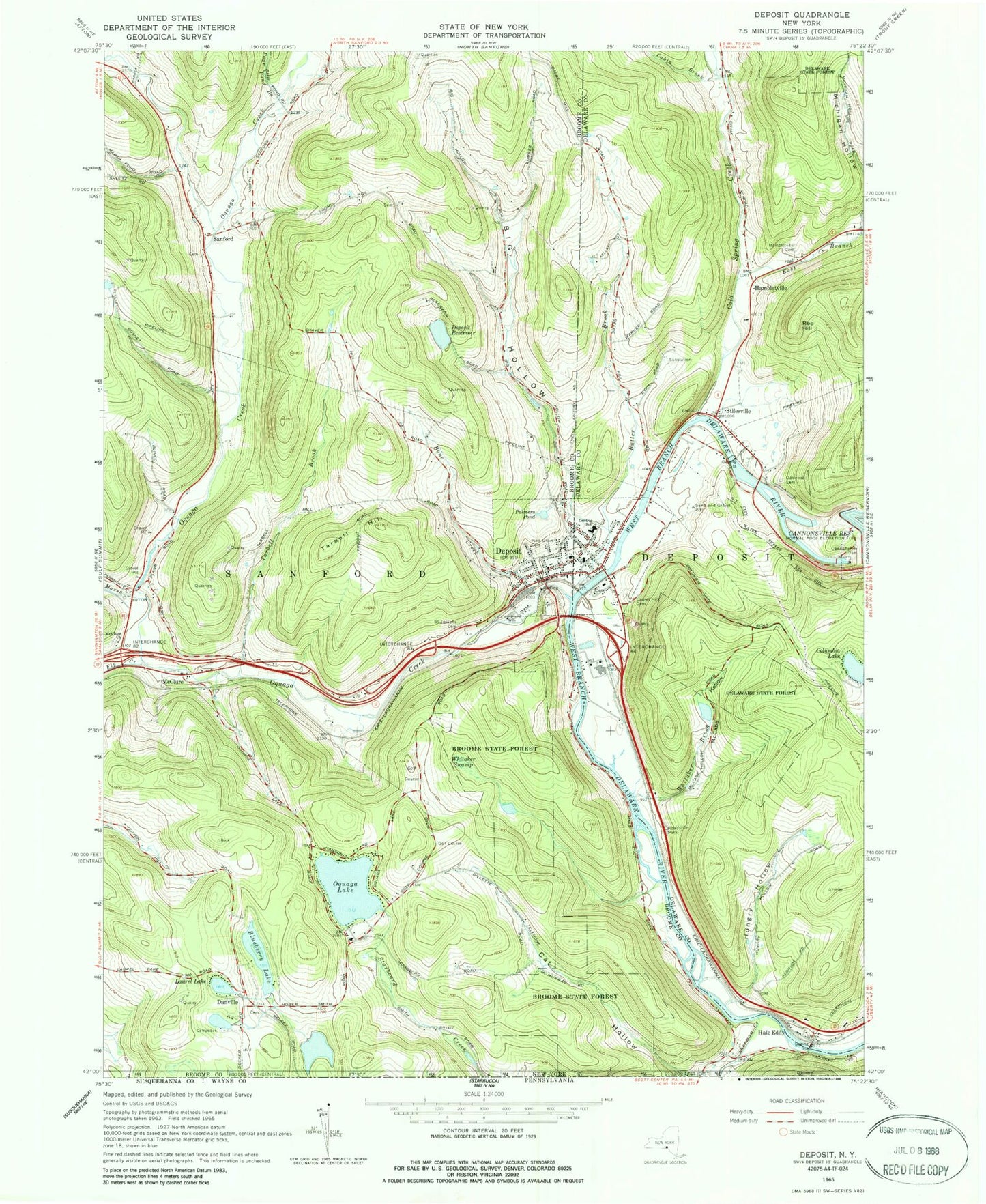
Classic USGS Deposit New York 7.5'x7.5' Topo Map
Couldn't load pickup availability
Historical USGS topographic quad map of Deposit in the state of New York. Map scale may vary for some years, but is generally around 1:24,000. Print size is approximately 24" x 27"
This quadrangle is in the following counties: Broome, Delaware.
The map contains contour lines, roads, rivers, towns, and lakes. Printed on high-quality waterproof paper with UV fade-resistant inks, and shipped rolled.
Contains the following named places: Amendola Bluestone Quarry, Big Hollow, Blueberry Lake, Bone Creek, Butler Brook, Cabin Brook, Cannonsville Dam, Central School, Christ Episcopal Church, Cold Spring Creek, Columbia Lake, Danville, Danville Cemetery, Deposit, Deposit Fire and Rescue, Deposit Free Library, Deposit Post Office, Deposit Private Hospital, Deposit Reservoir, Deposit Union Free School, Deposit Village Hall, East Branch Cold Spring Creek, First Baptist Church, First Presbyterian Church, First United Methodist Church, Fly Creek, Hale Eddy, Hale Eddy Cemetery, Hambletville, Hambletville Cemetery, Hungry Hollow, Laurel Hill Cemetery, Laurel Lake, Loomis Hill Cemetery, Maple Lane Assembly of God Church, Marsh Creek, McCabe Hollow, McClure, McClure Cemetery, McClure United Methodist Church, Michigan Hollow, Oakwood Cemetery, Oquaga Creek, Oquaga Lake, Page Pond Brook, Palmers Pond, Paul Devereux Hospital, Pine Grove Cemetery, Red Hill, Roods Creek Quarry, Saint Josephs Cemetery, Saint Joseph's Roman Catholic Church, Sanford, Sanford Cemetery, Scotts Golf Course, Sherman Creek, State Theatre, Stilesville, Tarbell Brook, Tarbell Hill, The Evangelistic Center, Town of Deposit, Town of Sanford, Village of Deposit, Whitaker Brook, Whitaker Swamp, WIYN-FM (Deposit), ZIP Code: 13754


