MyTopo
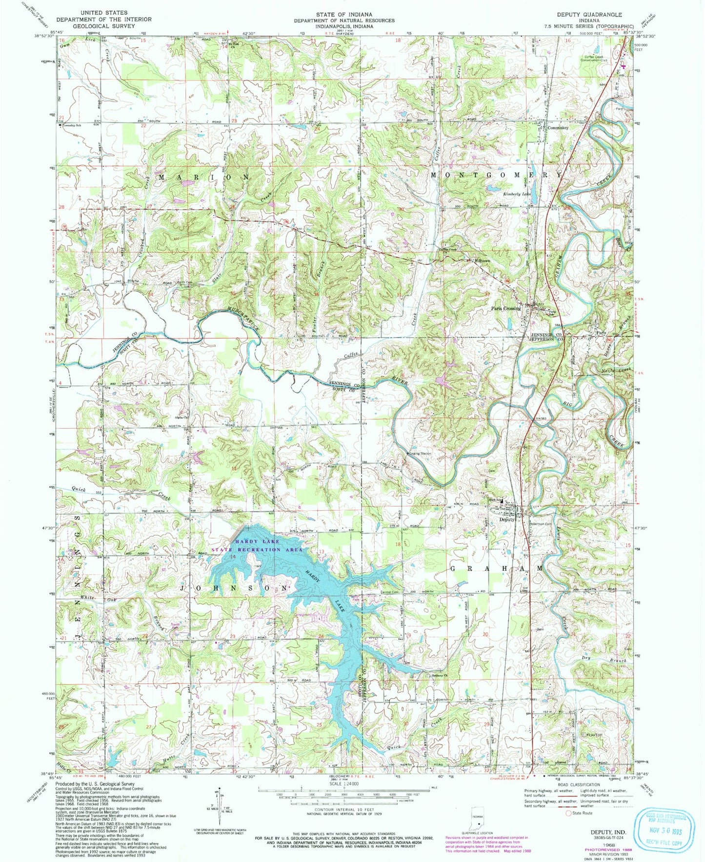
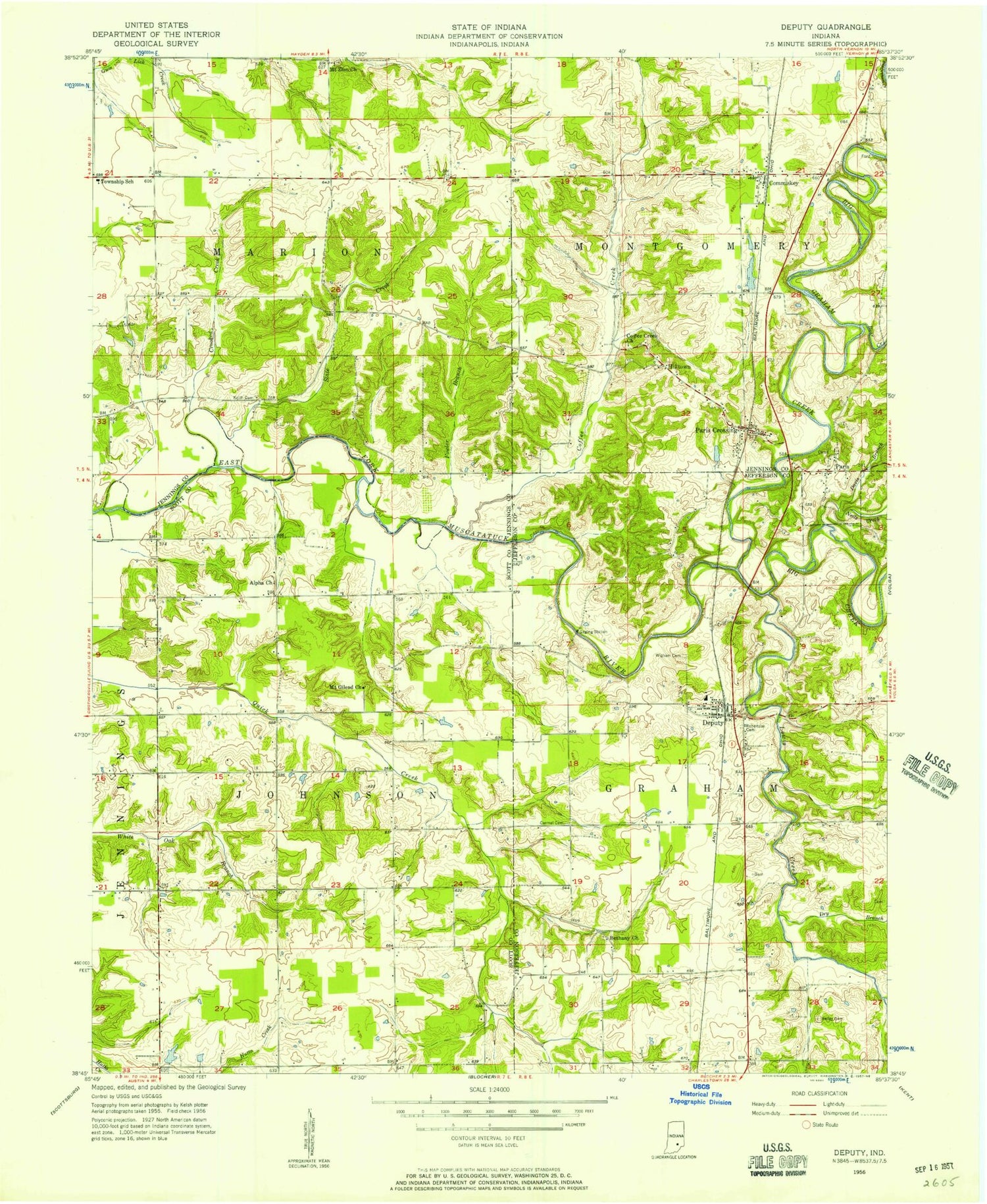
Classic USGS Deputy Indiana 7.5'x7.5' Topo Map
Couldn't load pickup availability
Historical USGS topographic quad map of Deputy in the state of Indiana. Map scale may vary for some years, but is generally around 1:24,000. Print size is approximately 24" x 27"
This quadrangle is in the following counties: Jefferson, Jennings, Scott.
The map contains contour lines, roads, rivers, towns, and lakes. Printed on high-quality waterproof paper with UV fade-resistant inks, and shipped rolled.
Contains the following named places: Alpha Church, Alpha Post Office, Bear Creek, Bethany Church, Big Creek, Carmel Cemetery, Coffee Creek, Coffee Creek Church, Coffee Creek Conservation Club, Commiskey, Commiskey Post Office, Crooked Creek, Davis Branch, Deputy, Deputy Census Designated Place, Deputy Elementary School, Deputy Post Office, Deputy Volunteer Fire Department, Dry Branch, Fowler Branch, Graham Creek, Hardy Lake, Hilltown, Keith Cemetery, Kimberly Lake, Lake Hardy Dam, Lewis Creek, Montgomery Township Volunteer Fire Department, Mount Zion Church, Neils Creek, Paris, Paris Crossing, Paris Crossing Post Office, Paris School, Parkers Station, Robertson Cemetery, Slate Creek, Slate Post Office, Township of Graham, Township of Johnson, Township of Marion, Township of Montgomery, Valley Cemetery, ZIP Codes: 47227, 47230, 47270