MyTopo
Classic USGS Derrick City Pennsylvania 7.5'x7.5' Topo Map
Couldn't load pickup availability
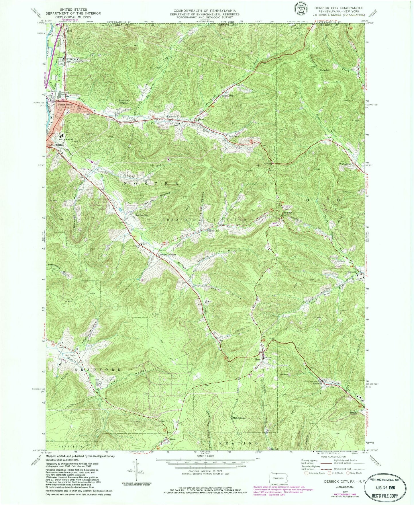
Historical USGS topographic quad map of Derrick City in the states of Pennsylvania, New York. Map scale may vary for some years, but is generally around 1:24,000. Print size is approximately 24" x 27"
This quadrangle is in the following counties: Cattaraugus, McKean.
The map contains contour lines, roads, rivers, towns, and lakes. Printed on high-quality waterproof paper with UV fade-resistant inks, and shipped rolled.
Contains the following named places: Aiken, Allen, Baker Run, Beechwood, Bells Camp, Bolivar Run, Bordell, Buchanan Hollow, Chamberlain Hollow, Coleville, Corwins Corners, Dallas City, Derrick City, Derrick City Elementary School, Derrick City Post Office, Derrick City Volunteer Fire Department Station 11 - 1, Driver School, Fairview Heights, Foster Brook, Foster Brook Census Designated Place, Foster Hollow, Foster Township Municipal Building, Foster Township Police Department, Fretz Junior High School, Fullerton, Garlock Hollow, Gilmore, Harrisburg Run, Lafferty Run, Lincoln School, Middletown, Minard Run School, Pennbrook Run, Pratt Hollow, Red Rock, Rew, Rew Census Designated Place, Rew Post Office, Rew Volunteer Fire Department - Station 8, Sawyer Cemetery, Sawyer Church, Sawyer City, Summit, Tibbitts Hollow, Totten Hollow, Township of Foster, Tuna, Walkertown, ZIP Code: 16727