MyTopo
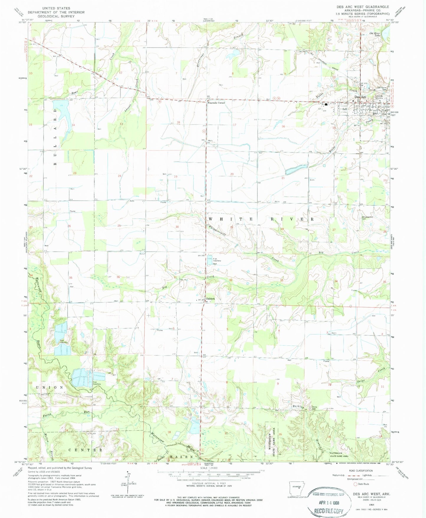
Classic USGS Des Arc West Arkansas 7.5'x7.5' Topo Map
Couldn't load pickup availability
Historical USGS topographic quad map of Des Arc West in the state of Arkansas. Map scale may vary for some years, but is generally around 1:24,000. Print size is approximately 24" x 27"
This quadrangle is in the following counties: Prairie.
The map contains contour lines, roads, rivers, towns, and lakes. Printed on high-quality waterproof paper with UV fade-resistant inks, and shipped rolled.
Contains the following named places: Abbington Church, Barnes Creek, Bob Norman Airstrip, Childers, Church of Christ, City of Des Arc, Des Arc Ambulance Service, Des Arc Elementary School, Faras Run, Fourmile Corner, Harrys, Lakeside Cemetery, Lakeside Church, Lasses Creek, Mellon Branch, Morris Chapel, Oak Grove Cemetery, Oak Prairie Church, Oak Prairie School, Oak Prairie Volunteer Fire Station, Old River Lake, Philadelphia Church, Tates Reservoir, Tates Reservoir Dam, Taylor Airstrip, Township of White River, Whippoorwill Cemetery, Whippoorwill Church, Whippoorwill Creek, White Cemetery, ZIP Code: 72040