MyTopo
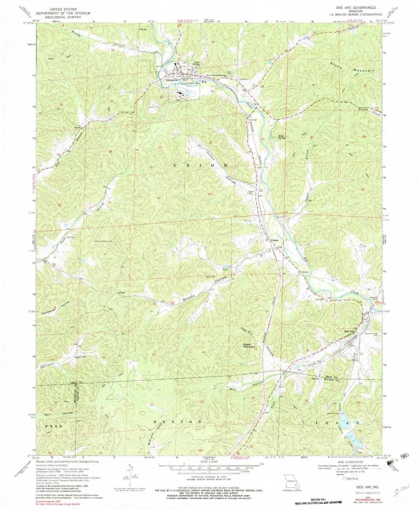
Classic USGS Des Arc Missouri 7.5'x7.5' Topo Map
Couldn't load pickup availability
Historical USGS topographic quad map of Des Arc in the state of Missouri. Map scale may vary for some years, but is generally around 1:24,000. Print size is approximately 24" x 27"
This quadrangle is in the following counties: Iron, Reynolds, Wayne.
The map contains contour lines, roads, rivers, towns, and lakes. Printed on high-quality waterproof paper with UV fade-resistant inks, and shipped rolled.
Contains the following named places: Annapolis, Annapolis Lead Mine, Annapolis Post Office, Black Creek, Brushy Creek, Brushy Hollow, Cedar Spring Hollow, Chain of Lakes, Chain of Lakes Dam Number 1, Chain of Lakes Dam Number 2, Chain of Lakes Dam Number 3, City of Annapolis, Des Acre Hollow, Des Arc, Dinger Iron Bank, Dry Hollow, Funk Cemetery, Funk School, Goose Creek, International Speciality Products Minerals Annapolis Quarry, Island Branch, Kinney Branch, Leadanna, Lewis Cemetery, Lewis Mountain, Mountain View Cemetery, New Peace and Harmony Church, Ruble Cemetery, Ruble Mountain, Seven Lakes Reservoir One, Seven Lakes Reservoir Three, Seven Lakes Reservoir Two, Singer Iron Bank, Sisk Cemetery, Slab Pond, Slabtown Valley, Southern Iron County Fire Protection District Des Arc Station, Southourn Iron County Fire Protection District Annapolis Station, Stony Mountain, Sutton Cemetery, Sutton Hollow, Sutton School, Tank Spring, Township of Union, Village of Des Arc, Vulcan, Vulcan Lookout Tower, Vulcan School, Wallace Cemetery, Webb Spring, ZIP Code: 63675