MyTopo
Classic USGS Des Lacs North Dakota 7.5'x7.5' Topo Map
Couldn't load pickup availability
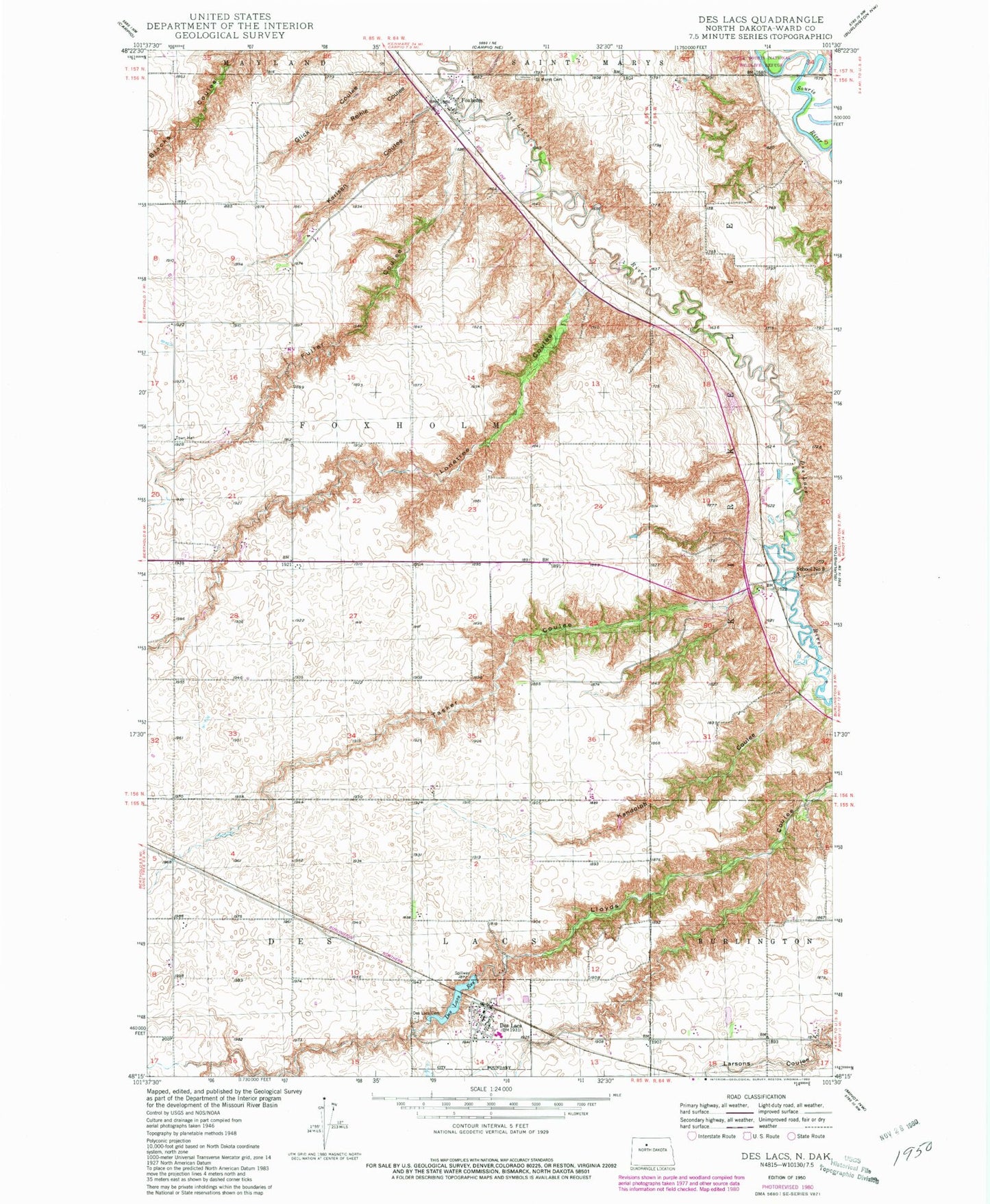
Historical USGS topographic quad map of Des Lacs in the state of North Dakota. Map scale may vary for some years, but is generally around 1:24,000. Print size is approximately 24" x 27"
This quadrangle is in the following counties: Ward.
The map contains contour lines, roads, rivers, towns, and lakes. Printed on high-quality waterproof paper with UV fade-resistant inks, and shipped rolled.
Contains the following named places: City of Des Lacs, Des Lacs, Des Lacs Cemetery, Des Lacs City Dam, Des Lacs Fire Department, Des Lacs Post Office, Des Lacs Reservoir, Des Lacs-Burlington High School, Foxholm, Foxholm Census Designated Place, Fuller Coulee, Glick Coulee, Kandolph Coulee, Karlsen Coulee, Lonetree Coulee, Reihle Coulee, Saint Marys Cemetery, School Number 3, Tasker Coulee, Township of Foxholm