MyTopo
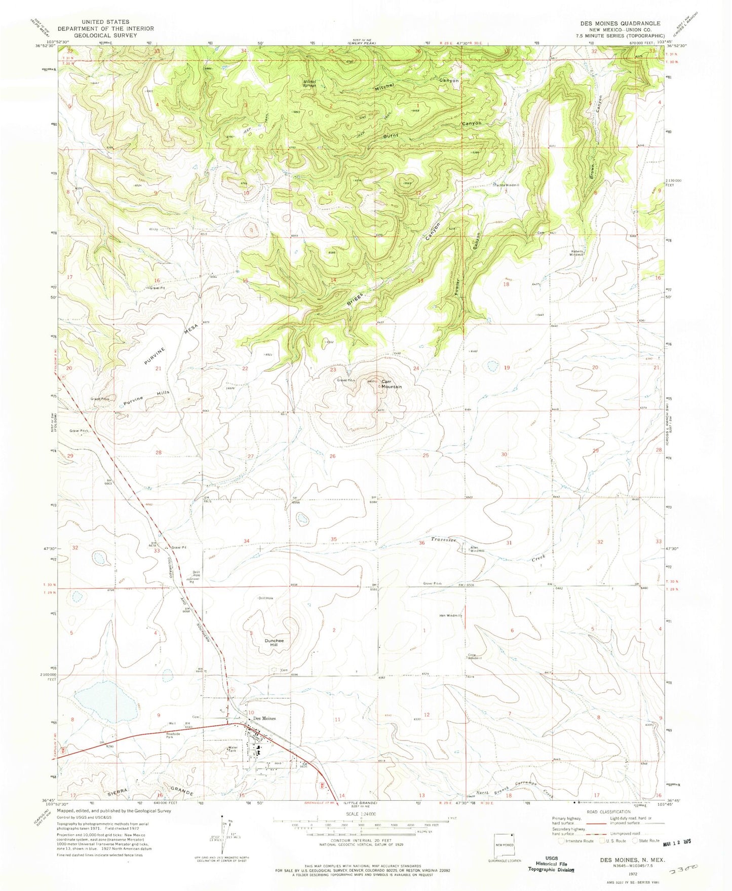
Classic USGS Des Moines New Mexico 7.5'x7.5' Topo Map
Couldn't load pickup availability
Historical USGS topographic quad map of Des Moines in the state of New Mexico. Map scale may vary for some years, but is generally around 1:24,000. Print size is approximately 24" x 27"
This quadrangle is in the following counties: Union.
The map contains contour lines, roads, rivers, towns, and lakes. Printed on high-quality waterproof paper with UV fade-resistant inks, and shipped rolled.
Contains the following named places: 10305 Water Well, Allen Windmill, Brown Canyon, Burnt Canyon, Carr Mountain, Colomex Pit, Colorado and Southern Ballast Pit, Crow Windmill, Des Moines, Des Moines - Folsom Emergency Medical Services, Des Moines Catholic Cemetery, Des Moines Cemetery, Des Moines Elementary School, Des Moines Fire Department, Des Moines High School, Des Moines Post Office, Des Moines Weather Station, Dunchee Hill, First Baptist Mission, Fowler Canyon, Hen Windmill, Los Lujanes, Mitchel Canyon, Mitchel Springs, Ojo del Pinaveta Cemetery, Pachta Windmill, Purvine Hills, Purvine Mesa, Roberts Windmill, Twin Mountain, Village of Des Moines