MyTopo
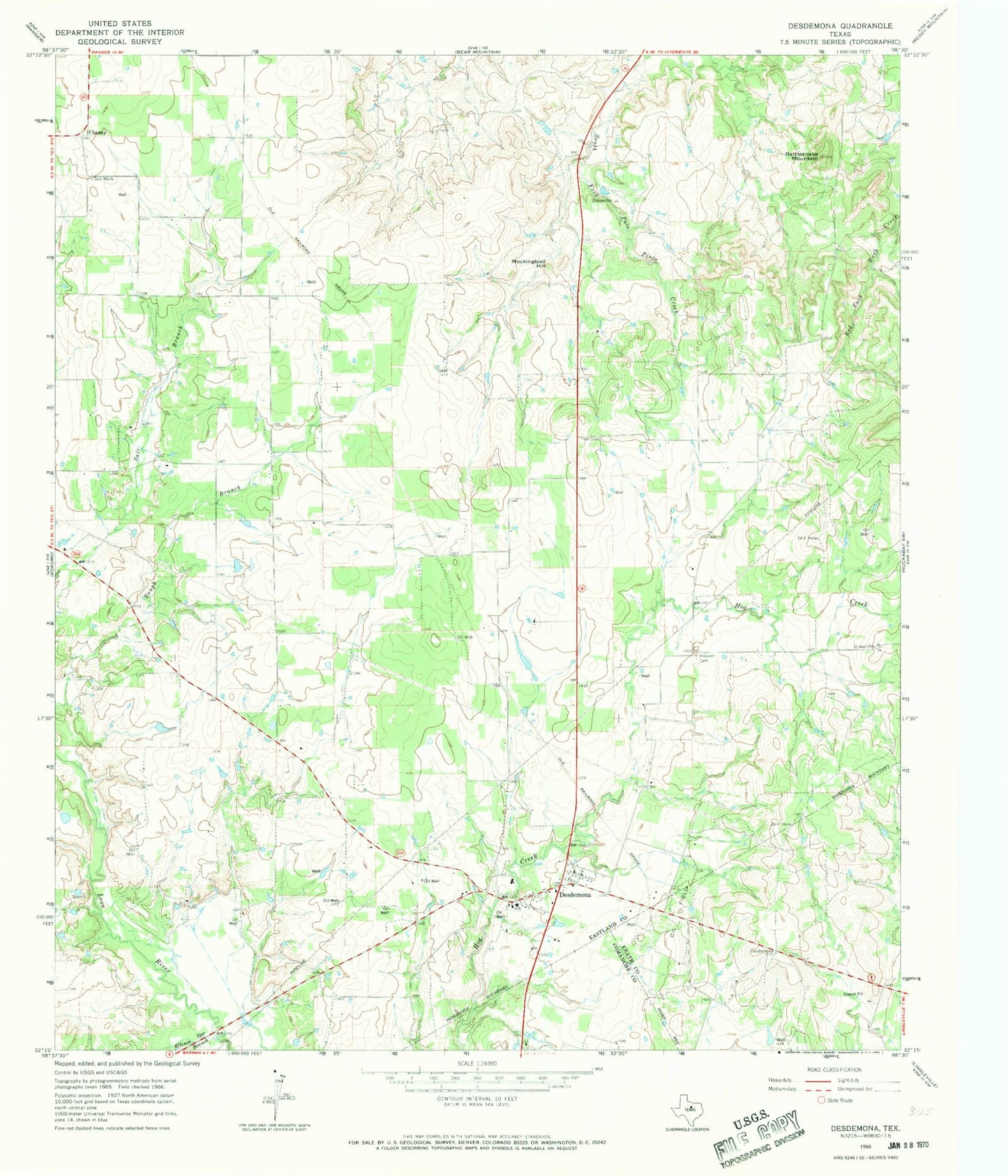
Classic USGS Desdemona Texas 7.5'x7.5' Topo Map
Couldn't load pickup availability
Historical USGS topographic quad map of Desdemona in the state of Texas. Map scale may vary for some years, but is generally around 1:24,000. Print size is approximately 24" x 27"
This quadrangle is in the following counties: Comanche, Eastland, Erath.
The map contains contour lines, roads, rivers, towns, and lakes. Printed on high-quality waterproof paper with UV fade-resistant inks, and shipped rolled.
Contains the following named places: Arnold Lake, Arnold Lake Dam, Chaney, Desdemona, Desdemona Post Office, Desdemona Volunteer Fire Department, Ellison Spring Branch, Holland Lake, Howard Cemetery, Howard Wade Lake, Howard Wade Lake Dam, Love and Rodgers Dam Number 1, Love and Rodgers Dam Number 3, Love and Rodgers Lake Number 1, Love and Rodgers Lake Number 3, Mockingbird Hill, Pack Lake, Pack Lake Dam, Perrin Dam, Perrin Lake, Rattlesnake Mountain, ZIP Code: 76445