MyTopo
Classic USGS Desert Well Arizona 7.5'x7.5' Topo Map
Couldn't load pickup availability
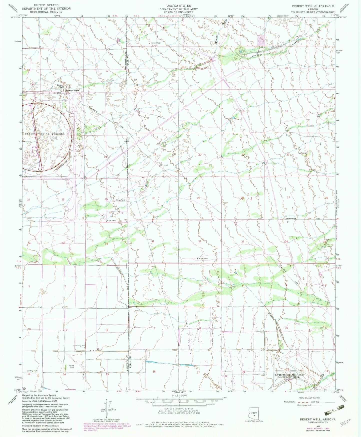
Historical USGS topographic quad map of Desert Well in the state of Arizona. Map scale may vary for some years, but is generally around 1:24,000. Print size is approximately 24" x 27"
This quadrangle is in the following counties: Maricopa, Pinal.
The map contains contour lines, roads, rivers, towns, and lakes. Printed on high-quality waterproof paper with UV fade-resistant inks, and shipped rolled.
Contains the following named places: Anderson Ranch, Apache Junction Landfill, Apache Junction Wastewater Treatment Plant, Apache Sun Golf Club, Benjamin Franklin Charter School - Queen Creek, Cimmaron Trails Mobile Home Park, Combs High School, Desert Proving Grounds, Desert Ridge High School, Desert Ridge Junior High School, Desert Well, Hawk Rock, Jack Barnes Elementary School, Los Hermanos Mobile Home Park, Meridian Elementary School, Mesa Fire Department Station 219, Pleasant Valley Mobile Home Park, Powerline Dam, Ranch Elementary School, Rittenhouse Dam, Siphon Draw, The Church of Jesus Christ of Latter Day Saints, Vineyard Road Dam, Weekes Wash, Womack Airport, Womack Airstrip