MyTopo
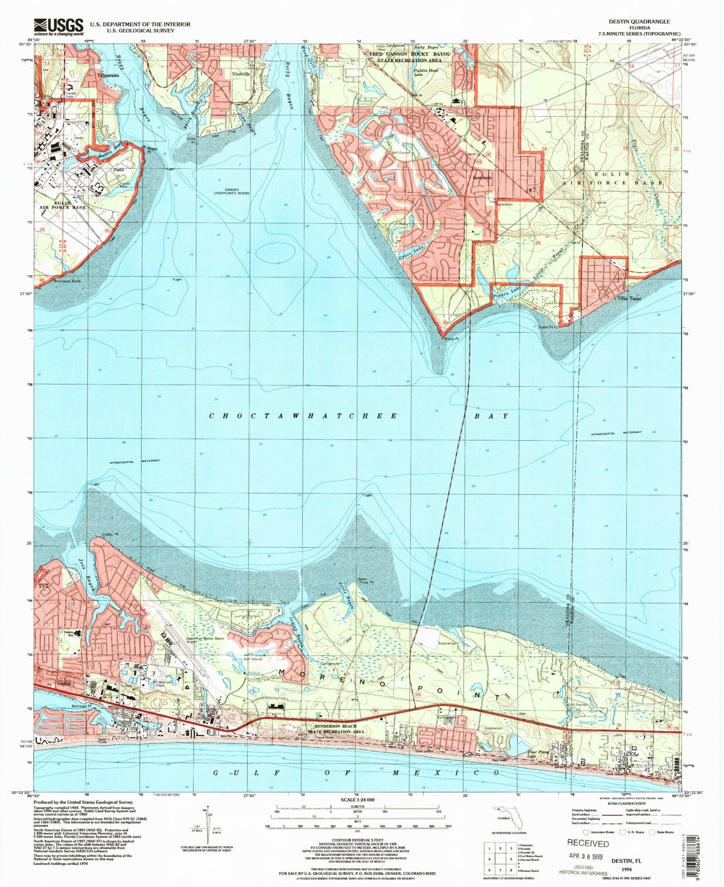
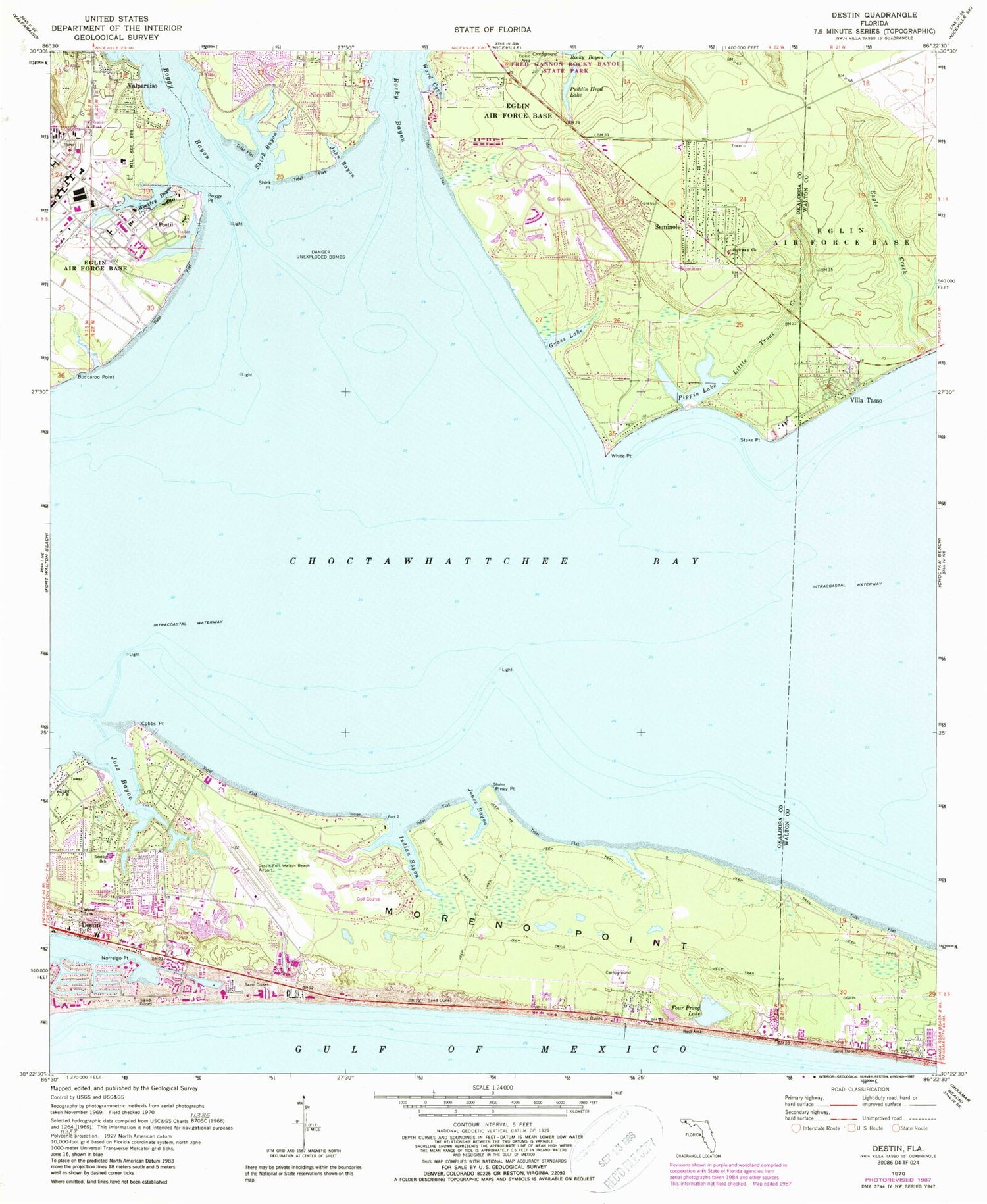
Classic USGS Destin Florida 7.5'x7.5' Topo Map
Couldn't load pickup availability
Historical USGS topographic quad map of Destin in the state of Florida. Map scale may vary for some years, but is generally around 1:24,000. Print size is approximately 24" x 27"
This quadrangle is in the following counties: Okaloosa, Walton.
The map contains contour lines, roads, rivers, towns, and lakes. Printed on high-quality waterproof paper with UV fade-resistant inks, and shipped rolled.
Contains the following named places: Addie R Lewis School, Boggy Point, Buccaroo Point, City of Destin, Cobbs Point, Dana Point, Destin, Destin Elementary School, Destin Executive Airport, Destin Fire Control District Headquarters Station 9, Destin Fire Control District Station 10, Destin Harbor, Destin Post Office, Eagle Creek, Four Prong Lake, Fred Gannon Rocky Bayou State Recreation Area, Grass Lake, Indian Bayou, Joes Bayou, John Bayou, Jones Bayou, Little Trout Creek, Moreno Plaza, Moreno Point, Niceville-Valparaiso Division, Norreigo Point, North Bay Fire Control District, Okaloosa County Emergency Medical Services Station 10, Okaloosa County Emergency Medical Services Station 2, Palmetto Plaza, Parkway Church, Piney Point, Pippin Lake, Postil, Puddin Head Lake, Seminole, Shirk Bayou, Shirk Point, Shoreline Village Mall, Stake Point, Sunset Cove, The Shores Shopping Center, Villa Tasso, Ward Cove, WAWD-TV (Fort Walton Beach), Weekley Bayou, Weekley Pond, White Point, WMMK-FM (Destin), ZIP Code: 32541