MyTopo
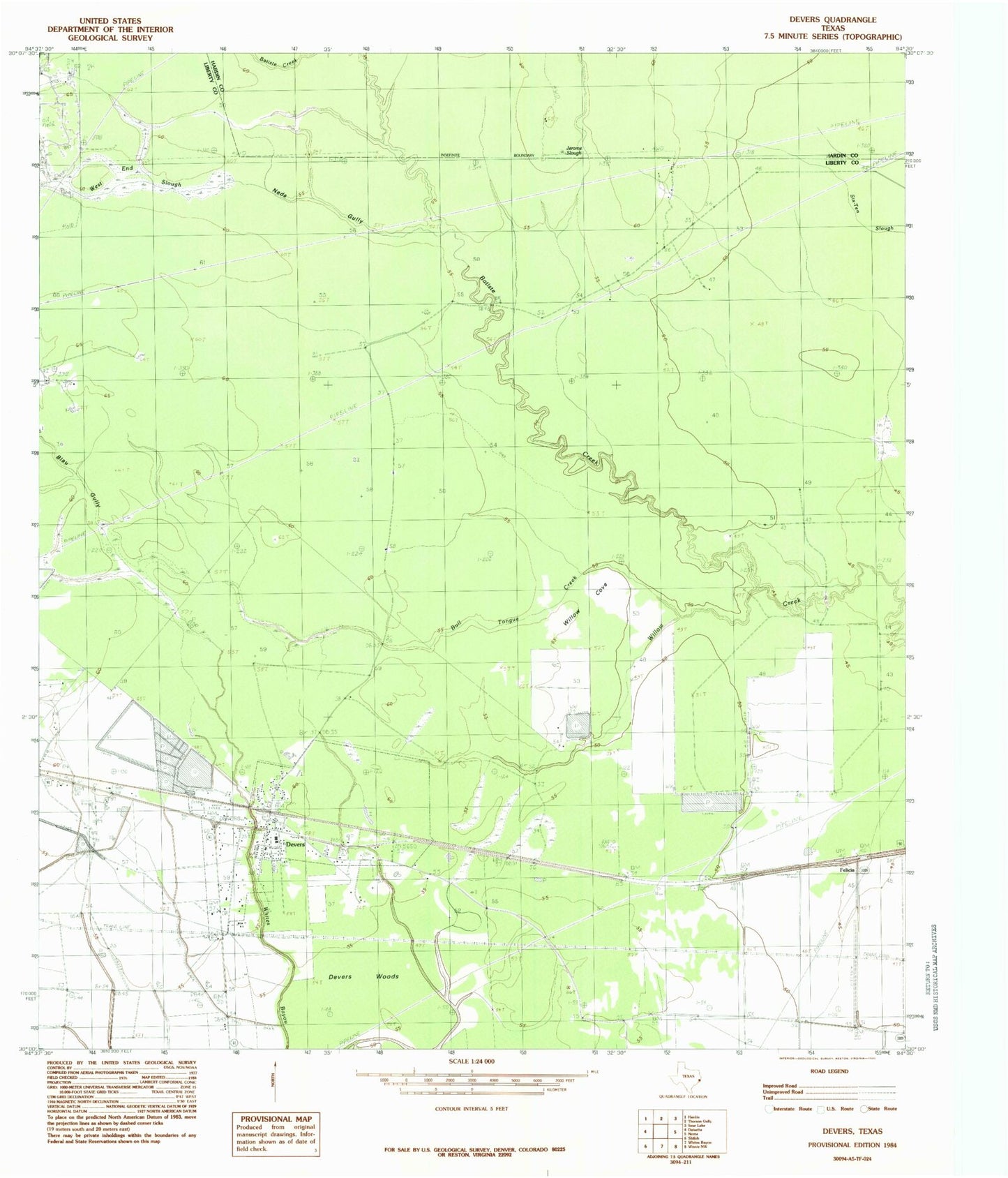
Classic USGS Devers Texas 7.5'x7.5' Topo Map
Couldn't load pickup availability
Historical USGS topographic quad map of Devers in the state of Texas. Map scale may vary for some years, but is generally around 1:24,000. Print size is approximately 24" x 27"
This quadrangle is in the following counties: Hardin, Liberty.
The map contains contour lines, roads, rivers, towns, and lakes. Printed on high-quality waterproof paper with UV fade-resistant inks, and shipped rolled.
Contains the following named places: Batiste Creek, Blau Gully, Boyt Pre - Kindergarten School, Bull Tongue Creek, City of Devers, Daisetta Division, Devers, Devers City Hall, Devers Elementary School, Devers Post Office, Devers Volunteer Fire Department, Devers Woods, Felicia, Hogpen Crossing, Jerome Slough, Keys Camp, KHYS-FM (Port Arthur), KSHN-FM (Liberty), KWIC-FM (Beaumont), KYKR-FM (Port Arthur), Meche Reservoir, Neds Gully, Sahara Cemetery, Stephen Meche Dam, Stockpen Prairie, Taylor Camp, West End Slough, Willow Cove, ZIP Code: 77533