MyTopo
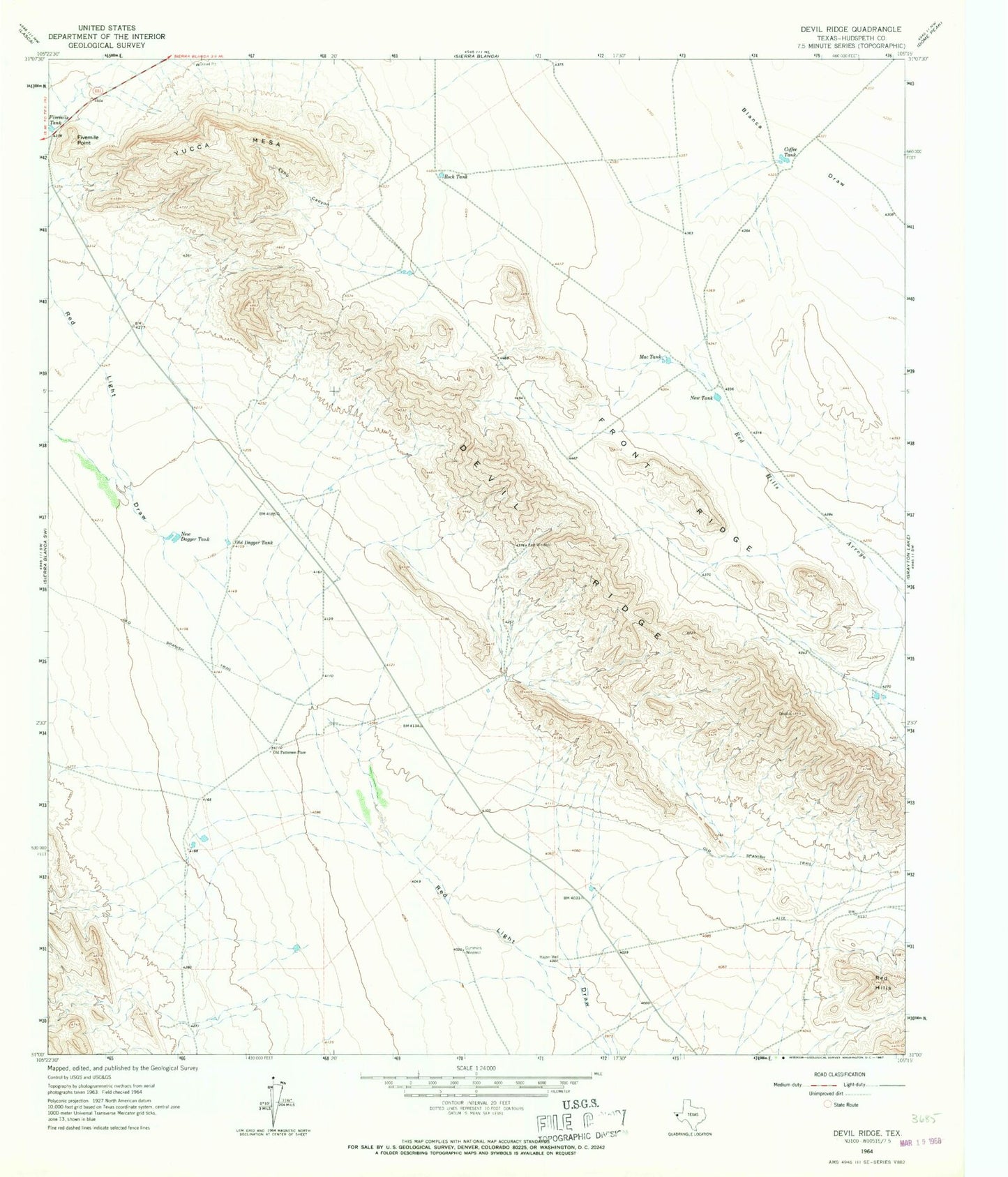
Classic USGS Devil Ridge Texas 7.5'x7.5' Topo Map
Regular price
$16.95
Regular price
Sale price
$16.95
Unit price
per
Couldn't load pickup availability
Historical USGS topographic quad map of Devil Ridge in the state of Texas. Map scale may vary for some years, but is generally around 1:24,000. Print size is approximately 24" x 27"
This quadrangle is in the following counties: Hudspeth.
The map contains contour lines, roads, rivers, towns, and lakes. Printed on high-quality waterproof paper with UV fade-resistant inks, and shipped rolled.
Contains the following named places: Coffee Tank, Cummins Windmill, Devil Ridge, East Windmill, Echo Canyon, Fivemile Point, Front Ridge, Hayter Well, Mac Tank, New Dagger Tank, New Tank, Old Dagger Tank, Old Patterson Place, Red Hills, Rock Tank, Yucca Mesa