MyTopo
Classic USGS Devil Track Lake Minnesota 7.5'x7.5' Topo Map
Couldn't load pickup availability
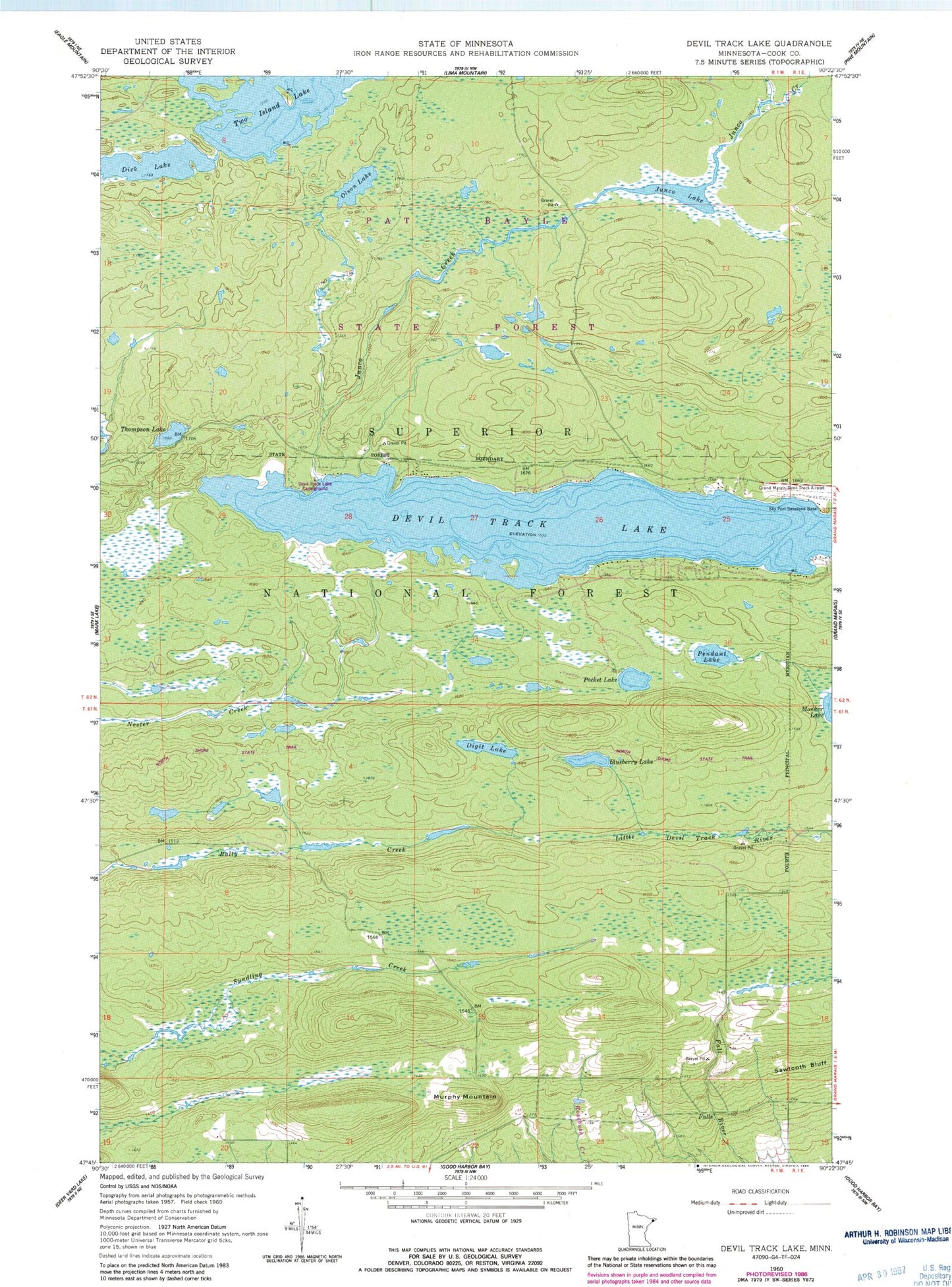
Historical USGS topographic quad map of Devil Track Lake in the state of Minnesota. Map scale may vary for some years, but is generally around 1:24,000. Print size is approximately 24" x 27"
This quadrangle is in the following counties: Cook.
The map contains contour lines, roads, rivers, towns, and lakes. Printed on high-quality waterproof paper with UV fade-resistant inks, and shipped rolled.
Contains the following named places: Blueberry Lake, Devil Lake Campground, Devil Track Lake, Dick Lake, Digit Lake, Grand Marais/Cook County Airport, Grand Marais-Cook County Seaplane Base, Grand Marais-Devil Track Airport, Junco Creek, Junco Lake, Murphy Mountain, Olso Lake, Pendant Lake, Pocket Lake, Sky Port Seaplane Base, Thompson Lake, Two Island Lake