MyTopo
Classic USGS Devils Hole Creek Wyoming 7.5'x7.5' Topo Map
Regular price
$16.95
Regular price
Sale price
$16.95
Unit price
per
Couldn't load pickup availability
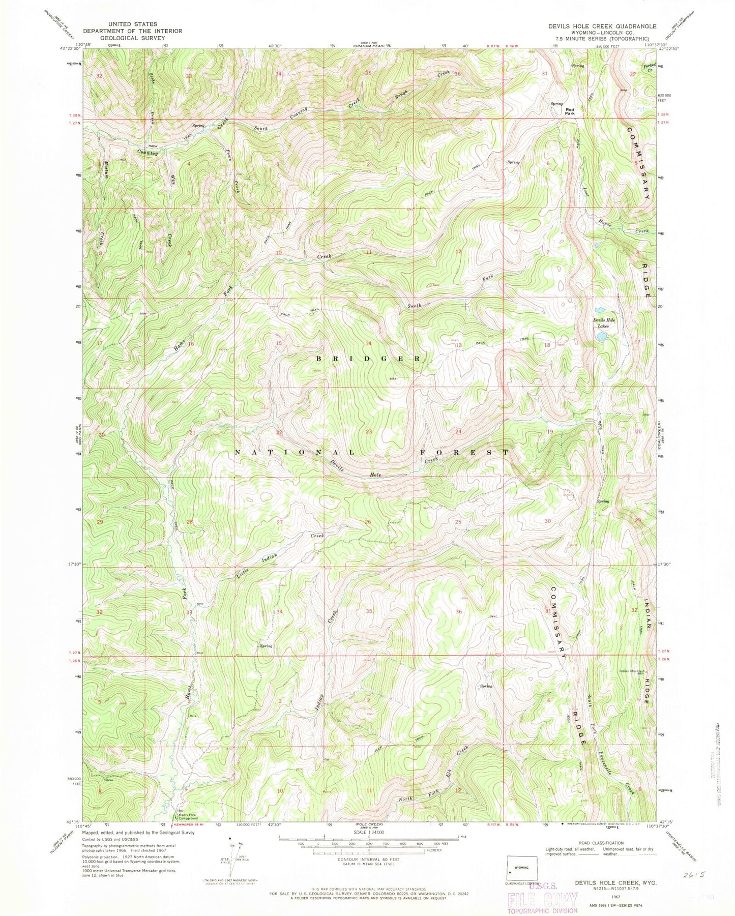
Historical USGS topographic quad map of Devils Hole Creek in the state of Wyoming. Typical map scale is 1:24,000, but may vary for certain years, if available. Print size: 24" x 27"
This quadrangle is in the following counties: Lincoln.
The map contains contour lines, roads, rivers, towns, and lakes. Printed on high-quality waterproof paper with UV fade-resistant inks, and shipped rolled.
Contains the following named places: Devils Hole Creek, Devils Hole Lakes, Fawn Creek, Indian Creek, Little Indian Creek, Mistum Creek, Red Park, Rough Creek, South Fork Hams Fork, Way Creek, Hams Fork Creek, Indian Ridge, Slide Creek, South Coantag Creek, Lincoln County, Hams Fork Campground