
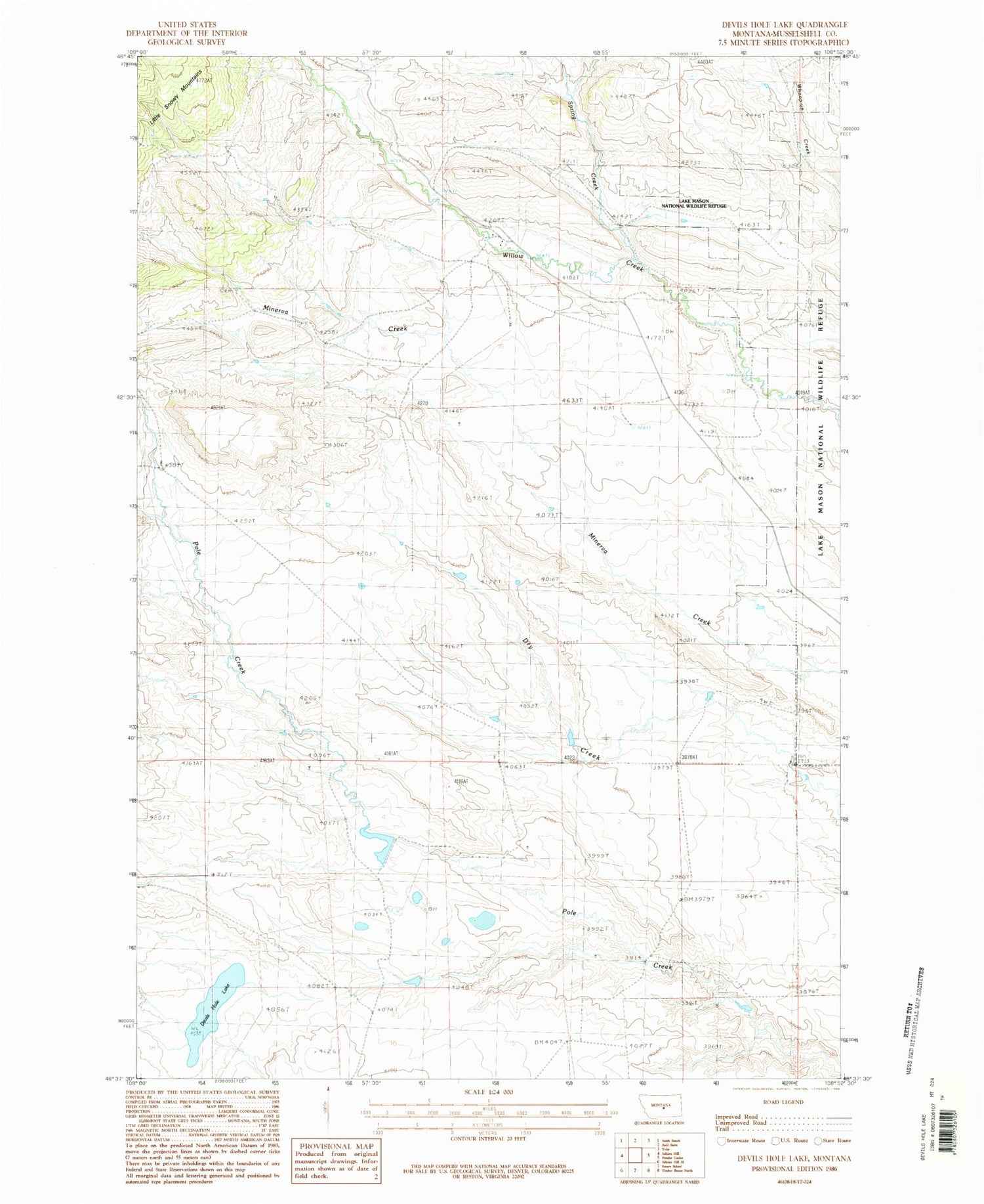
MyTopo
Classic USGS Devils Hole Lake Montana 7.5'x7.5' Topo Map
Regular price
$16.95
Regular price
Sale price
$16.95
Unit price
per
Couldn't load pickup availability
Historical USGS topographic quad map of Devils Hole Lake in the state of Montana. Map scale may vary for some years, but is generally around 1:24,000. Print size is approximately 24" x 27"
This quadrangle is in the following counties: Musselshell.
The map contains contour lines, roads, rivers, towns, and lakes. Printed on high-quality waterproof paper with UV fade-resistant inks, and shipped rolled.
Contains the following named places: 10N22E02C___01 Well, 11N22E33D___01 Well, 11N32E15AB__01 Well, Devils Hole Lake, Flat Post Office, Hyfield Post Office, Sahara Post Office, Snowy Mountain Dam, Spring Creek


