MyTopo
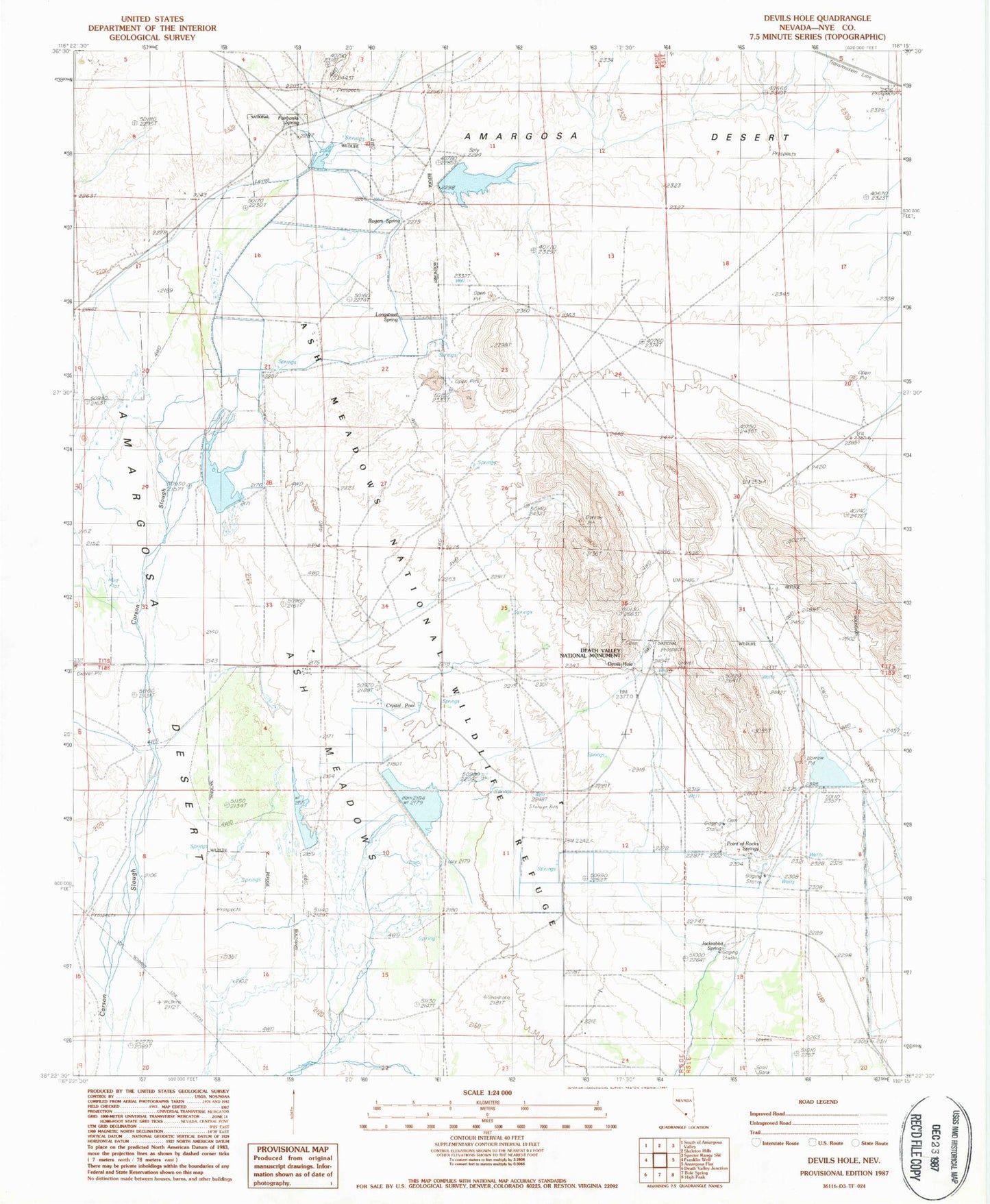
Classic USGS Devils Hole Nevada 7.5'x7.5' Topo Map
Couldn't load pickup availability
Historical USGS topographic quad map of Devils Hole in the state of Nevada. Map scale may vary for some years, but is generally around 1:24,000. Print size is approximately 24" x 27"
This quadrangle is in the following counties: Nye.
The map contains contour lines, roads, rivers, towns, and lakes. Printed on high-quality waterproof paper with UV fade-resistant inks, and shipped rolled.
Contains the following named places: Ash Meadows, Ash Meadows National Wildlife Refuge, Ash Meadows National Wildlife Refuge Office, Big Spring, Bradford Springs, Button Springs, Carson Marsh, Crystal Lake Dam, Crystal Marsh, Crystal Pool, Crystal Reservoir, D H Well, Dam C, Dam C Reservoir, Davis Ranch, Davis Ranch Spring, Devils Hole, Fairbanks Ranch, Fairbanks Spring, Forest Spring, Fox Ranch, Horseshoe Marsh, Horseshoe Reservoir, Indian Garden Spring, Indian Rock Spring, Indian Spring, Jackrabbit Spring, Japanese Ranch, Lake Number One, Lake Number One Dam, Little Lake Dam, Longstreet Spring, Main Spring, Marsh Spring, Mary Scott Spring, Mexican Spring, Parent Springs, Peterson Ranch, Peterson Reservoir, Point of Rocks Springs, Purgatory Spring Well, Rogers Spring, School Spring, Skruggs Spring, Soda Spring, Tubbs Spring, Winters Ranch