MyTopo
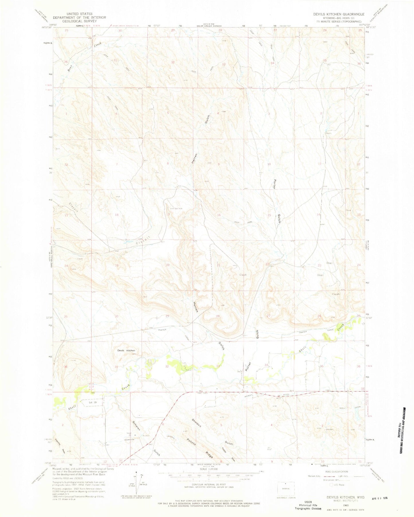
Classic USGS Devils Kitchen Wyoming 7.5'x7.5' Topo Map
Regular price
$16.95
Regular price
Sale price
$16.95
Unit price
per
Couldn't load pickup availability
Historical USGS topographic quad map of Devils Kitchen in the state of Wyoming. Map scale may vary for some years, but is generally around 1:24,000. Print size is approximately 24" x 27"
This quadrangle is in the following counties: Big Horn.
The map contains contour lines, roads, rivers, towns, and lakes. Printed on high-quality waterproof paper with UV fade-resistant inks, and shipped rolled.
Contains the following named places: Bear Creek Number Two Mine, Big Horn County, Devils Kitchen, Greybull Area Number One Mine, Herren Gulch, Odessa Cemetery, Porter Canal, Porter Gulch, Potato Draw, Scharen Gulch, Sheldon Gulch, Shell Canal Mine, Snake Mine, Thompson Lateral, Whaley Ditch