MyTopo
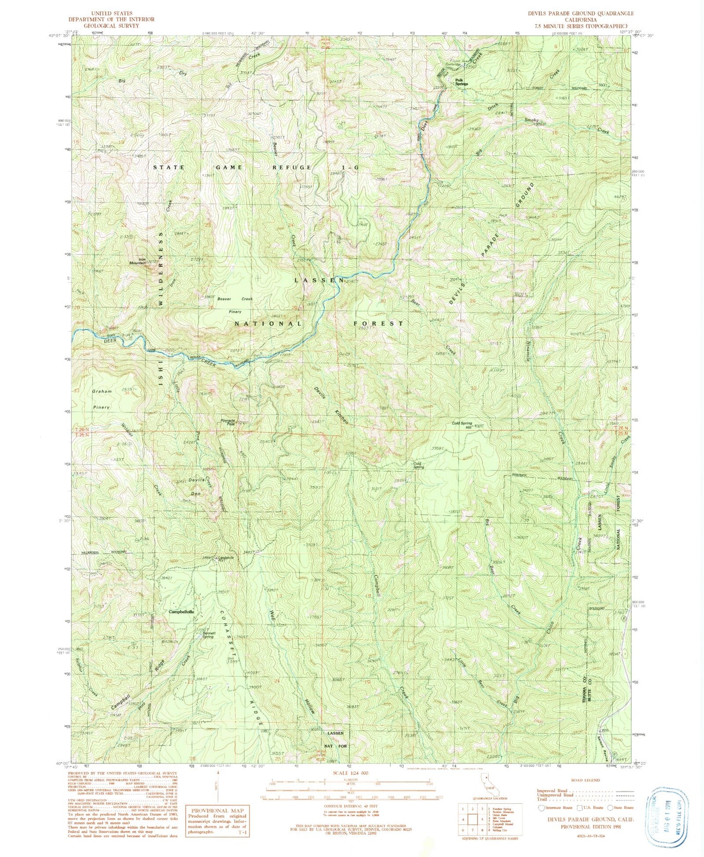
Classic USGS Devils Parade Ground California 7.5'x7.5' Topo Map
Couldn't load pickup availability
Historical USGS topographic quad map of Devils Parade Ground in the state of California. Typical map scale is 1:24,000, but may vary for certain years, if available. Print size: 24" x 27"
This quadrangle is in the following counties: Butte, Tehama.
The map contains contour lines, roads, rivers, towns, and lakes. Printed on high-quality waterproof paper with UV fade-resistant inks, and shipped rolled.
Contains the following named places: Little Smoky Creek, Ninemile Creek, Bear Creek, Beaver Creek, Bennett Spring, Big Bear Creek, Big Smoky Creek, Campbell Ridge, Campbellville, Cohasset Ridge, Cold Spring, Cold Spring Hill, Devils Den, Devils Kitchen, Devils Parade Ground, Iron Creek, Iron Mountain, Little Bear Creek, Little Pine Creek, Murphy Trail (historical), Polk Springs, Ditch Creek, Graham Trail (historical), Beaver Creek Pinery, Pinnacle Peak